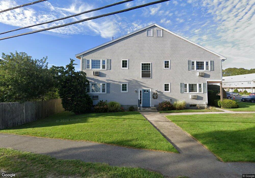
166 Upper County Rd Unit 2-3 Dennis Port, MA 02639
Dennis Port NeighborhoodEstimated Value: $218,000 - $238,000
1
Bed
1
Bath
650
Sq Ft
$350/Sq Ft
Est. Value
About This Home
This home is located at 166 Upper County Rd Unit 2-3, Dennis Port, MA 02639 and is currently estimated at $227,454, approximately $349 per square foot. 166 Upper County Rd Unit 2-3 is a home located in Barnstable County with nearby schools including Dennis-Yarmouth Regional High School and St. Pius X. School.
Ownership History
Date
Name
Owned For
Owner Type
Purchase Details
Closed on
Jan 21, 2022
Sold by
Ogrady Norman M
Bought by
Norman M Ogrady Lt
Current Estimated Value
Purchase Details
Closed on
Aug 27, 1999
Sold by
Erb John D and Erb Maureen E
Bought by
Chin Robin S
Home Financials for this Owner
Home Financials are based on the most recent Mortgage that was taken out on this home.
Original Mortgage
$38,000
Interest Rate
7.53%
Mortgage Type
Purchase Money Mortgage
Create a Home Valuation Report for This Property
The Home Valuation Report is an in-depth analysis detailing your home's value as well as a comparison with similar homes in the area
Home Values in the Area
Average Home Value in this Area
Purchase History
| Date | Buyer | Sale Price | Title Company |
|---|---|---|---|
| Norman M Ogrady Lt | -- | None Available | |
| Chin Robin S | $47,500 | -- |
Source: Public Records
Mortgage History
| Date | Status | Borrower | Loan Amount |
|---|---|---|---|
| Previous Owner | Chin Robin S | $38,000 |
Source: Public Records
Tax History
| Year | Tax Paid | Tax Assessment Tax Assessment Total Assessment is a certain percentage of the fair market value that is determined by local assessors to be the total taxable value of land and additions on the property. | Land | Improvement |
|---|---|---|---|---|
| 2025 | $850 | $196,300 | $0 | $196,300 |
| 2024 | $815 | $185,600 | $0 | $185,600 |
| 2023 | $710 | $152,100 | $0 | $152,100 |
| 2022 | $687 | $122,700 | $0 | $122,700 |
| 2021 | $666 | $110,500 | $0 | $110,500 |
| 2020 | $638 | $104,600 | $0 | $104,600 |
| 2019 | $575 | $93,200 | $0 | $93,200 |
| 2018 | $586 | $92,500 | $0 | $92,500 |
| 2017 | $613 | $99,600 | $0 | $99,600 |
| 2016 | $474 | $72,600 | $0 | $72,600 |
| 2015 | $465 | $72,600 | $0 | $72,600 |
| 2014 | $431 | $67,900 | $0 | $67,900 |
Source: Public Records
Map
Nearby Homes
- 174 Upper County Rd Unit 2-2
- 174 Upper County Rd Unit U2-2
- 9 Country Ln
- 12 Candlewood Ln Unit 1-6
- 10 Candlewood Ln Unit 2
- 10 Candlewood Ln Unit 2-10
- 47 Telegraph Rd Unit 1
- 121A Depot St
- 12 Indian Trail
- 24 Indian Trail
- 157 Depot St Unit 5
- 41 Center St
- 11 Lane Rd
- 268 Main St
- 18 Cross St
- 6 Raintree Rd
- 34 Pleasant St Unit 3
- 41 Depot Rd W
- 97 Depot St
- 18 Manning Rd
- 174 Upper County Rd Unit U1-10
- 166 Upper County Rd Unit 1-9
- 25 Upper County Rd
- 166 Upper County Rd Unit 1-8
- 174 Upper County Rd Unit 1-5
- 174 Upper County Rd Unit 16-Jan
- 166 Upper County Rd Unit 6-1
- 166 Upper County Rd Unit 2-4
- 166 Upper County Rd Unit 2-8
- 166 Upper County Rd Unit 2-7
- 166 Upper County Rd Unit 1-7
- 166 Upper County Rd Unit 1-10
- 166 Upper County Rd Unit 2-10
- 166 Upper County Rd Unit 2-11
- 166 Upper County Rd Unit U1-6
- 174 Upper County Rd Unit 2-7
- 174 Upper County Rd Unit 1-15
- 174 Upper County Rd Unit 2-11
- 174 Upper County Rd Unit U-1-
- 174 Upper County Rd Unit 1-14
Your Personal Tour Guide
Ask me questions while you tour the home.