Estimated Value: $316,000 - $406,000
3
Beds
2
Baths
1,828
Sq Ft
$203/Sq Ft
Est. Value
About This Home
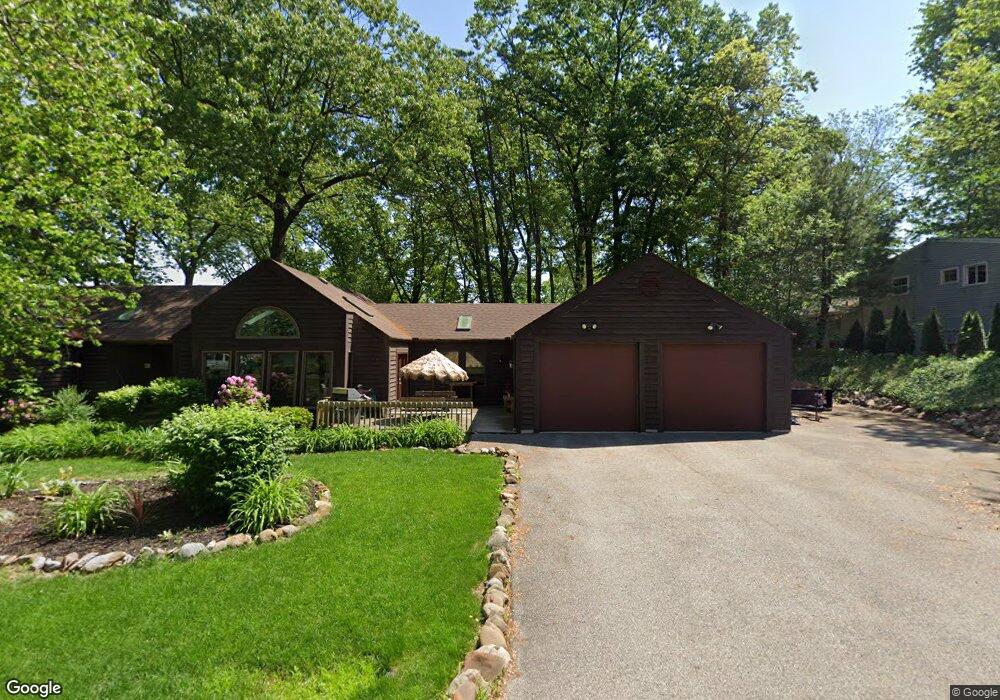
This home is located at 166 W Glenridge Rd, Akron, OH 44319 and is currently estimated at $371,230, approximately $203 per square foot. 166 W Glenridge Rd is a home located in Summit County with nearby schools including Greenwood Elementary School, Green Intermediate Elementary School, and Green Primary School.
Ownership History
Date
Name
Owned For
Owner Type
Purchase Details
Closed on
Dec 20, 2016
Sold by
Francis Lindsey
Bought by
Fracis John T
Current Estimated Value
Purchase Details
Closed on
Apr 19, 2007
Sold by
Anderson Eric R and Anderson Mariann
Bought by
Francis John T and Francis Lindsey
Home Financials for this Owner
Home Financials are based on the most recent Mortgage that was taken out on this home.
Original Mortgage
$155,400
Outstanding Balance
$94,166
Interest Rate
6.19%
Mortgage Type
Purchase Money Mortgage
Estimated Equity
$277,065
Purchase Details
Closed on
Apr 20, 1998
Sold by
Zumpano Fred E
Bought by
Anderson Eric R
Home Financials for this Owner
Home Financials are based on the most recent Mortgage that was taken out on this home.
Original Mortgage
$136,000
Interest Rate
7.27%
Mortgage Type
New Conventional
Create a Home Valuation Report for This Property
The Home Valuation Report is an in-depth analysis detailing your home's value as well as a comparison with similar homes in the area
Home Values in the Area
Average Home Value in this Area
Purchase History
| Date | Buyer | Sale Price | Title Company |
|---|---|---|---|
| Fracis John T | -- | None Available | |
| Francis John T | $194,250 | First American Title Akron | |
| Anderson Eric R | $170,000 | -- |
Source: Public Records
Mortgage History
| Date | Status | Borrower | Loan Amount |
|---|---|---|---|
| Open | Francis John T | $155,400 | |
| Closed | Anderson Eric R | $136,000 |
Source: Public Records
Tax History Compared to Growth
Tax History
| Year | Tax Paid | Tax Assessment Tax Assessment Total Assessment is a certain percentage of the fair market value that is determined by local assessors to be the total taxable value of land and additions on the property. | Land | Improvement |
|---|---|---|---|---|
| 2025 | $5,682 | $120,054 | $15,208 | $104,846 |
| 2024 | $5,682 | $120,054 | $15,208 | $104,846 |
| 2023 | $5,682 | $120,054 | $15,208 | $104,846 |
| 2022 | $4,745 | $89,919 | $11,351 | $78,568 |
| 2021 | $4,451 | $89,919 | $11,351 | $78,568 |
| 2020 | $4,365 | $89,920 | $11,350 | $78,570 |
| 2019 | $3,471 | $66,730 | $10,900 | $55,830 |
| 2018 | $3,547 | $66,730 | $10,900 | $55,830 |
| 2017 | $3,157 | $66,730 | $10,900 | $55,830 |
| 2016 | $3,142 | $55,670 | $10,900 | $44,770 |
| 2015 | $3,157 | $55,670 | $10,900 | $44,770 |
| 2014 | $3,137 | $55,670 | $10,900 | $44,770 |
| 2013 | $3,160 | $55,730 | $10,900 | $44,830 |
Source: Public Records
Map
Nearby Homes
- 3809 Butterfield Dr
- 265 E Pace Ave
- 221 Lake Front Dr
- TBD Heron Watch Dr
- 268 E Willowview Dr
- 0 Sandy Beach Dr
- 3785 S Main St
- 111 Magua Dr
- 441 Dorwil Dr
- 68 Starboard Cir
- 63 Starboard Cir Unit 64
- 213 Klinger St
- 4131 State Park Dr
- 4135 State Park Dr
- 0 S Main St
- 3803 Bay Path Dr
- 72 Weil Ave
- 4138 S Main St
- 3917 Cayugas Dr
- 399 Abbyshire Rd
- 158 W Glenridge Rd
- 3726 Chesterfield Dr
- 3739 Chesterfield Dr
- 0 Glenridge W
- 3747 Chesterfield Dr
- 184 W Glenridge Rd
- 37 Lake Front Dr
- 3736 Chesterfield Dr
- 159 W Glenridge Rd
- 3744 Chesterfield Dr
- 51 Lake Front Dr
- 3753 Chesterfield Dr
- 190 W Glenridge Rd
- 175 W Glenridge Rd
- 167 W Glenridge Rd
- 153 W Glenridge Rd
- 36 W Glenridge Rd
- 183 W Glenridge Rd
- 3750 Chesterfield Dr
- 15 Lake Front Dr