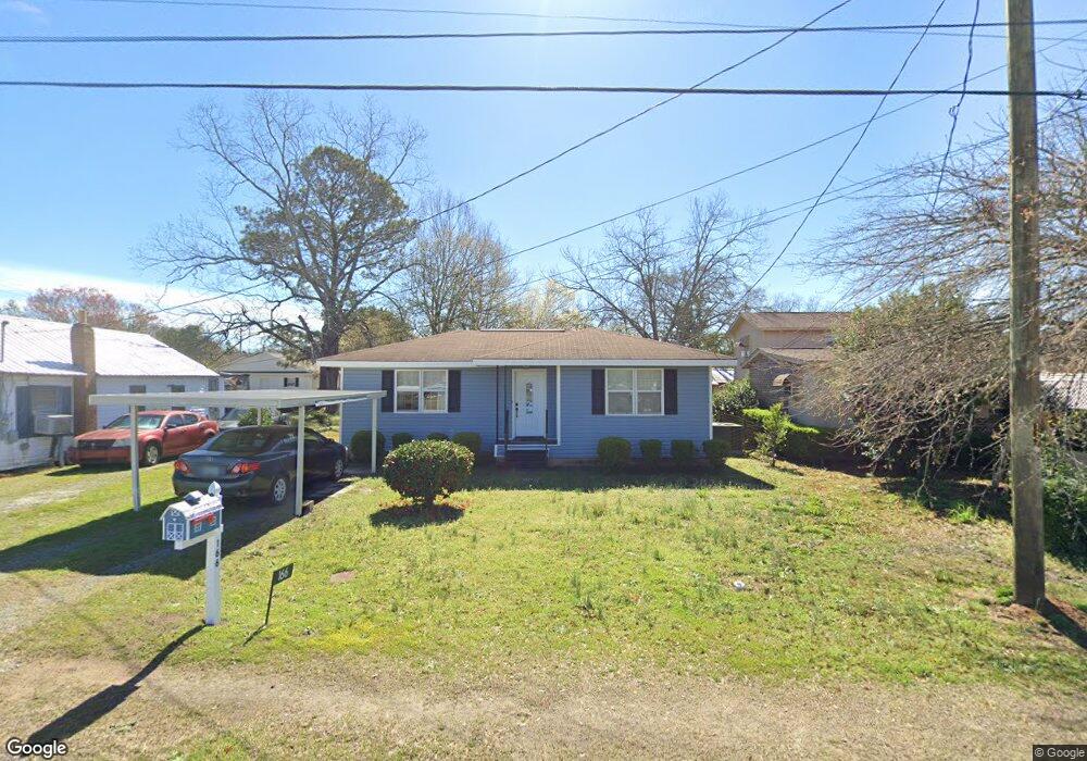
166 W Peter St Cochran, GA 31014
Estimated Value: $49,000 - $107,000
Studio
1
Bath
792
Sq Ft
$84/Sq Ft
Est. Value
About This Home
This home is located at 166 W Peter St, Cochran, GA 31014 and is currently estimated at $66,711, approximately $84 per square foot. 166 W Peter St is a home located in Bleckley County with nearby schools including Bleckley County Primary School, Bleckley County Elementary School, and Bleckley Middle School.
Ownership History
Date
Name
Owned For
Owner Type
Purchase Details
Closed on
Mar 31, 2009
Sold by
State Bank Of Cochran
Bought by
E & P Homes Llc
Current Estimated Value
Purchase Details
Closed on
Jul 1, 2008
Sold by
Saunders Edward W
Bought by
State Bank Of Cochran
Purchase Details
Closed on
Apr 22, 2004
Sold by
Bickers William C
Bought by
Saunders Edward W
Purchase Details
Closed on
Apr 24, 2003
Sold by
Mccloud Jane G
Bought by
Bickers William C
Purchase Details
Closed on
Nov 5, 1992
Sold by
Gay Charlotte
Bought by
Mccloud Jane G
Purchase Details
Closed on
Dec 18, 1971
Bought by
Gay Charlotte
Create a Home Valuation Report for This Property
The Home Valuation Report is an in-depth analysis detailing your home's value as well as a comparison with similar homes in the area
Home Values in the Area
Average Home Value in this Area
Purchase History
| Date | Buyer | Sale Price | Title Company |
|---|---|---|---|
| E & P Homes Llc | $20,000 | -- | |
| E & P Homes Llc | $20,000 | -- | |
| State Bank Of Cochran | $25,000 | -- | |
| Saunders Edward W | $20,000 | -- | |
| Bickers William C | $17,000 | -- | |
| Mccloud Jane G | -- | -- | |
| Gay Charlotte | -- | -- |
Source: Public Records
Tax History Compared to Growth
Tax History
| Year | Tax Paid | Tax Assessment Tax Assessment Total Assessment is a certain percentage of the fair market value that is determined by local assessors to be the total taxable value of land and additions on the property. | Land | Improvement |
|---|---|---|---|---|
| 2025 | $464 | $11,120 | $760 | $10,360 |
| 2024 | $464 | $12,320 | $760 | $11,560 |
| 2023 | $169 | $6,320 | $760 | $5,560 |
| 2022 | $88 | $3,240 | $477 | $2,763 |
| 2021 | $92 | $3,240 | $477 | $2,763 |
| 2020 | $68 | $5,160 | $760 | $4,400 |
| 2019 | $68 | $2,376 | $1,008 | $1,368 |
| 2018 | $96 | $2,376 | $1,008 | $1,368 |
| 2017 | $69 | $2,376 | $1,008 | $1,368 |
| 2016 | $69 | $2,376 | $1,008 | $1,368 |
| 2015 | -- | $3,159 | $1,120 | $2,039 |
| 2014 | -- | $8,046 | $1,120 | $6,926 |
| 2013 | -- | $8,045 | $1,120 | $6,925 |
Source: Public Records
Map
Nearby Homes
- 134 Easy St
- 142 Rose St
- 112 Pecan St
- 118 Pecan St
- 116 Pecan St
- 140 Racetrack Dr
- 116 W Lewis St
- 1277 Georgia 112
- 118 Edmondson Cir
- 0 Willow Creek Run
- 104 S 4th St
- 119 S 4th St
- 118 S 5th St
- 0 Limestone Rd Unit 25839040
- 0 Limestone Rd Unit 10659326
- 123 S 5th St
- 0 Tiffany Dr Unit 10664262
- RV Park Mac Thompson Rd
- Land Mac Thompson Rd
- 406 Mac Thompson Rd