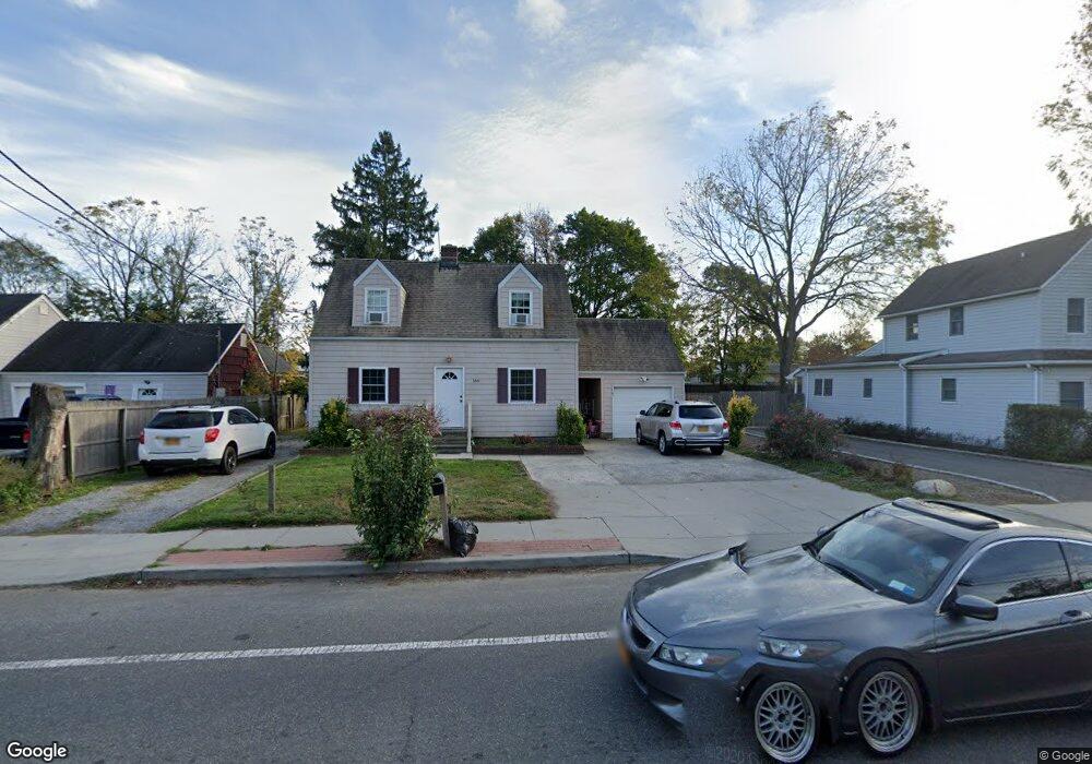
166 W Pulaski Rd Huntington Station, NY 11746
Estimated Value: $566,000 - $647,000
--
Bed
--
Bath
--
Sq Ft
9,148
Sq Ft Lot
About This Home
This home is located at 166 W Pulaski Rd, Huntington Station, NY 11746 and is currently estimated at $605,239. 166 W Pulaski Rd is a home located in Suffolk County with nearby schools including Jefferson Primary School, Woodhull Intermediate School, and J Taylor Finley Middle School.
Ownership History
Date
Name
Owned For
Owner Type
Purchase Details
Closed on
Jul 25, 2022
Sold by
Obadiah Albert
Bought by
Mojica-Martinez Lorena L
Current Estimated Value
Home Financials for this Owner
Home Financials are based on the most recent Mortgage that was taken out on this home.
Original Mortgage
$376,800
Interest Rate
6.02%
Mortgage Type
Purchase Money Mortgage
Purchase Details
Closed on
Jan 22, 2013
Sold by
Obadiah Albert and Obadiah Carolyn
Bought by
Obadiah Albert
Create a Home Valuation Report for This Property
The Home Valuation Report is an in-depth analysis detailing your home's value as well as a comparison with similar homes in the area
Home Values in the Area
Average Home Value in this Area
Purchase History
| Date | Buyer | Sale Price | Title Company |
|---|---|---|---|
| Mojica-Martinez Lorena L | $471,000 | None Available | |
| Obadiah Albert | -- | -- |
Source: Public Records
Mortgage History
| Date | Status | Borrower | Loan Amount |
|---|---|---|---|
| Previous Owner | Mojica-Martinez Lorena L | $376,800 |
Source: Public Records
Tax History Compared to Growth
Tax History
| Year | Tax Paid | Tax Assessment Tax Assessment Total Assessment is a certain percentage of the fair market value that is determined by local assessors to be the total taxable value of land and additions on the property. | Land | Improvement |
|---|---|---|---|---|
| 2024 | $8,160 | $2,375 | $300 | $2,075 |
| 2023 | $4,080 | $2,100 | $300 | $1,800 |
| 2022 | $8,111 | $2,100 | $300 | $1,800 |
| 2021 | $8,035 | $2,100 | $300 | $1,800 |
| 2020 | $7,944 | $2,100 | $300 | $1,800 |
| 2019 | $15,888 | $0 | $0 | $0 |
| 2018 | $7,551 | $2,100 | $300 | $1,800 |
| 2017 | $7,551 | $2,100 | $300 | $1,800 |
| 2016 | $7,457 | $2,100 | $300 | $1,800 |
| 2015 | -- | $2,100 | $300 | $1,800 |
| 2014 | -- | $2,100 | $300 | $1,800 |
Source: Public Records
Map
Nearby Homes
- 137 Columbia St
- 12 Terrace Dr
- 30 3rd Ave
- 92 Columbia St
- 19 W 11th St
- 128 Winding St
- 43 Columbia St
- 269 W Pulaski Rd
- 24 Columbia St
- 49 Tower St
- 0 Tower St
- 280 Lowndes Ave Unit 111G
- 280 Lowndes Ave Unit 305G
- 280 Lowndes Ave Unit 208
- 200 Lowndes Ave Unit A
- 55 9th Ave
- 57 E Pulaski Rd
- 237 Oakwood Rd
- 11 Edcris Ln
- 26 E 12th St
- 162 W Pulaski Rd
- 168 W Pulaski Rd
- 160 W Pulaski Rd
- 111 Railroad St
- 172 W Pulaski Rd
- 165 W Pulaski Rd
- 18 Spencer Ave
- 233 W Pulaski Rd
- 113 Railroad St
- 169 W Pulaski Rd
- 158 W Pulaski Rd
- 20 Spencer Ave
- 171 W Pulaski Rd
- 159 W Pulaski Rd
- 22 Spencer Ave
- 173 W Pulaski Rd
- 106 Railroad St
- 178 W Pulaski Rd
- 17 Spencer Ave