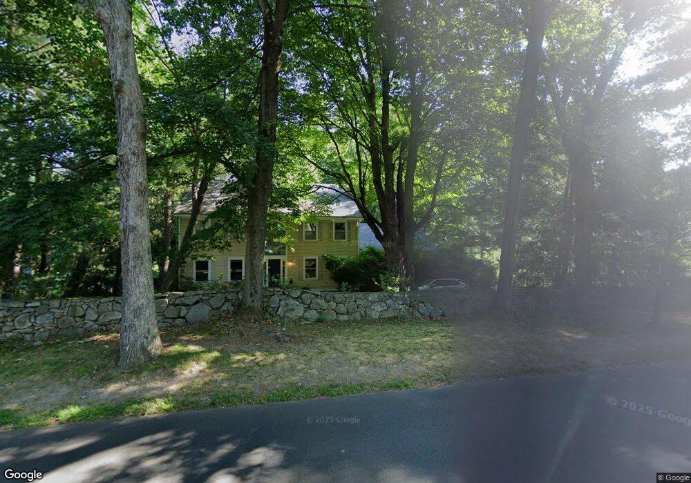
1660 Bronson Rd Fairfield, CT 06824
University NeighborhoodEstimated Value: $1,701,398 - $1,830,000
4
Beds
3
Baths
3,612
Sq Ft
$493/Sq Ft
Est. Value
About This Home
This home is located at 1660 Bronson Rd, Fairfield, CT 06824 and is currently estimated at $1,780,600, approximately $492 per square foot. 1660 Bronson Rd is a home located in Fairfield County with nearby schools including Mill Hill School, Roger Ludlowe Middle School, and Fairfield Ludlowe High School.
Ownership History
Date
Name
Owned For
Owner Type
Purchase Details
Closed on
May 18, 2015
Sold by
Me York
Bought by
Knowles Stephen
Current Estimated Value
Purchase Details
Closed on
Sep 5, 2000
Sold by
Fischer William A and Fischer Barbara A
Bought by
Knowles Stephen M and Knowles Karen B
Home Financials for this Owner
Home Financials are based on the most recent Mortgage that was taken out on this home.
Original Mortgage
$591,200
Interest Rate
8.16%
Purchase Details
Closed on
May 3, 1988
Sold by
Gesswein Martha
Bought by
Fischer Wm A
Create a Home Valuation Report for This Property
The Home Valuation Report is an in-depth analysis detailing your home's value as well as a comparison with similar homes in the area
Home Values in the Area
Average Home Value in this Area
Purchase History
| Date | Buyer | Sale Price | Title Company |
|---|---|---|---|
| Knowles Stephen | -- | -- | |
| Knowles Stephen | -- | -- | |
| Knowles Stephen M | $739,000 | -- | |
| Knowles Stephen M | $739,000 | -- | |
| Fischer Wm A | $625,000 | -- |
Source: Public Records
Mortgage History
| Date | Status | Borrower | Loan Amount |
|---|---|---|---|
| Previous Owner | Fischer Wm A | $49,936 | |
| Previous Owner | Fischer Wm A | $750,000 | |
| Previous Owner | Fischer Wm A | $591,200 |
Source: Public Records
Tax History
| Year | Tax Paid | Tax Assessment Tax Assessment Total Assessment is a certain percentage of the fair market value that is determined by local assessors to be the total taxable value of land and additions on the property. | Land | Improvement |
|---|---|---|---|---|
| 2025 | $21,042 | $741,160 | $435,890 | $305,270 |
| 2024 | $20,678 | $741,160 | $435,890 | $305,270 |
| 2023 | $20,389 | $741,160 | $435,890 | $305,270 |
| 2022 | $20,189 | $741,160 | $435,890 | $305,270 |
| 2021 | $19,996 | $741,160 | $435,890 | $305,270 |
| 2020 | $21,217 | $791,980 | $431,410 | $360,570 |
| 2019 | $21,217 | $791,980 | $431,410 | $360,570 |
| 2018 | $20,877 | $791,980 | $431,410 | $360,570 |
| 2017 | $20,449 | $791,980 | $431,410 | $360,570 |
| 2016 | $20,156 | $791,980 | $431,410 | $360,570 |
| 2015 | $20,333 | $820,190 | $456,190 | $364,000 |
| 2014 | -- | $820,190 | $456,190 | $364,000 |
Source: Public Records
Map
Nearby Homes
- 360 Duck Farm Rd
- 1353 Mill Plain Rd
- 2683 Bronson Rd
- 148 Millspaugh Dr
- 647 Bronson Rd
- 1091 Round Hill Rd
- 688 Hulls Farm Rd
- 218 Lower Farm Rd
- 53 Hilltop Dr
- 329 Bronson Rd
- 28 Mill Hill Rd Unit 28
- 153 Pease Ave
- 20 Ermine St
- 110 Queens Grant Dr
- 1380 Old Academy Rd
- 49 Southport Woods Dr
- 245 Unquowa Rd Unit 2
- 245 Unquowa Rd Unit 82
- 245 Unquowa Rd Unit 6
- 1478 Jennings Rd
- 1642 Bronson Rd
- 1700 Bronson Rd
- 1677 Bronson Rd
- 1728 Bronson Rd
- 1731 Bronson Rd
- 1625 Bronson Rd
- 1614 Bronson Rd
- 1780 Bronson Rd
- 130 N Cedar Rd
- 159 N Cedar Rd
- 1566 Bronson Rd
- 1573 Bronson Rd
- 1785 Bronson Rd
- 1542 Bronson Rd
- 159 Field Rock Rd
- 90 N Cedar Rd
- 189 N Cedar Rd
- 58 N Cedar Rd
- 170 Warner Hill Rd
- 172 N Cedar Rd
Your Personal Tour Guide
Ask me questions while you tour the home.