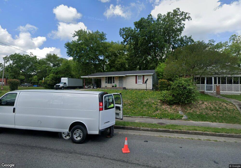
1660 Clinton Rd Macon, GA 31211
Estimated Value: $53,000 - $79,000
2
Beds
1
Bath
832
Sq Ft
$76/Sq Ft
Est. Value
About This Home
This home is located at 1660 Clinton Rd, Macon, GA 31211 and is currently estimated at $63,509, approximately $76 per square foot. 1660 Clinton Rd is a home located in Bibb County with nearby schools including Martin Luther King Jr. Elementary School, Appling Middle School, and Northeast High School.
Ownership History
Date
Name
Owned For
Owner Type
Purchase Details
Closed on
Sep 10, 2018
Sold by
Fuller Michael A
Bought by
Lyons James and Council Ulethra
Current Estimated Value
Purchase Details
Closed on
Mar 8, 2016
Sold by
Detoma William
Bought by
Fuller Michael A
Purchase Details
Closed on
Sep 30, 2014
Sold by
The Estate Of Mary Brookins Smith
Bought by
Detoma William
Purchase Details
Closed on
Mar 8, 2011
Sold by
Smith Peyton B By Exec
Bought by
Estate Of Mary Brookins Smith
Create a Home Valuation Report for This Property
The Home Valuation Report is an in-depth analysis detailing your home's value as well as a comparison with similar homes in the area
Home Values in the Area
Average Home Value in this Area
Purchase History
| Date | Buyer | Sale Price | Title Company |
|---|---|---|---|
| Lyons James | $38,000 | None Available | |
| Fuller Michael A | $37,000 | -- | |
| Detoma William | $10,250 | None Available | |
| Detoma William | $10,250 | None Available | |
| Estate Of Mary Brookins Smith | -- | -- |
Source: Public Records
Tax History Compared to Growth
Tax History
| Year | Tax Paid | Tax Assessment Tax Assessment Total Assessment is a certain percentage of the fair market value that is determined by local assessors to be the total taxable value of land and additions on the property. | Land | Improvement |
|---|---|---|---|---|
| 2025 | $300 | $19,196 | $1,850 | $17,346 |
| 2024 | $248 | $16,758 | $1,850 | $14,908 |
| 2023 | $426 | $16,758 | $1,850 | $14,908 |
| 2022 | $497 | $14,355 | $2,818 | $11,537 |
| 2021 | $545 | $14,355 | $2,818 | $11,537 |
| 2020 | $557 | $14,355 | $2,818 | $11,537 |
| 2019 | $500 | $14,355 | $2,818 | $11,537 |
| 2018 | $1,011 | $13,863 | $2,818 | $11,045 |
| 2017 | $519 | $13,863 | $2,818 | $11,045 |
| 2016 | $480 | $13,862 | $2,818 | $11,045 |
| 2015 | $333 | $13,862 | $2,818 | $11,045 |
| 2014 | $260 | $13,862 | $2,818 | $11,045 |
Source: Public Records
Map
Nearby Homes
- 1615 Engle Dr
- 1260 Jackson Springs Rd
- 661 Coleman Ln
- 1976 Long Ridge Dr
- 1971 Long Ridge Dr
- 1987 Long Ridge Dr
- 1020 Clay Ave
- 1746 Upper River Rd
- 1715 Foster Place
- 1006 Clay Ave Unit 1008,1020,1022
- 988 North Ave
- 1735 Foster Place
- 1898 Wood Valley Rd
- 1204 Norris St
- 916 Summit Ave
- 990 Center St
- 1059 Fort Hill St
- 970 Center St
- 1831 Upper River Rd
- 1660 Clinton Rd Unit 4
- 1660 Clinton Rd Unit 3&4
- 1670 Clinton Rd
- 1678 Clinton Rd
- 1652 Clinton Rd
- 0 Walls Rd
- 1680 Clinton Rd
- 1447 College Pkwy
- 1640 Clinton Rd
- 1644 Clinton Rd
- 1374 Wills Place Unit 5
- 1355 Walls Rd
- 1375 Wills Place
- 1368 Walls Rd
- 1610 Clinton Rd
- 1362 Walls Rd
- 1379 Wills Place
- 1443 Pitts Place
- 1447 Pitts Place
- 1400 Gray Hwy