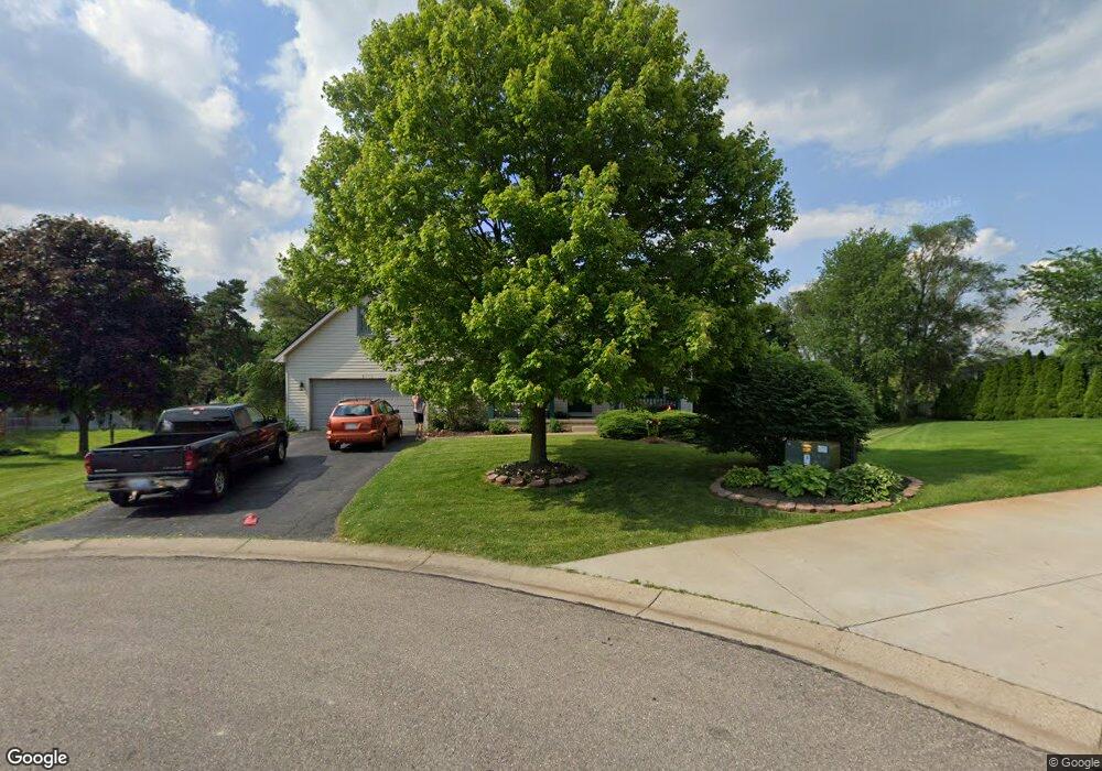
1660 High Pointe Dr Commerce Township, MI 48390
Estimated Value: $383,108 - $426,000
3
Beds
3
Baths
1,603
Sq Ft
$254/Sq Ft
Est. Value
About This Home
This home is located at 1660 High Pointe Dr, Commerce Township, MI 48390 and is currently estimated at $407,027, approximately $253 per square foot. 1660 High Pointe Dr is a home located in Oakland County with nearby schools including Walled Lake Elementary School, Sarah G. Banks Middle School, and Walled Lake Western High School.
Ownership History
Date
Name
Owned For
Owner Type
Purchase Details
Closed on
Mar 29, 1996
Sold by
Alflen Cynthia A
Bought by
Leonard E Glenn
Current Estimated Value
Home Financials for this Owner
Home Financials are based on the most recent Mortgage that was taken out on this home.
Original Mortgage
$163,800
Outstanding Balance
$4,485
Interest Rate
7.44%
Estimated Equity
$402,542
Create a Home Valuation Report for This Property
The Home Valuation Report is an in-depth analysis detailing your home's value as well as a comparison with similar homes in the area
Home Values in the Area
Average Home Value in this Area
Purchase History
| Date | Buyer | Sale Price | Title Company |
|---|---|---|---|
| Leonard E Glenn | $182,000 | -- |
Source: Public Records
Mortgage History
| Date | Status | Borrower | Loan Amount |
|---|---|---|---|
| Open | Leonard E Glenn | $163,800 |
Source: Public Records
Tax History
| Year | Tax Paid | Tax Assessment Tax Assessment Total Assessment is a certain percentage of the fair market value that is determined by local assessors to be the total taxable value of land and additions on the property. | Land | Improvement |
|---|---|---|---|---|
| 2025 | $3,278 | $181,940 | $0 | $0 |
| 2024 | $1,967 | $167,430 | $0 | $0 |
| 2023 | $1,854 | $163,340 | $0 | $0 |
| 2022 | $2,934 | $153,720 | $0 | $0 |
| 2021 | $2,880 | $134,250 | $0 | $0 |
| 2020 | $1,833 | $130,450 | $0 | $0 |
| 2019 | $2,691 | $121,050 | $0 | $0 |
| 2018 | $2,669 | $108,910 | $0 | $0 |
| 2017 | $2,648 | $108,910 | $0 | $0 |
| 2016 | $2,599 | $102,440 | $0 | $0 |
| 2015 | -- | $102,020 | $0 | $0 |
| 2014 | -- | $94,010 | $0 | $0 |
| 2011 | -- | $79,260 | $0 | $0 |
Source: Public Records
Map
Nearby Homes
- 150 Ladd Rd Unit A2
- 633 S Pontiac Trail
- 829 Grandview Dr
- 1040 Drakeshire Dr
- 44800 Bayview Dr Unit 33
- 8208 Chesapeake Cir Unit 95
- 30210 Chesapeake Cir Unit 360
- 24202 Chesapeake Cir Unit 287
- 44750 Bayview Dr Unit 37
- 732 Addison Cir
- 1200 Drakeshire Dr
- 2104 Trailway Ct
- 1211 Addington Dr Unit 7
- 10105 W Midway Ct
- 7104 Addington Dr
- 1338 Andover Cir
- 1179 Andover Cir Unit 48
- 1104 Andover Cir Unit 92
- 1599 Chanticlair Cir
- 120 Pickford St
- 1650 High Pointe Dr
- 1670 High Pointe Dr
- 1641 High Pointe Dr
- 1680 High Pointe Dr
- 1537 W West Maple Rd
- 1591 W West Maple Rd
- 1630 High Pointe Dr Unit 9
- 1690 High Pointe Dr Unit 3
- 1505 W West Maple Rd
- 1631 High Pointe Dr Unit 35
- 1605 W West Maple Rd
- 580 Alexander Dr
- 435 Woodland Hills Dr Unit 1
- 1621 W West Maple Rd
- 1620 High Pointe Dr
- 1700 High Pointe Dr
- 560 Alexander Dr
- 1621 High Pointe Dr
- 445 Woodland Hills Dr Unit 2
- 400 Woodland Hills Dr Unit 19