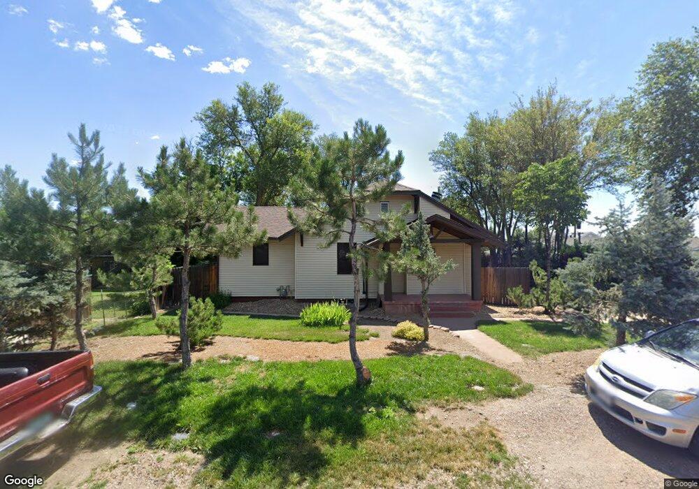
1660 Routt St Lakewood, CO 80215
Applewood Valley NeighborhoodEstimated Value: $430,134 - $588,000
3
Beds
1
Bath
2,308
Sq Ft
$219/Sq Ft
Est. Value
About This Home
This home is located at 1660 Routt St, Lakewood, CO 80215 and is currently estimated at $505,034, approximately $218 per square foot. 1660 Routt St is a home located in Jefferson County with nearby schools including Stober Elementary School, Everitt Middle School, and Wheat Ridge High School.
Ownership History
Date
Name
Owned For
Owner Type
Purchase Details
Closed on
Oct 20, 2011
Sold by
Beneficial Financial 1 Inc
Bought by
Dugan David M
Current Estimated Value
Purchase Details
Closed on
Mar 29, 2011
Sold by
Barnes Larry G
Bought by
Beneficial Financial Inc
Purchase Details
Closed on
Jan 23, 2003
Sold by
Barnes Larry Glenn
Bought by
Barnes Larry G
Home Financials for this Owner
Home Financials are based on the most recent Mortgage that was taken out on this home.
Original Mortgage
$147,000
Interest Rate
5.96%
Create a Home Valuation Report for This Property
The Home Valuation Report is an in-depth analysis detailing your home's value as well as a comparison with similar homes in the area
Home Values in the Area
Average Home Value in this Area
Purchase History
| Date | Buyer | Sale Price | Title Company |
|---|---|---|---|
| Dugan David M | $75,000 | Htco | |
| Beneficial Financial Inc | -- | None Available | |
| Barnes Larry G | -- | Commerce Title |
Source: Public Records
Mortgage History
| Date | Status | Borrower | Loan Amount |
|---|---|---|---|
| Previous Owner | Barnes Larry G | $147,000 |
Source: Public Records
Tax History Compared to Growth
Tax History
| Year | Tax Paid | Tax Assessment Tax Assessment Total Assessment is a certain percentage of the fair market value that is determined by local assessors to be the total taxable value of land and additions on the property. | Land | Improvement |
|---|---|---|---|---|
| 2024 | $2,326 | $25,796 | $15,114 | $10,682 |
| 2023 | $2,326 | $25,796 | $15,114 | $10,682 |
| 2022 | $2,150 | $23,308 | $11,787 | $11,521 |
| 2021 | $2,181 | $23,979 | $12,126 | $11,853 |
| 2020 | $1,914 | $21,142 | $10,922 | $10,220 |
| 2019 | $1,890 | $21,142 | $10,922 | $10,220 |
| 2018 | $1,603 | $17,347 | $7,764 | $9,583 |
| 2017 | $1,409 | $17,347 | $7,764 | $9,583 |
| 2016 | $1,396 | $16,031 | $4,728 | $11,303 |
| 2015 | $1,255 | $16,031 | $4,728 | $11,303 |
| 2014 | $1,255 | $13,206 | $5,349 | $7,857 |
Source: Public Records
Map
Nearby Homes
- 1723 Robb St Unit 45
- 1723 Robb St Unit 26
- 1802 Simms St
- 11422 W 17th Place
- 1830 Simms St
- 11423 W 17th Place Unit I11423
- 1540 Simms St
- 1678 Tabor St
- 1832 Simms St Unit 1832A
- 1825 Simms St
- 11715 W 18th Ave
- 11813 W 17th Ave
- 1555 Swadley St
- 11217 W 18th Ave Unit A
- 2055 Quail Dr
- 12075 W 18th Dr
- 11940 W Independence Ave
- 2110 Tabor Dr
- 11133 W 17th Ave Unit 105
- 2140 Tabor Dr
- 1646 Routt St
- 1665 Robb St
- 1655 Routt St
- 1633 Robb St Unit 8
- 1661 Routt St
- 1629 Robb St Unit 7
- 1640 Routt St
- 1645 Routt St
- 1625 Robb St Unit 6
- 1671 Routt St
- 1621 Robb St Unit 5
- 1679 Robb St
- 1617 Robb St Unit 4
- 1681 Routt St
- 1690 Routt St
- 1651 Routt St
- 1621 N Robb St
- 1613 Robb St Unit 3
- 1609 Robb St Unit 2
- 1613 N Robb St