Estimated Value: $488,000 - $525,000
3
Beds
2
Baths
1,512
Sq Ft
$339/Sq Ft
Est. Value
About This Home
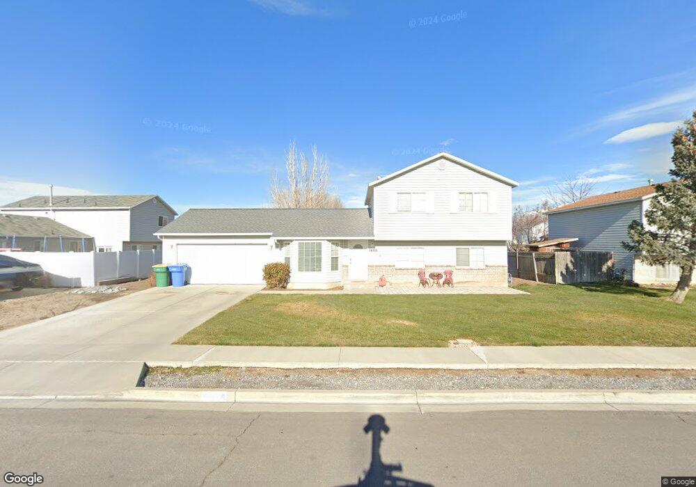
This home is located at 1660 W 525 S, Lehi, UT 84043 and is currently estimated at $512,781, approximately $339 per square foot. 1660 W 525 S is a home located in Utah County with nearby schools including Snow Springs Elementary, Willowcreek Middle School, and Lehi High School.
Ownership History
Date
Name
Owned For
Owner Type
Purchase Details
Closed on
Oct 30, 2000
Sold by
Rs Plus Investments
Bought by
Smith Gary M and Smith Jeanette Kniffen
Current Estimated Value
Home Financials for this Owner
Home Financials are based on the most recent Mortgage that was taken out on this home.
Original Mortgage
$135,096
Outstanding Balance
$49,816
Interest Rate
7.89%
Mortgage Type
FHA
Estimated Equity
$462,965
Purchase Details
Closed on
Mar 5, 1999
Sold by
Smith Jeff F
Bought by
Rs Plus Investments
Home Financials for this Owner
Home Financials are based on the most recent Mortgage that was taken out on this home.
Original Mortgage
$85,009
Interest Rate
6.76%
Mortgage Type
Seller Take Back
Purchase Details
Closed on
Mar 2, 1999
Sold by
Salisbury Development Llc
Bought by
Smith Jeff F
Home Financials for this Owner
Home Financials are based on the most recent Mortgage that was taken out on this home.
Original Mortgage
$85,009
Interest Rate
6.76%
Mortgage Type
Seller Take Back
Create a Home Valuation Report for This Property
The Home Valuation Report is an in-depth analysis detailing your home's value as well as a comparison with similar homes in the area
Home Values in the Area
Average Home Value in this Area
Purchase History
| Date | Buyer | Sale Price | Title Company |
|---|---|---|---|
| Smith Gary M | -- | Provo Land Title Company | |
| Rs Plus Investments | -- | Provo Land Title Company | |
| Smith Jeff F | -- | Provo Land Title Company |
Source: Public Records
Mortgage History
| Date | Status | Borrower | Loan Amount |
|---|---|---|---|
| Open | Smith Gary M | $135,096 | |
| Previous Owner | Smith Jeff F | $85,009 |
Source: Public Records
Tax History Compared to Growth
Tax History
| Year | Tax Paid | Tax Assessment Tax Assessment Total Assessment is a certain percentage of the fair market value that is determined by local assessors to be the total taxable value of land and additions on the property. | Land | Improvement |
|---|---|---|---|---|
| 2025 | $2,027 | $260,370 | $193,300 | $280,100 |
| 2024 | $2,027 | $237,160 | $0 | $0 |
| 2023 | $1,873 | $237,930 | $0 | $0 |
| 2022 | $1,979 | $243,815 | $0 | $0 |
| 2021 | $1,757 | $327,300 | $111,900 | $215,400 |
| 2020 | $1,656 | $304,900 | $103,600 | $201,300 |
| 2019 | $1,456 | $278,600 | $103,600 | $175,000 |
| 2018 | $1,373 | $248,400 | $96,200 | $152,200 |
| 2017 | $1,274 | $122,540 | $0 | $0 |
| 2016 | $1,282 | $114,400 | $0 | $0 |
| 2015 | $1,291 | $109,395 | $0 | $0 |
| 2014 | $1,158 | $97,515 | $0 | $0 |
Source: Public Records
Map
Nearby Homes
- 380 S 1500 W
- 1743 W Grays Place
- 581 S 1500 W
- 1784 W Grays Place
- 1379 W 425 S
- 1363 W 425 S
- The Annie Plan at Longhorn Meadows
- The Kaitlyn Plan at Longhorn Meadows
- The Autumn Plan at Longhorn Meadows
- The Aurora Plan at Longhorn Meadows
- The Roosevelt Plan at Longhorn Meadows
- The Christine Plan at Longhorn Meadows
- The Brooke Plan at Longhorn Meadows
- The Madison Plan at Longhorn Meadows
- The Avery Plan at Longhorn Meadows
- The Tracie Plan at Longhorn Meadows
- 1356 W 425 S
- 161 S 1475 W
- 1664 W 800 S
- 374 S 1330 West St