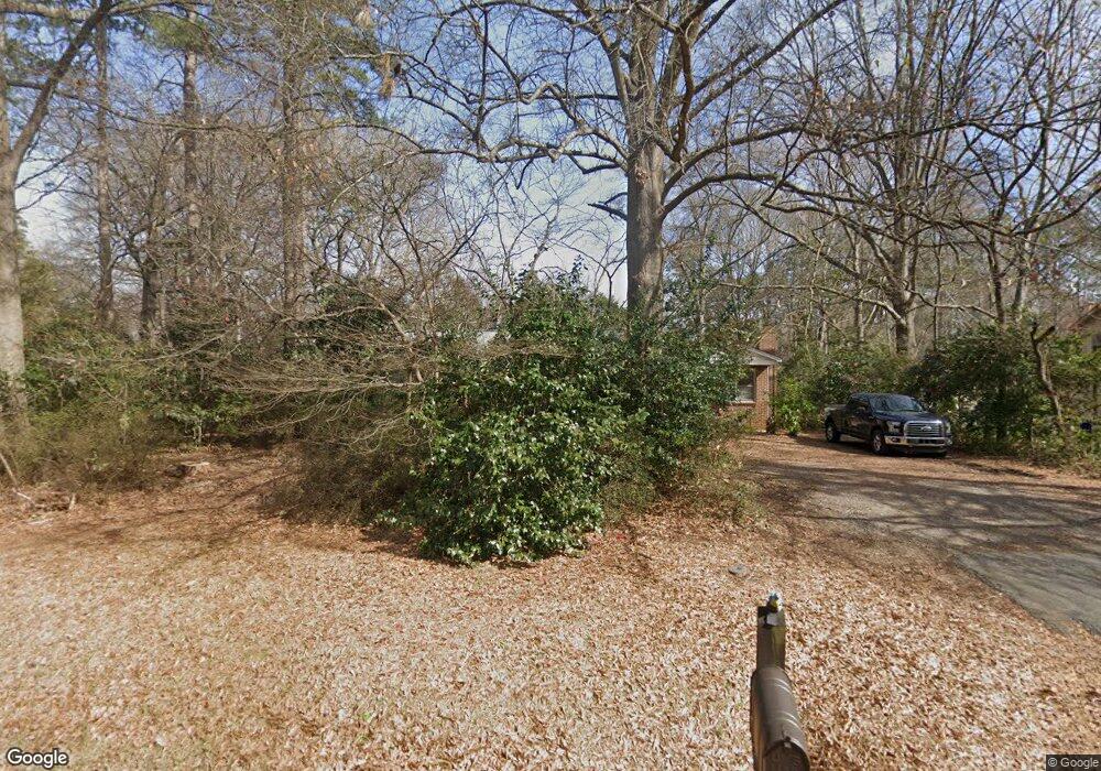
1662 Ebinport Rd Rock Hill, SC 29732
Estimated Value: $243,557 - $351,000
--
Bed
--
Bath
1,815
Sq Ft
$174/Sq Ft
Est. Value
About This Home
This home is located at 1662 Ebinport Rd, Rock Hill, SC 29732 and is currently estimated at $316,639, approximately $174 per square foot. 1662 Ebinport Rd is a home located in York County with nearby schools including Ebinport Elementary School, W.C. Sullivan Middle School, and Rock Hill High School.
Ownership History
Date
Name
Owned For
Owner Type
Purchase Details
Closed on
Feb 28, 2014
Sold by
Dickert Lewis H and Odom Martha S
Bought by
Mottier Robert Charles and Mottier Kelly Buddin
Current Estimated Value
Home Financials for this Owner
Home Financials are based on the most recent Mortgage that was taken out on this home.
Original Mortgage
$44,000
Outstanding Balance
$33,363
Interest Rate
4.35%
Mortgage Type
New Conventional
Estimated Equity
$283,276
Purchase Details
Closed on
Jan 25, 2005
Sold by
Simpson Betty H
Bought by
Simpson Betty H
Purchase Details
Closed on
Jan 12, 2005
Sold by
Not Provided
Bought by
Simpson Ellie F and Dickert Lewis H
Create a Home Valuation Report for This Property
The Home Valuation Report is an in-depth analysis detailing your home's value as well as a comparison with similar homes in the area
Home Values in the Area
Average Home Value in this Area
Purchase History
| Date | Buyer | Sale Price | Title Company |
|---|---|---|---|
| Mottier Robert Charles | $55,000 | -- | |
| Simpson Betty H | -- | -- | |
| Simpson Ellie F | -- | -- |
Source: Public Records
Mortgage History
| Date | Status | Borrower | Loan Amount |
|---|---|---|---|
| Open | Mottier Robert Charles | $44,000 |
Source: Public Records
Tax History Compared to Growth
Tax History
| Year | Tax Paid | Tax Assessment Tax Assessment Total Assessment is a certain percentage of the fair market value that is determined by local assessors to be the total taxable value of land and additions on the property. | Land | Improvement |
|---|---|---|---|---|
| 2024 | $1,793 | $4,933 | $1,030 | $3,903 |
| 2023 | $1,810 | $4,933 | $1,030 | $3,903 |
| 2022 | $1,703 | $4,933 | $1,030 | $3,903 |
| 2021 | -- | $4,933 | $1,030 | $3,903 |
| 2020 | $1,657 | $4,933 | $0 | $0 |
| 2019 | $1,485 | $4,290 | $0 | $0 |
| 2018 | $1,455 | $4,290 | $0 | $0 |
| 2017 | $1,393 | $4,290 | $0 | $0 |
| 2016 | $1,355 | $4,290 | $0 | $0 |
| 2014 | $601 | $7,260 | $1,680 | $5,580 |
| 2013 | $601 | $4,720 | $1,120 | $3,600 |
Source: Public Records
Map
Nearby Homes
- 1631 Wendover Ct
- 1585 Kallaramo Rd
- 1845 Matthews Dr
- 740 Tavern Ct Unit 7
- 2020 Malvern Rd
- 854 Hillcroft Place
- 893 Ragin Ln
- 914 Ragin Ln
- 3708 Celanese Rd
- 1412 Ebinport Rd
- 1981 Hamptonwood Rd
- 2087 Poinsett Dr
- 800 Warrington Place
- 1352 Steed St
- 728 Herlong Ave
- 1516 Ellen Ave
- 1642 Amber Ln
- 2733 Harlinsdale Dr
- 1527 Ellen Ave
- 832 Bridgewood Dr
- 1656 Ebinport Rd
- 1710 Ebinport Rd
- 1709 Hyatt Ave
- 1707 Hyatt Ave
- 1711 Hyatt Ave
- 1720 Ebinport Rd
- 1663 Ebinport Rd
- 1663 Ebinport Rd
- 1705 Ebinport Rd
- 1713 Hyatt Ave
- 1646 Ebinport Rd
- 1711 Ebinport Rd
- 1708 Hyatt Ave
- 1706 Hyatt Ave
- 1724 Ebinport Rd
- 1655 Ebinport Rd
- 1721 Hyatt Ave
- 1613 Wendover Ct
- 1721 Ebinport Rd
- 1518 Shadewood Ct
