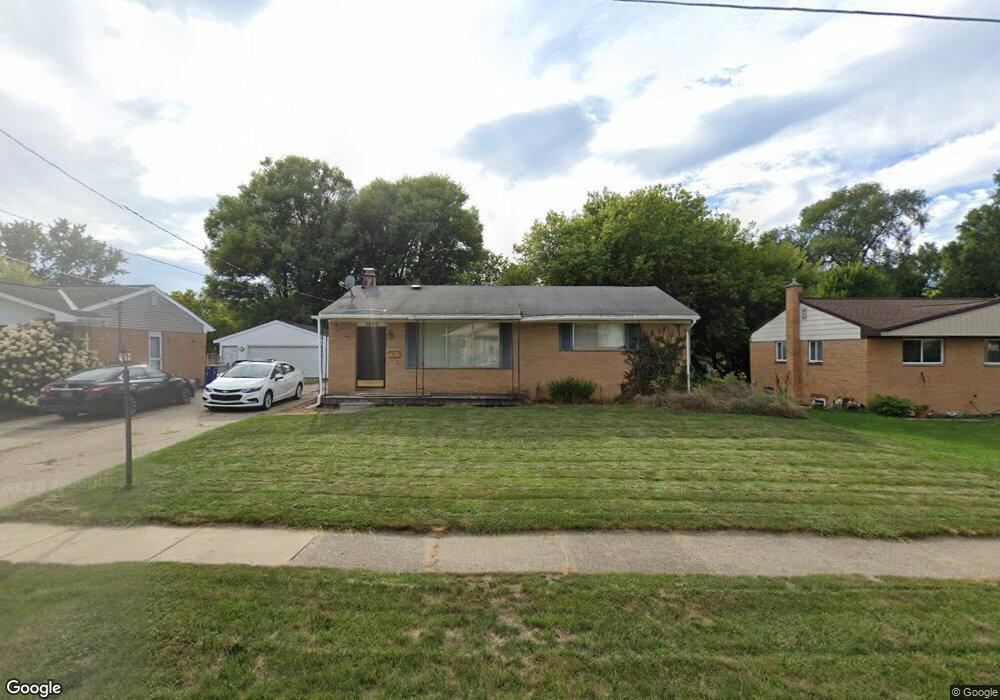
1663 Benjamin Ave NE Grand Rapids, MI 49505
North East Citizens Action NeighborhoodEstimated Value: $255,525 - $296,000
3
Beds
1
Bath
960
Sq Ft
$288/Sq Ft
Est. Value
About This Home
This home is located at 1663 Benjamin Ave NE, Grand Rapids, MI 49505 and is currently estimated at $276,381, approximately $287 per square foot. 1663 Benjamin Ave NE is a home located in Kent County with nearby schools including Riverside Middle School, Union High School, and Lighthouse Academy - Waalkes Campus.
Ownership History
Date
Name
Owned For
Owner Type
Purchase Details
Closed on
Aug 30, 2006
Sold by
Moore Walter A and Moore Brenda
Bought by
Moore Wendy
Current Estimated Value
Home Financials for this Owner
Home Financials are based on the most recent Mortgage that was taken out on this home.
Original Mortgage
$119,175
Outstanding Balance
$71,257
Interest Rate
6.59%
Mortgage Type
Purchase Money Mortgage
Estimated Equity
$205,124
Purchase Details
Closed on
Jun 7, 1990
Create a Home Valuation Report for This Property
The Home Valuation Report is an in-depth analysis detailing your home's value as well as a comparison with similar homes in the area
Home Values in the Area
Average Home Value in this Area
Purchase History
| Date | Buyer | Sale Price | Title Company |
|---|---|---|---|
| Moore Wendy | $119,175 | Devon Title Of West Mi | |
| -- | -- | -- |
Source: Public Records
Mortgage History
| Date | Status | Borrower | Loan Amount |
|---|---|---|---|
| Open | Moore Wendy | $119,175 |
Source: Public Records
Tax History Compared to Growth
Tax History
| Year | Tax Paid | Tax Assessment Tax Assessment Total Assessment is a certain percentage of the fair market value that is determined by local assessors to be the total taxable value of land and additions on the property. | Land | Improvement |
|---|---|---|---|---|
| 2025 | $2,026 | $109,900 | $0 | $0 |
| 2024 | $2,026 | $101,400 | $0 | $0 |
| 2023 | $1,940 | $86,900 | $0 | $0 |
| 2022 | $1,951 | $75,400 | $0 | $0 |
| 2021 | $1,908 | $70,700 | $0 | $0 |
| 2020 | $1,824 | $67,100 | $0 | $0 |
| 2019 | $1,910 | $60,200 | $0 | $0 |
| 2018 | $1,844 | $55,100 | $0 | $0 |
| 2017 | $1,796 | $59,800 | $0 | $0 |
| 2016 | $1,817 | $53,500 | $0 | $0 |
| 2015 | $1,690 | $53,500 | $0 | $0 |
| 2013 | -- | $51,400 | $0 | $0 |
Source: Public Records
Map
Nearby Homes
- 1237 Dale Ct NE
- 1666 Carlton Ave NE
- 1444 Sweet St NE
- 1119 Kentwood Dr NE
- 1824 Herrick Ave NE
- 1452 Carlton Ave NE
- 1524 Sweet St NE
- 1119 Spencer St NE
- 1455 Ball Ave NE
- 1339 Fuller Ave NE
- 1335 Knapp St NE
- 2027 Joan Ave NE
- 1238 Carlton Ave NE
- 2100 Dawson Ave NE
- 1250 Mayfield Ave NE
- 1848 Emerald Ave NE
- 1256 Diamond Ave NE
- 1228 Spring Ave NE
- 1332 Leonard St NE
- 1825 Meadowfield Dr NE
- 1675 Benjamin Ave NE
- 1657 Benjamin Ave NE
- 1695 Benjamin Ave NE
- 1651 Benjamin Ave NE
- 1646 Auburn Ave NE
- 1640 Auburn Ave NE
- 1634 Auburn Ave NE
- 1654 Auburn Ave NE
- 1703 Benjamin Ave NE
- 1633 Benjamin Ave NE
- 1664 Benjamin Ave NE
- 1674 Benjamin Ave NE
- 1656 Benjamin Ave NE
- 1628 Auburn Ave NE
- 1660 Auburn Ave NE
- 1692 Benjamin Ave NE
- 1650 Benjamin Ave NE
- 1709 Benjamin Ave NE
- 1625 Benjamin Ave NE
- 1620 Auburn Ave NE