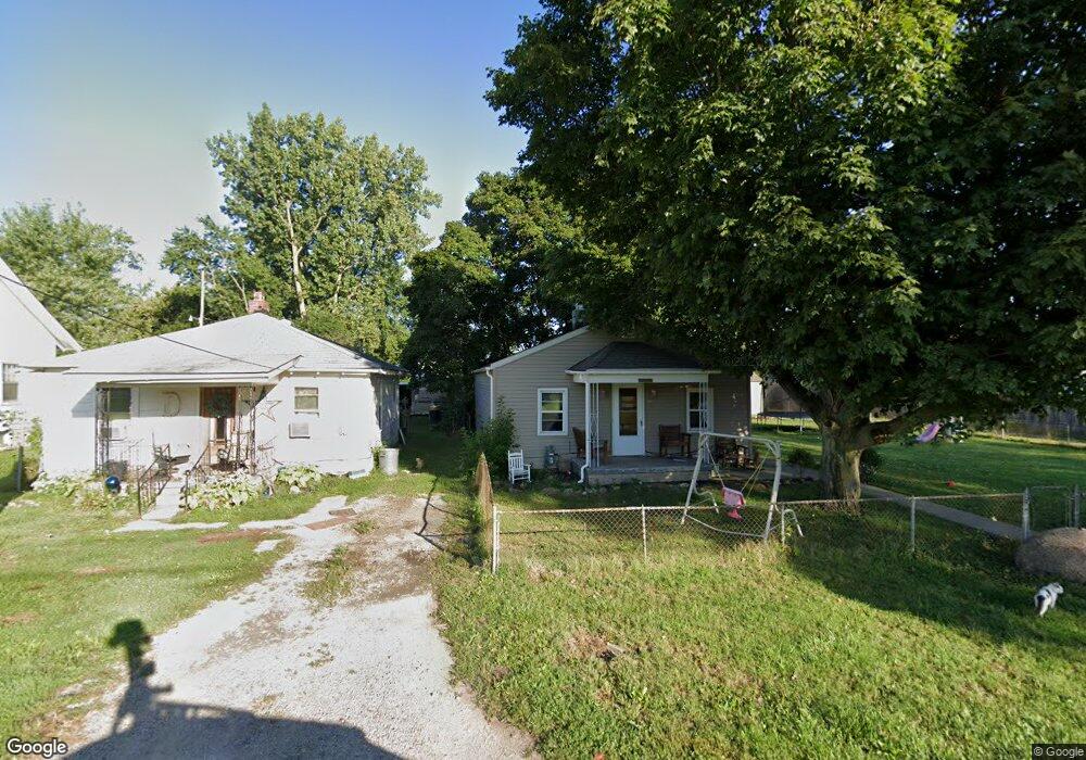
1663 S Central Ave Columbus, OH 43223
Brookshire NeighborhoodEstimated Value: $132,000 - $195,000
3
Beds
1
Bath
816
Sq Ft
$188/Sq Ft
Est. Value
About This Home
This home is located at 1663 S Central Ave, Columbus, OH 43223 and is currently estimated at $153,748, approximately $188 per square foot. 1663 S Central Ave is a home located in Franklin County with nearby schools including James A Harmon Elementary School, Franklin Woods Intermediate School, and Finland Middle School.
Ownership History
Date
Name
Owned For
Owner Type
Purchase Details
Closed on
Oct 1, 2022
Sold by
Loves Investments Llc
Bought by
Morales Anthony R
Current Estimated Value
Purchase Details
Closed on
Jan 27, 2012
Sold by
Love Wesley L and Love Sheryl H
Bought by
Loves Investments Llc
Purchase Details
Closed on
Jan 23, 2006
Sold by
Bayes Roy L
Bought by
Love Wesley L and Love Sheryl H
Purchase Details
Closed on
Aug 11, 2000
Sold by
Wagy Frizzell Evelyn and Wagy Doris M
Bought by
Bayes Roy L
Create a Home Valuation Report for This Property
The Home Valuation Report is an in-depth analysis detailing your home's value as well as a comparison with similar homes in the area
Home Values in the Area
Average Home Value in this Area
Purchase History
| Date | Buyer | Sale Price | Title Company |
|---|---|---|---|
| Morales Anthony R | $70,000 | None Listed On Document | |
| Loves Investments Llc | -- | None Available | |
| Loves Investments Llc | -- | None Available | |
| Love Wesley L | $30,000 | None Available | |
| Bayes Roy L | $37,000 | -- |
Source: Public Records
Tax History
| Year | Tax Paid | Tax Assessment Tax Assessment Total Assessment is a certain percentage of the fair market value that is determined by local assessors to be the total taxable value of land and additions on the property. | Land | Improvement |
|---|---|---|---|---|
| 2025 | $5,693 | $35,320 | $6,480 | $28,840 |
| 2024 | $5,693 | $35,320 | $6,480 | $28,840 |
| 2023 | $1,897 | $35,315 | $6,475 | $28,840 |
| 2022 | $1,497 | $19,850 | $5,810 | $14,040 |
| 2021 | $1,808 | $19,850 | $5,810 | $14,040 |
| 2020 | $1,422 | $19,850 | $5,810 | $14,040 |
| 2019 | $1,408 | $16,520 | $4,830 | $11,690 |
| 2018 | $697 | $16,520 | $4,830 | $11,690 |
| 2017 | $1,309 | $16,520 | $4,830 | $11,690 |
| 2016 | $1,138 | $12,920 | $2,070 | $10,850 |
| 2015 | $557 | $12,920 | $2,070 | $10,850 |
| 2014 | $1,017 | $12,920 | $2,070 | $10,850 |
| 2013 | $588 | $15,190 | $2,415 | $12,775 |
Source: Public Records
Map
Nearby Homes
- 0 S Central Ave
- 1521 October Ridge Ct
- 1295 Woodbrook Ln Unit 223
- 1258 Woodbrook Cir W Unit 199
- 1543 Red Leaf Ln
- 2210 October Ridge Dr
- 2375 Woodbrook Cir S Unit 167
- 2375 Woodbrook Cir N Unit 128
- 1208 Woodbrook Ln Unit 307
- 1640 Butterfly Ct
- 1360 Hafton Woods Dr
- 1173 Woodbrook Cir W Unit 56
- 2600 Plainview Ave
- 1335 Hafton Woods Dr
- 2336 Woodbrook Cir N Unit 92 B
- 2348 Woodbrook Cir N Unit F
- 1372 Stanwix Ct
- 1085 Hardesty Place E Unit 4
- 2072 Asher Ct
- 2407 Bluff Run Dr
- 1667 S Central Ave
- 1671 S Central Ave
- 0 Chambers Ave
- 1666 Peabody Ave
- 2451 Chambers Ave
- 1660 Peabody Ave
- 1678 Peabody Ave
- 1678 Peabody Ave
- 2465 Chambers Ave
- 1682 Peabody Ave
- 2441 Chambers Ave
- 2469 Chambers Ave
- 1683 S Central Ave
- 1683 S Central Ave
- 2506 Franklin Ave
- 0 Chambers Ave
- 2429 Chambers Ave
- 2508 Franklin Ave
- 2456 Chambers Ave
- 2456 Chambers Ave
Your Personal Tour Guide
Ask me questions while you tour the home.