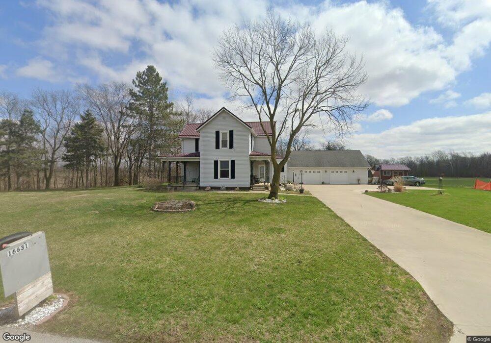
16631 State Route 190 Fort Jennings, OH 45844
Estimated Value: $211,000 - $336,000
4
Beds
3
Baths
1,566
Sq Ft
$182/Sq Ft
Est. Value
About This Home
This home is located at 16631 State Route 190, Fort Jennings, OH 45844 and is currently estimated at $284,894, approximately $181 per square foot. 16631 State Route 190 is a home located in Putnam County with nearby schools including Fort Jennings Elementary School and Fort Jennings High School.
Ownership History
Date
Name
Owned For
Owner Type
Purchase Details
Closed on
Nov 3, 2005
Sold by
Kunz Patricia
Bought by
Wilson Barbara S
Current Estimated Value
Home Financials for this Owner
Home Financials are based on the most recent Mortgage that was taken out on this home.
Original Mortgage
$50,000
Outstanding Balance
$14,752
Interest Rate
6.04%
Mortgage Type
New Conventional
Estimated Equity
$270,142
Create a Home Valuation Report for This Property
The Home Valuation Report is an in-depth analysis detailing your home's value as well as a comparison with similar homes in the area
Home Values in the Area
Average Home Value in this Area
Purchase History
| Date | Buyer | Sale Price | Title Company |
|---|---|---|---|
| Wilson Barbara S | $140,000 | None Available |
Source: Public Records
Mortgage History
| Date | Status | Borrower | Loan Amount |
|---|---|---|---|
| Open | Wilson Barbara S | $50,000 |
Source: Public Records
Tax History Compared to Growth
Tax History
| Year | Tax Paid | Tax Assessment Tax Assessment Total Assessment is a certain percentage of the fair market value that is determined by local assessors to be the total taxable value of land and additions on the property. | Land | Improvement |
|---|---|---|---|---|
| 2024 | $1,966 | $61,000 | $5,850 | $55,150 |
| 2023 | $2,020 | $45,380 | $4,360 | $41,020 |
| 2022 | $1,776 | $45,381 | $4,361 | $41,020 |
| 2021 | $1,532 | $44,670 | $4,360 | $40,310 |
| 2020 | $1,532 | $40,460 | $3,720 | $36,740 |
| 2019 | $1,298 | $37,950 | $4,360 | $33,590 |
| 2018 | $1,279 | $37,950 | $4,360 | $33,590 |
| 2017 | $1,269 | $37,950 | $4,360 | $33,590 |
| 2016 | $1,324 | $40,460 | $3,720 | $36,740 |
| 2015 | $1,415 | $40,460 | $3,720 | $36,740 |
| 2014 | $1,431 | $40,460 | $3,720 | $36,740 |
| 2013 | $1,451 | $40,460 | $3,720 | $36,740 |
Source: Public Records
Map
Nearby Homes
- 17736 Road 20p
- 20501 U S 224
- 0 Heritage Cir Unit 6112034
- 0 Heritage Cir Unit 303239
- 320 Auglaize St
- 0 Road 24-Q
- 7510 State Route 66
- 106 Carnation St
- 15105 Road 15m
- 1220 Rose Anna Dr
- 1303 Carolyn Dr
- 650 E 6th St
- 810 N Franklin St
- 704 N Franklin St
- 903 E 3rd St
- 8951 Brickner Rd
- 821 E 3rd St
- 610 N Washington St
- 405 N Franklin St
- 633 E 2nd St
- 16822 Road 20p
- 16451 State Route 190
- 16413 State Route 190
- 16847 State Route 190
- 16952 Road 20p
- 16608 Road 20p
- 17010 State Route 190
- 17048 Sr
- 17048 State Route 190
- 17194 Road 20p
- 17160 State Route 190
- 20916 Road Q
- 17177 State Route 190 Unit 17179
- 16119 Ohio 190
- 17275 State Route 190
- 16119 State Route 190
- 17337 State Route 190
- 21991 Road Q
- 21735 Sr
- 17460 Road 20p