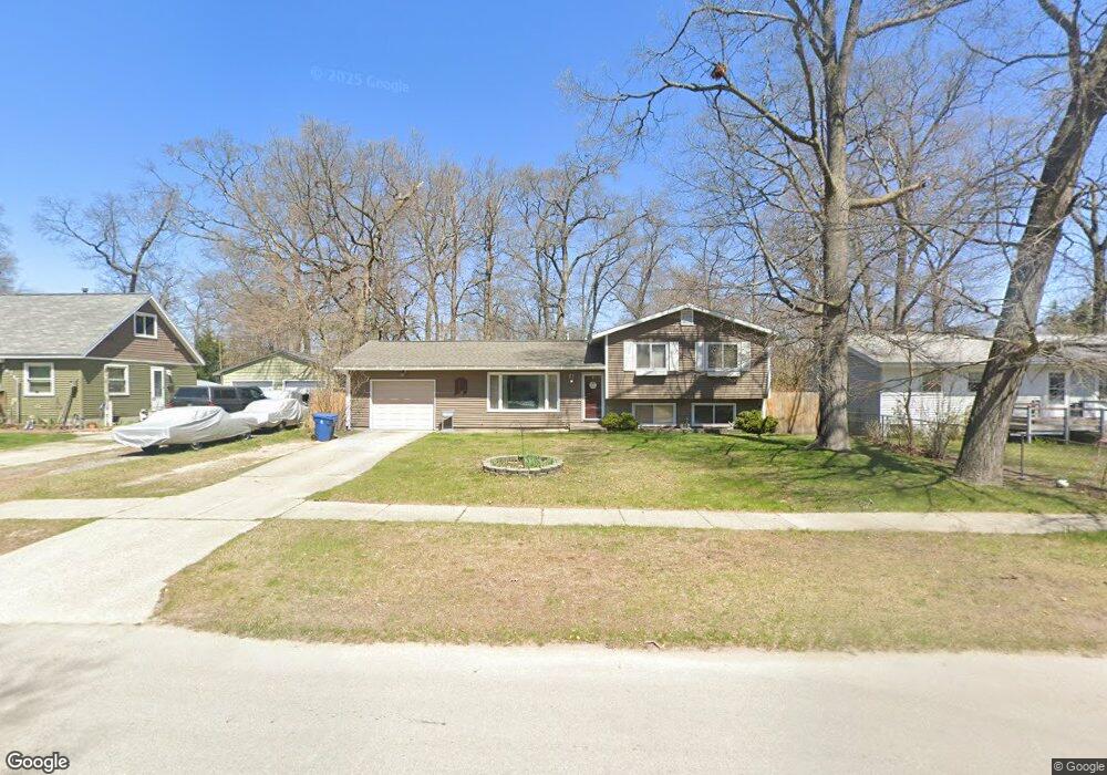
1664 Leif Ave Norton Shores, MI 49441
Estimated Value: $250,364 - $292,000
--
Bed
2
Baths
1,684
Sq Ft
$163/Sq Ft
Est. Value
About This Home
This home is located at 1664 Leif Ave, Norton Shores, MI 49441 and is currently estimated at $274,091, approximately $162 per square foot. 1664 Leif Ave is a home located in Muskegon County with nearby schools including Mona Shores High School, Dr. Martin Luther King Academy, and West Shore Lutheran School.
Ownership History
Date
Name
Owned For
Owner Type
Purchase Details
Closed on
Feb 11, 2020
Sold by
Mccarty Sue A
Bought by
Mccarty Cameron R and Mccarty Rebecca
Current Estimated Value
Home Financials for this Owner
Home Financials are based on the most recent Mortgage that was taken out on this home.
Original Mortgage
$159,080
Outstanding Balance
$141,174
Interest Rate
3.72%
Mortgage Type
New Conventional
Estimated Equity
$132,917
Create a Home Valuation Report for This Property
The Home Valuation Report is an in-depth analysis detailing your home's value as well as a comparison with similar homes in the area
Home Values in the Area
Average Home Value in this Area
Purchase History
| Date | Buyer | Sale Price | Title Company |
|---|---|---|---|
| Mccarty Cameron R | $164,000 | None Available |
Source: Public Records
Mortgage History
| Date | Status | Borrower | Loan Amount |
|---|---|---|---|
| Open | Mccarty Cameron R | $159,080 |
Source: Public Records
Tax History Compared to Growth
Tax History
| Year | Tax Paid | Tax Assessment Tax Assessment Total Assessment is a certain percentage of the fair market value that is determined by local assessors to be the total taxable value of land and additions on the property. | Land | Improvement |
|---|---|---|---|---|
| 2025 | $2,380 | $113,300 | $0 | $0 |
| 2024 | $1,866 | $103,500 | $0 | $0 |
| 2023 | $1,782 | $90,800 | $0 | $0 |
| 2022 | $2,172 | $78,400 | $0 | $0 |
| 2021 | $2,110 | $72,200 | $0 | $0 |
| 2020 | $2,015 | $67,400 | $0 | $0 |
| 2019 | $1,978 | $61,000 | $0 | $0 |
| 2018 | $1,932 | $56,700 | $0 | $0 |
| 2017 | $1,887 | $54,900 | $0 | $0 |
| 2016 | $1,461 | $50,800 | $0 | $0 |
| 2015 | -- | $48,700 | $0 | $0 |
| 2014 | $1,753 | $48,600 | $0 | $0 |
| 2013 | -- | $45,400 | $0 | $0 |
Source: Public Records
Map
Nearby Homes
- 1744 W Norton Ave
- 1733 Woodside Rd
- 1582 Haverhill Rd
- 1936 Lawnel Ave
- 1480 Marlboro Rd
- 3658 Lake Harbor Rd
- 1448 Marlboro Rd
- 3246 Royal Oak Rd
- 3283 Mccracken St
- 1689 Bonneville Dr
- 1650 Bonneville Dr
- 1752 Bonneville Dr
- 1456 Greenwich Rd
- 3684 Harris Dr
- 1947 Spencer Dr
- 1243 Crandall Ave
- 2881 Cornell Ct
- 2059 Garland Dr
- 3320 Davis Rd
- 1377 Princeton Rd
- 1654 Leif Ave
- 1674 Leif Ave
- 1673 Leif Ave
- 1642 Leif Ave
- 1671 Leif Ave
- 1690 Leif Ave
- 1657 Leif Ave
- 1641 Leif Ave
- 1632 Leif Ave
- 1695 Leif Ave
- 1702 Leif Ave
- 1663 Columbus Ave
- 1673 Columbus Ave
- 1651 Columbus Ave
- 1703 Leif Ave
- 1683 Columbus Ave
- 1664 W Norton Ave
- 1633 Leif Ave
- 1641 Columbus Ave
- 1654 W Norton Ave