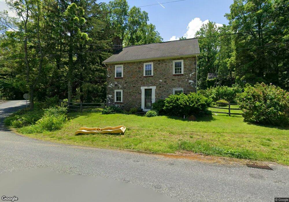
1665 Kumry Rd Quakertown, PA 18951
Milford-Quakertown NeighborhoodEstimated Value: $494,406 - $609,000
4
Beds
1
Bath
2,550
Sq Ft
$211/Sq Ft
Est. Value
About This Home
This home is located at 1665 Kumry Rd, Quakertown, PA 18951 and is currently estimated at $538,469, approximately $211 per square foot. 1665 Kumry Rd is a home located in Bucks County with nearby schools including Pfaff Elementary School, Quakertown Community Senior High School, and Faith Christian Academy 7-12th.
Ownership History
Date
Name
Owned For
Owner Type
Purchase Details
Closed on
Dec 26, 2023
Sold by
1665 Kumry Road Trust
Bought by
Cmh Homes Inc
Current Estimated Value
Purchase Details
Closed on
Nov 30, 2005
Sold by
1665 Kumry Road Trust
Bought by
Datcuk Peter T and Sezov Natalie M
Home Financials for this Owner
Home Financials are based on the most recent Mortgage that was taken out on this home.
Original Mortgage
$346,385
Interest Rate
6.14%
Mortgage Type
Fannie Mae Freddie Mac
Purchase Details
Closed on
Dec 17, 2004
Sold by
Skaroff Robert D and Skaroff Annette S
Bought by
1665 Kumry Road Trust
Purchase Details
Closed on
Nov 15, 1996
Sold by
Hixson Mary E
Bought by
Skaroff Robert D and Skaroff Annette J
Home Financials for this Owner
Home Financials are based on the most recent Mortgage that was taken out on this home.
Original Mortgage
$161,100
Interest Rate
7.99%
Create a Home Valuation Report for This Property
The Home Valuation Report is an in-depth analysis detailing your home's value as well as a comparison with similar homes in the area
Home Values in the Area
Average Home Value in this Area
Purchase History
| Date | Buyer | Sale Price | Title Company |
|---|---|---|---|
| Cmh Homes Inc | $120,000 | None Listed On Document | |
| Datcuk Peter T | $365,000 | None Available | |
| 1665 Kumry Road Trust | $219,700 | -- | |
| Skaroff Robert D | $179,000 | -- |
Source: Public Records
Mortgage History
| Date | Status | Borrower | Loan Amount |
|---|---|---|---|
| Previous Owner | Datcuk Peter T | $346,385 | |
| Previous Owner | Skaroff Robert D | $161,100 |
Source: Public Records
Tax History Compared to Growth
Tax History
| Year | Tax Paid | Tax Assessment Tax Assessment Total Assessment is a certain percentage of the fair market value that is determined by local assessors to be the total taxable value of land and additions on the property. | Land | Improvement |
|---|---|---|---|---|
| 2025 | $5,727 | $28,400 | $3,870 | $24,530 |
| 2024 | $5,727 | $28,400 | $3,870 | $24,530 |
| 2023 | $5,670 | $28,400 | $3,870 | $24,530 |
| 2022 | $5,574 | $28,400 | $3,870 | $24,530 |
| 2021 | $5,574 | $28,400 | $3,870 | $24,530 |
| 2020 | $5,574 | $28,400 | $3,870 | $24,530 |
| 2019 | $5,420 | $28,400 | $3,870 | $24,530 |
| 2018 | $5,232 | $28,400 | $3,870 | $24,530 |
| 2017 | $5,070 | $28,400 | $3,870 | $24,530 |
| 2016 | $5,070 | $28,400 | $3,870 | $24,530 |
| 2015 | -- | $28,400 | $3,870 | $24,530 |
| 2014 | -- | $28,400 | $3,870 | $24,530 |
Source: Public Records
Map
Nearby Homes
- 1690 Kumry Rd
- 1715 Kumry Rd
- 0 Krammes Rd Unit PABU2104522
- 1730 Fels Rd
- 1625 Canary Rd
- 1615 Canary Rd
- 1605 Canary Rd
- 1370 Kumry Rd
- 2120 Brinkman Rd
- 1365 Fennel Rd
- 1765 Old Plains Rd
- 1410 Fels Rd
- 1926 Alamingo Dr
- 1270 Fennel Rd
- 1999 Crossing Way
- 2255 Spinnerstown Rd
- 2070 Trumbauersville Rd
- 1813 Sycamore Dr
- 2420 Bannerstone Dr
- 1844 Enclave Dr