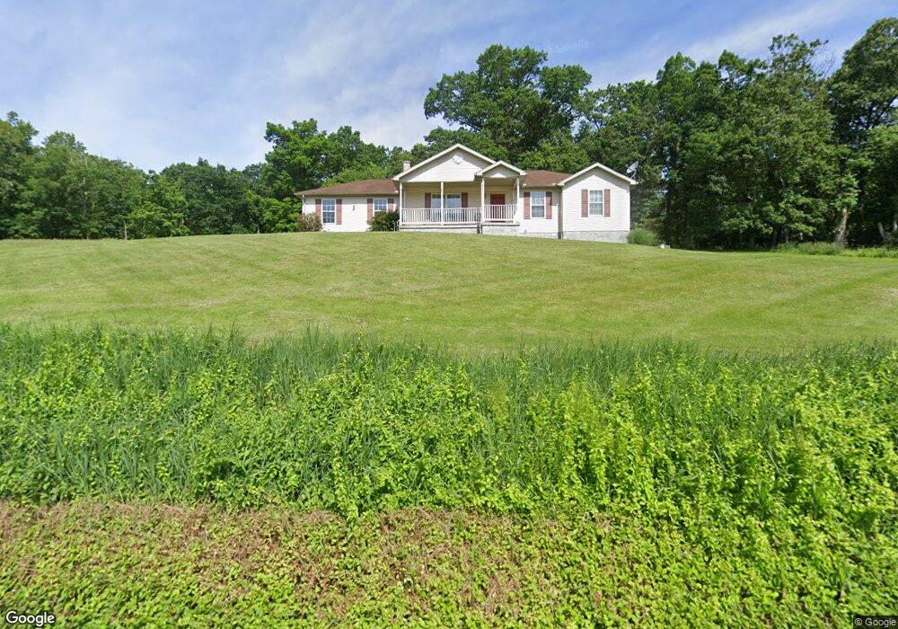
1665 Lockport Rd Lewistown, PA 17044
Estimated Value: $190,000 - $298,000
3
Beds
2
Baths
1,406
Sq Ft
$168/Sq Ft
Est. Value
About This Home
This home is located at 1665 Lockport Rd, Lewistown, PA 17044 and is currently estimated at $235,645, approximately $167 per square foot. 1665 Lockport Rd is a home located in Mifflin County with nearby schools including Strodes Mills Elementary School, Mifflin County Middle School, and Mifflin County Junior High School.
Ownership History
Date
Name
Owned For
Owner Type
Purchase Details
Closed on
Jun 14, 2013
Sold by
Ammon Helen and Ammon Helen A
Bought by
Ammon Ellen M
Current Estimated Value
Home Financials for this Owner
Home Financials are based on the most recent Mortgage that was taken out on this home.
Original Mortgage
$54,000
Outstanding Balance
$38,447
Interest Rate
3.51%
Estimated Equity
$197,198
Purchase Details
Closed on
Jul 2, 1999
Bought by
Sigler Millard A and Sigler Elma H
Create a Home Valuation Report for This Property
The Home Valuation Report is an in-depth analysis detailing your home's value as well as a comparison with similar homes in the area
Home Values in the Area
Average Home Value in this Area
Purchase History
| Date | Buyer | Sale Price | Title Company |
|---|---|---|---|
| Ammon Ellen M | -- | -- | |
| Sigler Millard A | -- | -- |
Source: Public Records
Mortgage History
| Date | Status | Borrower | Loan Amount |
|---|---|---|---|
| Open | Ammon Ellen M | $54,000 |
Source: Public Records
Tax History Compared to Growth
Tax History
| Year | Tax Paid | Tax Assessment Tax Assessment Total Assessment is a certain percentage of the fair market value that is determined by local assessors to be the total taxable value of land and additions on the property. | Land | Improvement |
|---|---|---|---|---|
| 2025 | $2,651 | $47,100 | $11,350 | $35,750 |
| 2024 | $2,651 | $47,100 | $11,350 | $35,750 |
| 2023 | $2,628 | $47,100 | $11,350 | $35,750 |
| 2022 | $2,628 | $47,100 | $11,350 | $35,750 |
| 2021 | $2,604 | $47,100 | $11,350 | $35,750 |
| 2020 | $2,604 | $47,100 | $11,350 | $35,750 |
| 2019 | $2,554 | $47,100 | $11,350 | $35,750 |
| 2018 | $2,541 | $47,100 | $11,350 | $35,750 |
| 2017 | $2,541 | $47,100 | $11,350 | $35,750 |
| 2016 | $2,459 | $47,100 | $11,350 | $35,750 |
| 2015 | -- | $47,100 | $11,350 | $35,750 |
| 2012 | -- | $47,150 | $11,350 | $35,800 |
Source: Public Records
Map
Nearby Homes
- 1810 Lockport Rd
- 41 Aspen Dr Unit 3
- 162 Birch Dr
- 131 Snooks Hill Rd
- 67 Airport Hill Rd
- 149 Juniata Dr
- 10 Flat Land Rd
- 00 Ferguson Valley Rd
- 65 Hillside Dr
- 4755 State Route 103 N
- 00 522 S
- 78 Brannon Ln
- 0 River Rd
- 924 W 6th St
- 23 N Water St
- 817 W 6th St
- 20 N Market St
- 705-707 W 6th St
- 622 W 5th St
- 616 W 5th St
- 1729 Lockport Rd
- 1726 Lockport Rd
- 1738 Lockport Rd
- 1745 Lockport Rd
- 1755 Lockport Rd
- 1765 Lockport Rd
- 1793 Lockport Rd
- 1793 Lockport Rd
- 1754 Lockport Rd
- 1768 Lockport Rd
- 1798 Lockport Rd
- 1803 Lockport Rd
- 3 Canal Rd
- 1835 Lockport Rd
- 88 Canal Rd
- 1857 Lockport Rd
- 1873 Lockport Rd
- 1858 Lockport Rd
- 108 Canal Rd
- 1897 Lockport Rd