1665 Marsh Hawk Cir Castle Rock, CO 80109
Red Hawk NeighborhoodEstimated Value: $760,000 - $822,000
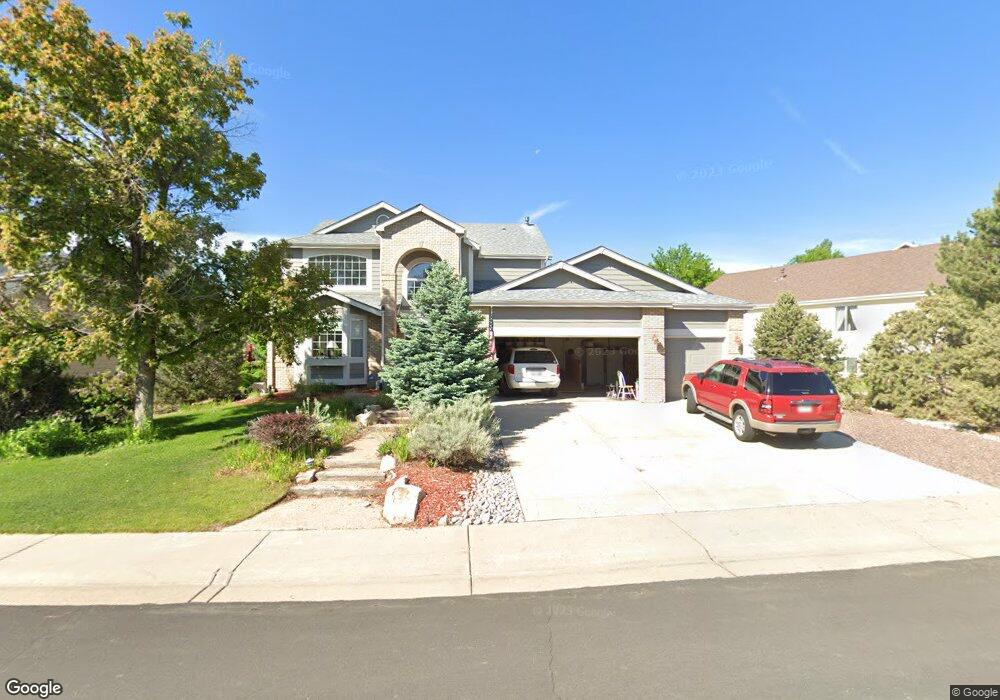
About This Home
This home is located at 1665 Marsh Hawk Cir, Castle Rock, CO 80109 and is currently estimated at $787,882, approximately $142 per square foot. 1665 Marsh Hawk Cir is a home located in Douglas County with nearby schools including Clear Sky Elementary School, Castle Rock Middle School, and Castle View High School.
Ownership History
We collect this data history from publicly available records. To have your information removed, we recommend requesting removal directly through your county’s website.
Purchase Details
Purchase Details
Home Financials for this Owner
Home Financials are based on the most recent Mortgage that was taken out on this home.Purchase Details
Home Financials for this Owner
Home Financials are based on the most recent Mortgage that was taken out on this home.Home Values in the Area
Average Home Value in this Area
Purchase History
We collect this data history from publicly available records. To have your information removed, we recommend requesting removal directly through your county’s website.
| Date | Buyer | Sale Price | Title Company |
|---|---|---|---|
| -- | None Listed On Document | ||
| $370,000 | Land Title Guarantee Company | ||
| $294,500 | First American Heritage Titl |
Mortgage History
We collect this data history from publicly available records. To have your information removed, we recommend requesting removal directly through your county’s website.
| Date | Status | Borrower | Loan Amount |
|---|---|---|---|
| Previous Owner | $200,000 | ||
| Previous Owner | $150,000 | ||
| Previous Owner | $100,000 | ||
| Previous Owner | $184,000 | ||
| Previous Owner | $279,750 |
Tax History
We collect this data history from publicly available records. To have your information removed, we recommend requesting removal directly through your county’s website.
| Year | Tax Paid | Tax Assessment Tax Assessment Total Assessment is a certain percentage of the fair market value that is determined by local assessors to be the total taxable value of land and additions on the property. | Land | Improvement |
|---|---|---|---|---|
| 2026 | $3,081 | $54,190 | $13,140 | $41,050 |
| 2025 | $3,081 | $54,190 | $13,140 | $41,050 |
| 2024 | $3,081 | $54,860 | $10,960 | $43,900 |
| 2023 | $3,124 | $54,860 | $10,960 | $43,900 |
| 2022 | $2,441 | $36,630 | $7,820 | $28,810 |
| 2021 | $2,547 | $36,630 | $7,820 | $28,810 |
| 2020 | $2,417 | $35,480 | $6,470 | $29,010 |
| 2019 | $2,429 | $35,480 | $6,470 | $29,010 |
| 2018 | $2,372 | $33,790 | $4,950 | $28,840 |
| 2017 | $2,172 | $33,790 | $4,950 | $28,840 |
| 2016 | $2,122 | $32,160 | $4,540 | $27,620 |
| 2015 | $1,092 | $32,160 | $4,540 | $27,620 |
| 2014 | $2,004 | $27,090 | $3,980 | $23,110 |
Map
- 1760 Cooper Ct
- 1026 Switch Grass Dr
- 1895 Rough Ct
- 1843 Rough Ct
- 1490 Thunder Butte Rd
- 1308 Rosemary Dr
- 1489 Red Peak Dr
- 1480 Thunder Butte Rd
- 1475 Bergen Rock St
- 1515 Short Grass Ct
- 1720 Wild Rye Ct
- 1585 Bent Grass Cir
- 1761 Wild Rye Ct
- 1459 Thunder Butte Rd
- 1458 Nemrick Place
- 1663 Rose Petal Ln
- 1298 Melting Snow Way
- 1196 Melting Snow Way
- 1676 Bent Wedge Point
- 1105 Melting Snow Way
- 1669 Marsh Hawk Cir
- 1671 Marsh Hawk Cir
- 1667 Marsh Hawk Cir
- 1081 Surlyn Ct
- 1093 Surlyn Ct
- 1668 Marsh Hawk Cir
- 1670 Marsh Hawk Cir
- 1673 Marsh Hawk Cir
- 1672 Marsh Hawk Cir
- 1666 Marsh Hawk Cir
- 1065 Surlyn Ct
- 1663 Marsh Hawk Cir
- 1840 Cooper Ct
- 1664 Marsh Hawk Cir
- 1674 Marsh Hawk Cir
- 991 Harpy Ct
- 1675 Marsh Hawk Cir
- 1661 Marsh Hawk Cir
- 1047 Surlyn Ct
- 1820 Cooper Ct
Ask me questions while you tour the home.