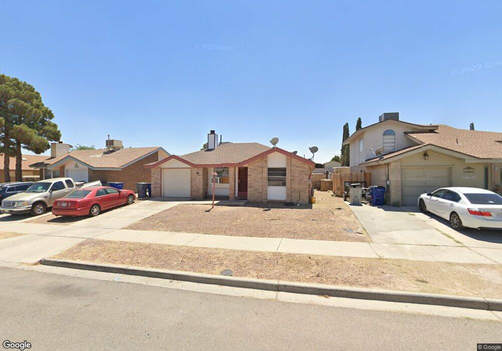
1665 Paul Todd Dr Unit 1 El Paso, TX 79936
Marty Robbins North NeighborhoodEstimated Value: $166,000 - $174,000
3
Beds
2
Baths
966
Sq Ft
$175/Sq Ft
Est. Value
About This Home
This home is located at 1665 Paul Todd Dr Unit 1, El Paso, TX 79936 and is currently estimated at $169,173, approximately $175 per square foot. 1665 Paul Todd Dr Unit 1 is a home located in El Paso County with nearby schools including Vista Del Sol Elementary School, Capt Walter E Clarke Middle School, and Americas High School.
Ownership History
Date
Name
Owned For
Owner Type
Purchase Details
Closed on
Feb 24, 1998
Sold by
Delgado Antonio and Delgado Iris
Bought by
Silva Edmundo and Magallanes Patricia A
Current Estimated Value
Home Financials for this Owner
Home Financials are based on the most recent Mortgage that was taken out on this home.
Original Mortgage
$39,100
Outstanding Balance
$7,147
Interest Rate
7.01%
Estimated Equity
$162,026
Create a Home Valuation Report for This Property
The Home Valuation Report is an in-depth analysis detailing your home's value as well as a comparison with similar homes in the area
Home Values in the Area
Average Home Value in this Area
Purchase History
| Date | Buyer | Sale Price | Title Company |
|---|---|---|---|
| Silva Edmundo | -- | -- |
Source: Public Records
Mortgage History
| Date | Status | Borrower | Loan Amount |
|---|---|---|---|
| Open | Silva Edmundo | $39,100 |
Source: Public Records
Tax History Compared to Growth
Tax History
| Year | Tax Paid | Tax Assessment Tax Assessment Total Assessment is a certain percentage of the fair market value that is determined by local assessors to be the total taxable value of land and additions on the property. | Land | Improvement |
|---|---|---|---|---|
| 2025 | $3,624 | $147,295 | $10,858 | $136,437 |
| 2024 | $3,624 | $140,798 | $10,858 | $129,940 |
| 2023 | $3,831 | $133,063 | $10,858 | $122,205 |
| 2022 | $3,633 | $125,442 | $10,858 | $114,584 |
| 2021 | $3,087 | $98,084 | $10,858 | $87,226 |
| 2020 | $2,358 | $74,296 | $10,858 | $63,438 |
| 2018 | $2,073 | $70,869 | $10,858 | $60,011 |
| 2017 | $2,049 | $71,747 | $10,858 | $60,889 |
| 2016 | $2,049 | $71,747 | $10,858 | $60,889 |
| 2015 | $2,010 | $71,747 | $10,858 | $60,889 |
| 2014 | $2,010 | $72,389 | $10,858 | $61,531 |
Source: Public Records
Map
Nearby Homes
- 11833 Haddad Ct
- 1776 Marlys Larson St
- 1607 Gene Torres Dr
- 1641 Henri Dunant Way
- 11711 Dick Mayers Dr
- 1612 Phil Gibbs Dr
- 1625 Phil Gibbs Dr
- 1640 James Chisum Dr
- 11718 Jim Thorpe Dr
- 11856 Scott Simpson Dr
- 1604 James Chisum Dr
- 1709 Mitchell Jones Dr
- 1601 Joe Porter Dr
- 11765 Scott Simpson Dr
- 1690 Leroy Bonse Dr
- 1619 Doug Olson Dr
- 11709 Ronald McNair Dr
- 1547 Whistler Ln
- 11948 Mcauliffe Dr
- 1808 Neil Armstrong Ln
- 1665 Paul Todd Dr
- 1669 Paul Todd Dr
- 1661 Paul Todd Dr
- 11828 Jim Ferriell Dr
- 1673 Paul Todd Dr
- 1657 Paul Todd Dr
- 11832 Jim Ferriell Dr
- 11824 Jim Ferriell Dr
- 11836 Jim Ferriell Dr
- 1653 Paul Todd Dr
- 1662 Paul Todd Dr
- 1677 Paul Todd Dr
- 11820 Jim Ferriell Dr
- 1666 Paul Todd Dr
- 1670 Paul Todd Dr
- 11840 Jim Ferriell Dr
- 1649 Paul Todd Dr
- 1674 Paul Todd Dr
- 11800 Frank Shorter Ln
- 11805 Frank Shorter Ln