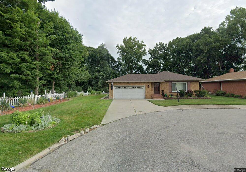
16655 Anthony St Maple Heights, OH 44137
Estimated Value: $121,000 - $131,000
3
Beds
2
Baths
1,186
Sq Ft
$107/Sq Ft
Est. Value
About This Home
This home is located at 16655 Anthony St, Maple Heights, OH 44137 and is currently estimated at $126,498, approximately $106 per square foot. 16655 Anthony St is a home located in Cuyahoga County with nearby schools including Abraham Lincoln Elementary School, Rockside/ J.F. Kennedy School, and Italy High School.
Ownership History
Date
Name
Owned For
Owner Type
Purchase Details
Closed on
Jul 7, 2025
Sold by
Hardwick Jerome
Bought by
Hardwick Willie C
Current Estimated Value
Purchase Details
Closed on
Jan 11, 2023
Sold by
Hardwick Willie C
Bought by
Hardwick Jerome
Purchase Details
Closed on
Dec 4, 2013
Sold by
Hardwick Willie C and Hardwick Ozella E
Bought by
Hardwick Willie C and Hardwick Ozella E
Purchase Details
Closed on
Jan 1, 1975
Bought by
Hardwick Willie C and Hardwick Ozella
Create a Home Valuation Report for This Property
The Home Valuation Report is an in-depth analysis detailing your home's value as well as a comparison with similar homes in the area
Home Values in the Area
Average Home Value in this Area
Purchase History
| Date | Buyer | Sale Price | Title Company |
|---|---|---|---|
| Hardwick Willie C | -- | None Listed On Document | |
| Hardwick Jerome | -- | None Listed On Document | |
| Hardwick Willie C | -- | Attorney | |
| Hardwick Willie C | -- | -- |
Source: Public Records
Tax History Compared to Growth
Tax History
| Year | Tax Paid | Tax Assessment Tax Assessment Total Assessment is a certain percentage of the fair market value that is determined by local assessors to be the total taxable value of land and additions on the property. | Land | Improvement |
|---|---|---|---|---|
| 2024 | $2,930 | $41,545 | $9,065 | $32,480 |
| 2023 | $1,408 | $20,550 | $5,500 | $15,050 |
| 2022 | $1,441 | $20,550 | $5,500 | $15,050 |
| 2021 | $1,524 | $20,550 | $5,500 | $15,050 |
| 2020 | $1,105 | $15,580 | $4,170 | $11,410 |
| 2019 | $1,085 | $44,500 | $11,900 | $32,600 |
| 2018 | $1,078 | $15,580 | $4,170 | $11,410 |
| 2017 | $888 | $13,690 | $3,850 | $9,840 |
| 2016 | $847 | $13,690 | $3,850 | $9,840 |
| 2015 | $909 | $13,690 | $3,850 | $9,840 |
| 2014 | $909 | $15,060 | $4,240 | $10,820 |
Source: Public Records
Map
Nearby Homes
- 5082 Philip Ave
- 5110 Philip Ave
- 5061 Philip Ave
- 16712 Kollin Ave
- 5185 Clement Ave
- 5208 Clement Ave
- 5210 Theodore St
- 16241 Glenburn Ave
- 5031 Cato St
- 5212 Catherine St
- 5231 Philip Ave
- 5257 Philip Ave
- 5320 Clement Ave
- 5247 Henry St
- 5199 Arch St
- 15911 Friend Ave
- 5239 Arch St
- 16312 Sunny Glenn Ave
- 16216 Sunny Glenn Ave
- 17204 Maple Heights Blvd
- 16665 Anthony St
- 16669 Anthony St
- 16650 Anthony St
- 16660 Anthony St
- 16675 Anthony St
- 16664 Anthony St
- 16670 Anthony St
- 17160 Mccracken Rd
- 5040 Anthony St
- 17180 Mccracken Rd
- 16200 Mccracken Rd
- 5050 Anthony St
- 5019 Anthony St
- 17200 Mccracken Rd
- 16911 Raymond St
- 5025 Anthony St
- 5035 Anthony St
- 17220 Mccracken Rd
- 16901 Raymond St
- 16895 Raymond St