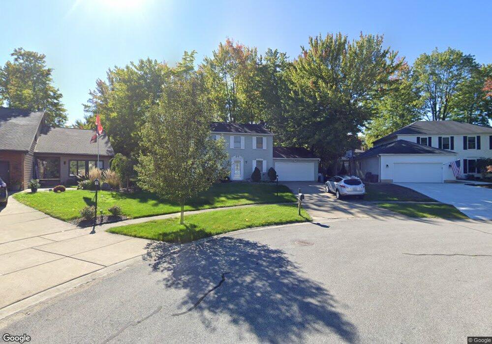
16657 Beech Cir Strongsville, OH 44136
Estimated Value: $340,675 - $409,000
4
Beds
3
Baths
1,860
Sq Ft
$202/Sq Ft
Est. Value
About This Home
This home is located at 16657 Beech Cir, Strongsville, OH 44136 and is currently estimated at $374,919, approximately $201 per square foot. 16657 Beech Cir is a home located in Cuyahoga County with nearby schools including Strongsville High School, Saint Ambrose Catholic School, and Sts Joseph & John Interparochial School.
Ownership History
Date
Name
Owned For
Owner Type
Purchase Details
Closed on
Mar 7, 2002
Sold by
Kochis Joseph A and Kochis Cheryl A
Bought by
Mclaughlin David M and Graf Danielle L
Current Estimated Value
Home Financials for this Owner
Home Financials are based on the most recent Mortgage that was taken out on this home.
Original Mortgage
$165,300
Outstanding Balance
$68,904
Interest Rate
7.03%
Estimated Equity
$306,015
Purchase Details
Closed on
Jun 11, 2001
Sold by
C & M Development Company An Ohio Part
Bought by
Kochis Joseph A and Kochis Cheryl A
Purchase Details
Closed on
Aug 30, 1988
Sold by
Fleck Joseph G
Bought by
C & M Development Company
Purchase Details
Closed on
Oct 15, 1979
Bought by
Fleck Joseph G
Purchase Details
Closed on
Jan 1, 1978
Bought by
Northeast Land Co
Create a Home Valuation Report for This Property
The Home Valuation Report is an in-depth analysis detailing your home's value as well as a comparison with similar homes in the area
Home Values in the Area
Average Home Value in this Area
Purchase History
| Date | Buyer | Sale Price | Title Company |
|---|---|---|---|
| Mclaughlin David M | $174,000 | -- | |
| Kochis Joseph A | $120,000 | Chicago Title Insurance Comp | |
| C & M Development Company | $124,500 | -- | |
| Fleck Joseph G | $84,900 | -- | |
| Northeast Land Co | -- | -- |
Source: Public Records
Mortgage History
| Date | Status | Borrower | Loan Amount |
|---|---|---|---|
| Open | Mclaughlin David M | $165,300 |
Source: Public Records
Tax History Compared to Growth
Tax History
| Year | Tax Paid | Tax Assessment Tax Assessment Total Assessment is a certain percentage of the fair market value that is determined by local assessors to be the total taxable value of land and additions on the property. | Land | Improvement |
|---|---|---|---|---|
| 2024 | $4,757 | $101,325 | $21,910 | $79,415 |
| 2023 | $5,049 | $80,640 | $22,190 | $58,450 |
| 2022 | $5,013 | $80,640 | $22,190 | $58,450 |
| 2021 | $4,973 | $80,640 | $22,190 | $58,450 |
| 2020 | $4,609 | $66,120 | $18,200 | $47,920 |
| 2019 | $4,474 | $188,900 | $52,000 | $136,900 |
| 2018 | $4,060 | $66,120 | $18,200 | $47,920 |
| 2017 | $4,001 | $60,310 | $14,420 | $45,890 |
| 2016 | $3,968 | $60,310 | $14,420 | $45,890 |
| 2015 | $4,024 | $60,310 | $14,420 | $45,890 |
| 2014 | $4,024 | $60,310 | $14,420 | $45,890 |
Source: Public Records
Map
Nearby Homes
- 16711 Beech Cir
- 15772 Boston Rd
- 17745 Brick Mill Run
- 15604-REAR Boston Rd
- 18229 Howe Rd
- 16486 S Red Rock Dr
- 97 Weathervane Ln
- 19694 Benbow Rd
- 19364 Ridgeline Ct
- 19740 Benbow Rd
- 17130 Golden Star Dr
- 15188 Trails Landing
- 14985 Camden Cir
- 17159 Turkey Meadow Ln
- 18987 Laurell Cir
- 159 Sunflower Dr
- 17682 Drake Rd
- 18411 Yorktown Oval
- 19813 Cross Trail S
- 17934 Cambridge Oval
- 16625 Beech Cir
- 16689 Beech Cir
- 16668 Currier Dr
- 16636 Currier Dr
- 16700 Currier Dr
- 19216 Bears Paw Ln
- 16632 Beech Cir
- 19174 Bears Paw Ln
- 16732 Currier Dr
- 19258 Bears Paw Ln
- 19132 Bears Paw Ln
- 16753 Beech Cir
- 16664 Beech Cir
- 16696 Beech Cir
- 19300 Bears Paw Ln
- 16764 Currier Dr
- 16728 Beech Cir
- 19090 Bears Paw Ln
- 16661 Currier Dr
- 16760 Beech Cir