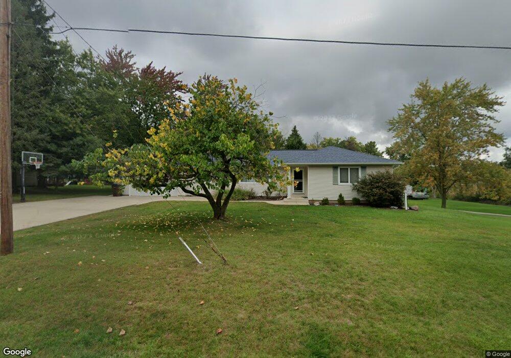
1666 Duguid Rd Jackson, MI 49203
Estimated Value: $219,275 - $238,000
Studio
--
Bath
1,690
Sq Ft
$136/Sq Ft
Est. Value
About This Home
This home is located at 1666 Duguid Rd, Jackson, MI 49203 and is currently estimated at $229,319, approximately $135 per square foot. 1666 Duguid Rd is a home located in Jackson County with nearby schools including Townsend Elementary School, Vandercook Lake High School, and Francis Street Primary School.
Ownership History
Date
Name
Owned For
Owner Type
Purchase Details
Closed on
Aug 22, 2005
Sold by
Bristow Raymond C and Bristow Raymond
Bought by
Odowd James E and Odowd Megan M
Current Estimated Value
Home Financials for this Owner
Home Financials are based on the most recent Mortgage that was taken out on this home.
Original Mortgage
$148,500
Outstanding Balance
$78,809
Interest Rate
5.82%
Mortgage Type
Fannie Mae Freddie Mac
Estimated Equity
$150,510
Create a Home Valuation Report for This Property
The Home Valuation Report is an in-depth analysis detailing your home's value as well as a comparison with similar homes in the area
Home Values in the Area
Average Home Value in this Area
Purchase History
| Date | Buyer | Sale Price | Title Company |
|---|---|---|---|
| Odowd James E | $165,000 | At |
Source: Public Records
Mortgage History
| Date | Status | Borrower | Loan Amount |
|---|---|---|---|
| Open | Odowd James E | $148,500 |
Source: Public Records
Tax History
| Year | Tax Paid | Tax Assessment Tax Assessment Total Assessment is a certain percentage of the fair market value that is determined by local assessors to be the total taxable value of land and additions on the property. | Land | Improvement |
|---|---|---|---|---|
| 2025 | $2,526 | $90,300 | $0 | $0 |
| 2024 | $16 | $93,100 | $0 | $0 |
| 2023 | $1,556 | $84,100 | $0 | $0 |
| 2022 | $2,336 | $72,600 | $0 | $0 |
| 2021 | $2,445 | $79,000 | $0 | $0 |
| 2020 | $2,423 | $77,300 | $0 | $0 |
| 2019 | $2,214 | $73,800 | $0 | $0 |
| 2018 | $2,161 | $64,200 | $0 | $0 |
| 2017 | $1,910 | $61,600 | $0 | $0 |
| 2016 | $1,335 | $60,200 | $60,200 | $0 |
| 2015 | $1,820 | $58,100 | $58,100 | $0 |
| 2014 | $1,820 | $56,600 | $0 | $0 |
| 2013 | -- | $56,600 | $56,600 | $0 |
Source: Public Records
Map
Nearby Homes
- 4030 Gatewood Dr
- 3846 Nelson Dr
- 108 Bagg Ave
- 1 Pete St Unit 39
- 61 Lois Ln Unit 61
- 2350 Brooklyn Rd
- 121 Bagg Ave
- 509 E Bird St
- 172 Taylor Ave Unit 84
- 1222 Connie Ave Unit 125
- 171 Carolyn Ave Unit 120
- 1225 Lucy Ave Unit 100
- 1248 Upper Lucy #111 Unit 111
- 4900 Nantucket Dr Unit 1
- VL Spring Arbor Rd
- 4600 Nantucket Dr Unit 12
- 4600 Nantucket Dr Unit 9
- 4700 Nantucket Dr Unit 15
- 4700 Nantucket Dr Unit 13
- 4600 Nantucket Dr Unit 10
Your Personal Tour Guide
Ask me questions while you tour the home.