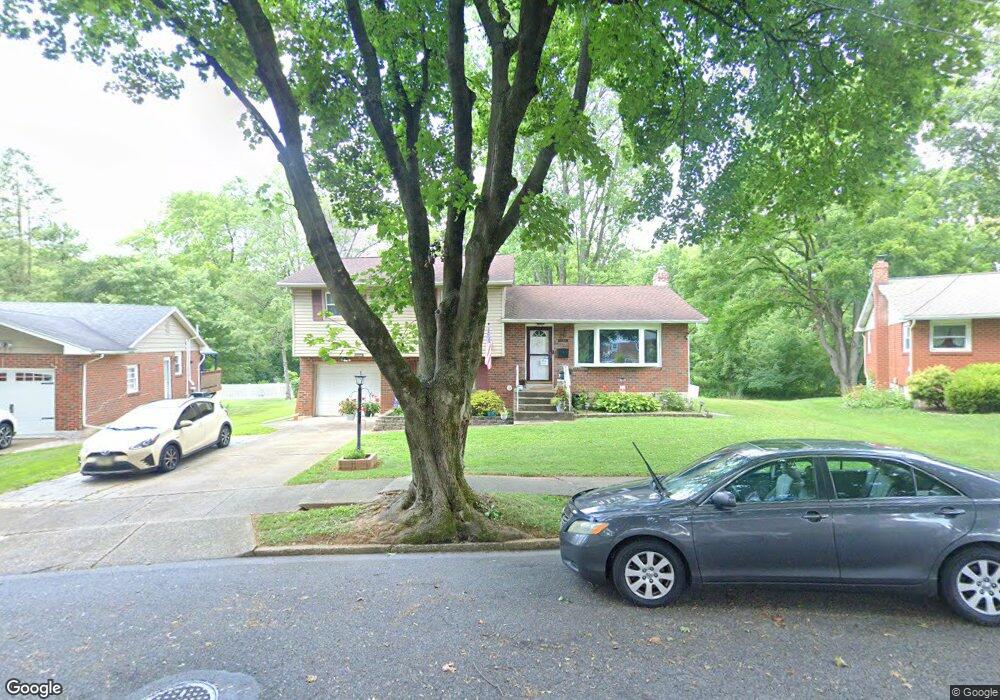
1666 Lois Ln Bethlehem, PA 18018
West Bethlehem NeighborhoodEstimated Value: $359,000 - $382,000
3
Beds
2
Baths
1,480
Sq Ft
$250/Sq Ft
Est. Value
About This Home
This home is located at 1666 Lois Ln, Bethlehem, PA 18018 and is currently estimated at $369,263, approximately $249 per square foot. 1666 Lois Ln is a home located in Lehigh County with nearby schools including James Buchanan Elementary School, Nitschmann Middle School, and Liberty High School.
Ownership History
Date
Name
Owned For
Owner Type
Purchase Details
Closed on
Jul 31, 2002
Sold by
Rosenfeld Adam
Bought by
Rivera Elisha and Rivera Irma
Current Estimated Value
Home Financials for this Owner
Home Financials are based on the most recent Mortgage that was taken out on this home.
Original Mortgage
$143,763
Outstanding Balance
$61,225
Interest Rate
6.64%
Mortgage Type
FHA
Estimated Equity
$308,038
Purchase Details
Closed on
Jan 5, 2002
Sold by
Standard Mercantile Bancorp Inc
Bought by
Rosenfeld Adam
Purchase Details
Closed on
Oct 10, 2001
Sold by
Jefferson Warren and Jefferson Wendy
Bought by
Standard Mercantile Bancorp
Purchase Details
Closed on
May 15, 1995
Sold by
Shimoski Joseph M
Bought by
Jefferson Warren L and Jefferson Wendy J
Purchase Details
Closed on
Jun 1, 1987
Bought by
Shimoski Joseph M
Create a Home Valuation Report for This Property
The Home Valuation Report is an in-depth analysis detailing your home's value as well as a comparison with similar homes in the area
Home Values in the Area
Average Home Value in this Area
Purchase History
| Date | Buyer | Sale Price | Title Company |
|---|---|---|---|
| Rivera Elisha | $144,900 | -- | |
| Rosenfeld Adam | $40,000 | -- | |
| Standard Mercantile Bancorp | -- | -- | |
| Jefferson Warren L | $100,000 | -- | |
| Shimoski Joseph M | -- | -- |
Source: Public Records
Mortgage History
| Date | Status | Borrower | Loan Amount |
|---|---|---|---|
| Open | Rivera Elisha | $143,763 |
Source: Public Records
Tax History Compared to Growth
Tax History
| Year | Tax Paid | Tax Assessment Tax Assessment Total Assessment is a certain percentage of the fair market value that is determined by local assessors to be the total taxable value of land and additions on the property. | Land | Improvement |
|---|---|---|---|---|
| 2025 | $4,873 | $169,600 | $39,200 | $130,400 |
| 2024 | $4,817 | $169,600 | $39,200 | $130,400 |
| 2023 | $4,774 | $169,600 | $39,200 | $130,400 |
| 2022 | $4,852 | $169,600 | $130,400 | $39,200 |
| 2021 | $4,830 | $169,600 | $39,200 | $130,400 |
| 2020 | $4,676 | $169,600 | $39,200 | $130,400 |
| 2019 | $4,710 | $169,600 | $39,200 | $130,400 |
| 2018 | $4,618 | $169,600 | $39,200 | $130,400 |
| 2017 | $4,413 | $169,600 | $39,200 | $130,400 |
| 2016 | -- | $169,600 | $39,200 | $130,400 |
| 2015 | -- | $168,600 | $39,200 | $129,400 |
| 2014 | -- | $168,600 | $39,200 | $129,400 |
Source: Public Records
Map
Nearby Homes
- 1541 Stanford Rd
- 1011 Highland Ave
- 1559 Kelchner Rd
- 1918 Pinehurst Rd
- 922 Beverly Ave
- 1209 Manchester Rd
- 1440 Greenview Dr
- 1768 W Union Blvd
- 1556 Bayberry Ln
- 1309 Greenview Dr
- 1198 Pennsylvania Ave
- 1336 Greenview Dr
- 2180 Pinehurst Rd
- 650 Highland Ave
- 1334 W Union Blvd
- 1853 Richmond Ave
- 1247 Birchwood Dr
- 2035 Drury Ln
- 1512 W Broad St
- 2035 W Broad St