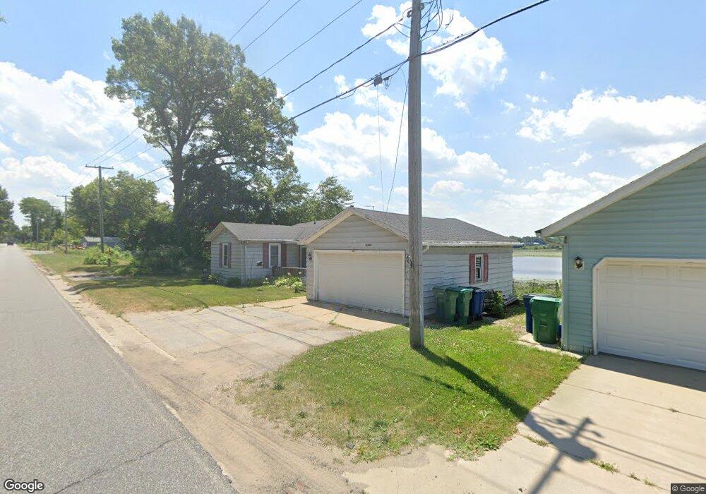
1666 W Severs Rd La Porte, IN 46350
Estimated Value: $168,027 - $247,000
3
Beds
2
Baths
854
Sq Ft
$237/Sq Ft
Est. Value
About This Home
This home is located at 1666 W Severs Rd, La Porte, IN 46350 and is currently estimated at $202,757, approximately $237 per square foot. 1666 W Severs Rd is a home located in LaPorte County with nearby schools including Prescott Elementary School, F. Willard Crichfield Elementary School, and La Porte High School.
Ownership History
Date
Name
Owned For
Owner Type
Purchase Details
Closed on
Mar 9, 2007
Sold by
Gmac Mortgage Llc
Bought by
Mckie Joshua J and Mckie Angela N
Current Estimated Value
Home Financials for this Owner
Home Financials are based on the most recent Mortgage that was taken out on this home.
Original Mortgage
$77,900
Outstanding Balance
$47,126
Interest Rate
6.25%
Mortgage Type
Unknown
Estimated Equity
$155,631
Purchase Details
Closed on
Dec 14, 2006
Sold by
Mannia Chester J and Mannia Chester J
Bought by
Gmac Mortgage Corp
Create a Home Valuation Report for This Property
The Home Valuation Report is an in-depth analysis detailing your home's value as well as a comparison with similar homes in the area
Home Values in the Area
Average Home Value in this Area
Purchase History
| Date | Buyer | Sale Price | Title Company |
|---|---|---|---|
| Mckie Joshua J | $77,900 | Transcontinental Title Co | |
| Gmac Mortgage Corp | $54,991 | None Available |
Source: Public Records
Mortgage History
| Date | Status | Borrower | Loan Amount |
|---|---|---|---|
| Open | Mckie Joshua J | $77,900 |
Source: Public Records
Tax History Compared to Growth
Tax History
| Year | Tax Paid | Tax Assessment Tax Assessment Total Assessment is a certain percentage of the fair market value that is determined by local assessors to be the total taxable value of land and additions on the property. | Land | Improvement |
|---|---|---|---|---|
| 2024 | $502 | $97,100 | $29,200 | $67,900 |
| 2022 | $460 | $86,000 | $19,500 | $66,500 |
| 2021 | $412 | $81,400 | $19,500 | $61,900 |
| 2020 | $526 | $81,400 | $19,500 | $61,900 |
| 2019 | $573 | $91,500 | $19,500 | $72,000 |
| 2018 | $508 | $85,600 | $19,500 | $66,100 |
| 2017 | $419 | $80,000 | $19,500 | $60,500 |
| 2016 | $524 | $90,700 | $17,800 | $72,900 |
| 2014 | $468 | $89,600 | $17,800 | $71,800 |
Source: Public Records
Map
Nearby Homes
- 169 W Mcclung Rd Unit 201
- 169 W Mcclung Rd Unit 203
- 195 W Mcclung Rd
- 0 N Kuchar Dr Unit NRA812041
- 206 Outlook Cove Dr
- 306 Outlook Cove Dr
- 865 W 200 N
- 125 W Mcclung Rd
- 610 Home St
- 17 Elm Dr
- 1944 Park St
- 1960 Park St
- 1964 Park St
- 1962 Park St
- 0 W Lot 81 Concord Dr Unit NRA809376
- 0 W 450 St N Unit NRA827579
- 842-Lot 59 W Broken Arrow Dr
- 0 N Us Hwy 35 Unit NRA809471
- 0 Pawnee Trail Unit NRA824498
- 6877 N Nature Ln
- 1678 W Severs Rd
- 1602 W Severs Rd
- 1722 W Severs Rd
- 1495 W Severs Rd
- 1588 W Severs Rd
- 1526 W Severs Rd
- 1558 W Severs Rd
- 1768 W Severs Rd
- 1782 W Severs Rd
- 1556 W Severs Rd
- 1866 W Severs Rd
- 1422 W Severs Rd
- 1374 W Severs Rd
- 1900 W Severs Rd
- 173 W Mcclung Rd
- 177 W Mcclung Rd
- 207 N Saint Road 39
- 1312 W Severs Rd
- 2005 State Road 39
- 207 N 39 State Rd