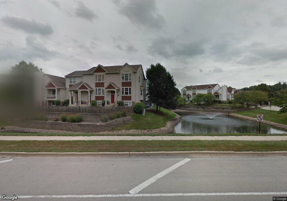
1667 Apple Tree Ln Unit 20 West Chicago, IL 60185
Chicago West NeighborhoodEstimated Value: $270,198 - $327,000
Studio
--
Bath
1,428
Sq Ft
$208/Sq Ft
Est. Value
About This Home
This home is located at 1667 Apple Tree Ln Unit 20, West Chicago, IL 60185 and is currently estimated at $297,550, approximately $208 per square foot. 1667 Apple Tree Ln Unit 20 is a home located in DuPage County with nearby schools including Currier Elementary School, Leman Middle School, and West Chicago Community High School.
Ownership History
Date
Name
Owned For
Owner Type
Purchase Details
Closed on
Oct 29, 2004
Sold by
Brown Patrick E and Schweitzer Kathy M
Bought by
Mcwilliams Jerry L and Mcwilliams Samarth H
Current Estimated Value
Home Financials for this Owner
Home Financials are based on the most recent Mortgage that was taken out on this home.
Original Mortgage
$149,200
Outstanding Balance
$74,307
Interest Rate
5.75%
Mortgage Type
Purchase Money Mortgage
Estimated Equity
$223,243
Purchase Details
Closed on
Oct 24, 1997
Sold by
Appletree Development Llc
Bought by
Brown Patrick E and Schweitzer Kathy M
Home Financials for this Owner
Home Financials are based on the most recent Mortgage that was taken out on this home.
Original Mortgage
$135,379
Interest Rate
7.65%
Mortgage Type
FHA
Create a Home Valuation Report for This Property
The Home Valuation Report is an in-depth analysis detailing your home's value as well as a comparison with similar homes in the area
Home Values in the Area
Average Home Value in this Area
Purchase History
| Date | Buyer | Sale Price | Title Company |
|---|---|---|---|
| Mcwilliams Jerry L | $186,500 | -- | |
| Brown Patrick E | -- | -- |
Source: Public Records
Mortgage History
| Date | Status | Borrower | Loan Amount |
|---|---|---|---|
| Open | Mcwilliams Jerry L | $149,200 | |
| Previous Owner | Brown Patrick E | $135,379 | |
| Closed | Mcwilliams Jerry L | $37,300 |
Source: Public Records
Tax History
| Year | Tax Paid | Tax Assessment Tax Assessment Total Assessment is a certain percentage of the fair market value that is determined by local assessors to be the total taxable value of land and additions on the property. | Land | Improvement |
|---|---|---|---|---|
| 2024 | $5,387 | $68,672 | $11,376 | $57,296 |
| 2023 | $5,070 | $62,720 | $10,390 | $52,330 |
| 2022 | $4,874 | $57,560 | $9,540 | $48,020 |
| 2021 | $4,683 | $55,170 | $9,140 | $46,030 |
| 2020 | $4,582 | $53,490 | $8,860 | $44,630 |
| 2019 | $4,439 | $50,940 | $8,440 | $42,500 |
| 2018 | $4,155 | $47,170 | $7,820 | $39,350 |
| 2017 | $4,040 | $44,820 | $7,430 | $37,390 |
| 2016 | $3,905 | $41,790 | $6,930 | $34,860 |
| 2015 | $3,798 | $38,680 | $6,410 | $32,270 |
| 2014 | $3,695 | $37,550 | $6,220 | $31,330 |
| 2013 | $3,755 | $38,930 | $6,450 | $32,480 |
Source: Public Records
Map
Nearby Homes
- 1350 Sarana Ave
- 264 Augusta Ave
- 29W200 Forest Ave
- 1105 Joliet St
- 30W038 Willow Ln Unit D
- 0N160 Sarana Ave
- 30W015 Juniper Ct
- 28W032 Roosevelt Rd
- 30W073 Penny Ln
- 29W092 Pomeroy St
- 2S030 Bristol Ln
- 30W011 Kensington Dr Unit 1
- 28W760 Du Page St
- 128 E Blair St
- 833 E Sterling Ave
- 0S760 Cleveland St
- 790 Hillview Ave
- Lot 17,18,19 Roosevelt Rd
- 27W0S Roosevelt Rd
- 0N052 Woodland Ct
- 1665 Apple Tree Ln
- 1663 Apple Tree Ln Unit 18
- 1661 Apple Tree Ln Unit 17
- 1657 Apple Tree Ln Unit 24
- 1655 Apple Tree Ln Unit 23
- 1653 Apple Tree Ln Unit 22
- 1651 Apple Tree Ln Unit 21
- 1647 Apple Tree Ln
- 1643 Apple Tree Ln Unit 26
- 1645 Apple Tree Ln
- 1641 Apple Tree Ln Unit 25
- 1662 Orchard Ct Unit 99
- 1660 Apple Tree Ln Unit 8
- 1666 Orchard Ct Unit 97
- 1664 Orchard Ct Unit 98
- 1660 Orchard Ct Unit 100
- 1662 Apple Tree Ln Unit 7
- 1672 Apple Tree Ln Unit 3
- 1650 Apple Tree Ln Unit 12
- 1670 Apple Tree Ln Unit 4
Your Personal Tour Guide
Ask me questions while you tour the home.