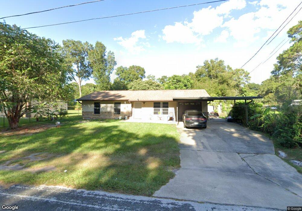
1667 Pratt St Deland, FL 32720
Estimated Value: $234,000 - $247,000
3
Beds
2
Baths
2,192
Sq Ft
$111/Sq Ft
Est. Value
About This Home
This home is located at 1667 Pratt St, Deland, FL 32720 and is currently estimated at $242,452, approximately $110 per square foot. 1667 Pratt St is a home located in Volusia County with nearby schools including Woodward Avenue Elementary School, Deland High School, and Southwestern Middle School.
Ownership History
Date
Name
Owned For
Owner Type
Purchase Details
Closed on
Jan 15, 2014
Sold by
Gent Gloria
Bought by
Clark Leonard L
Current Estimated Value
Purchase Details
Closed on
Apr 21, 1997
Sold by
Kresta Kim D
Bought by
Kresta Kim D and Gent Gloria
Purchase Details
Closed on
Jun 15, 1982
Bought by
Clark Leonard L
Purchase Details
Closed on
Feb 15, 1982
Bought by
Clark Leonard L
Create a Home Valuation Report for This Property
The Home Valuation Report is an in-depth analysis detailing your home's value as well as a comparison with similar homes in the area
Home Values in the Area
Average Home Value in this Area
Purchase History
| Date | Buyer | Sale Price | Title Company |
|---|---|---|---|
| Clark Leonard L | $50,000 | Watson Title Services Inc | |
| Kresta Kim D | $10,600 | -- | |
| Clark Leonard L | $6,400 | -- | |
| Clark Leonard L | $33,000 | -- |
Source: Public Records
Tax History Compared to Growth
Tax History
| Year | Tax Paid | Tax Assessment Tax Assessment Total Assessment is a certain percentage of the fair market value that is determined by local assessors to be the total taxable value of land and additions on the property. | Land | Improvement |
|---|---|---|---|---|
| 2025 | $3,027 | $185,482 | $34,500 | $150,982 |
| 2024 | $3,027 | $188,420 | $34,500 | $153,920 |
| 2023 | $3,027 | $176,328 | $26,250 | $150,078 |
| 2022 | $2,820 | $160,859 | $24,750 | $136,109 |
| 2021 | $2,665 | $127,467 | $18,750 | $108,717 |
| 2020 | $2,489 | $121,853 | $16,875 | $104,978 |
| 2019 | $2,463 | $117,278 | $13,875 | $103,403 |
| 2018 | $2,268 | $100,531 | $10,500 | $90,031 |
| 2017 | $2,106 | $87,339 | $10,500 | $76,839 |
| 2016 | $1,835 | $71,065 | $0 | $0 |
| 2015 | $1,756 | $65,535 | $0 | $0 |
| 2014 | $1,557 | $56,897 | $0 | $0 |
Source: Public Records
Map
Nearby Homes
- 0 Hwy 92 Unit MFRA4664896
- 1762 Blue Oak Ct
- 1519 Monroe St
- 1773 Blue Oak Ct
- 1581 S Montgomery St
- 0 W Beresford Rd Unit MFRV4941057
- 1299 Blue Ash Ln
- Eclipse Plan at Oak Hammock - Estate Key Collection
- Dawn Plan at Oak Hammock - Estate Key Collection
- Bloom Plan at Oak Hammock - Estate Key Collection
- Celeste Plan at Oak Hammock - Estate Key Collection
- Aura Plan at Oak Hammock - Estate Key Collection
- 1572 S Montgomery St
- 1351 Blue Ash Ln
- 1513 S Elsasser St
- 1570 S High St
- 1309 Hammock Reserve Dr
- 1383 Blue Ash Ln
- 1387 Blue Ash Ln
- 1301 Hammock Reserve Dr
- 1655 Pratt St
- 1652 Margaret St
- 1643 Pratt St
- 1650 Margaret St
- 1670 Margaret St
- 1638 Margaret St
- 1183 Taylor Rd W
- 1169 Taylor Rd W
- 1631 Pratt St
- 1626 Margaret St
- 1159 Taylor Rd W
- 1619 Pratt St
- 1535 Rambling Oaks Ln
- 1647 Margaret St
- 1645 Margaret St
- 1614 Margaret St
- 1655 Margaret St
- 1525 Rambling Oaks Ln
- 1643 Margaret St
- 1135 Taylor Rd W