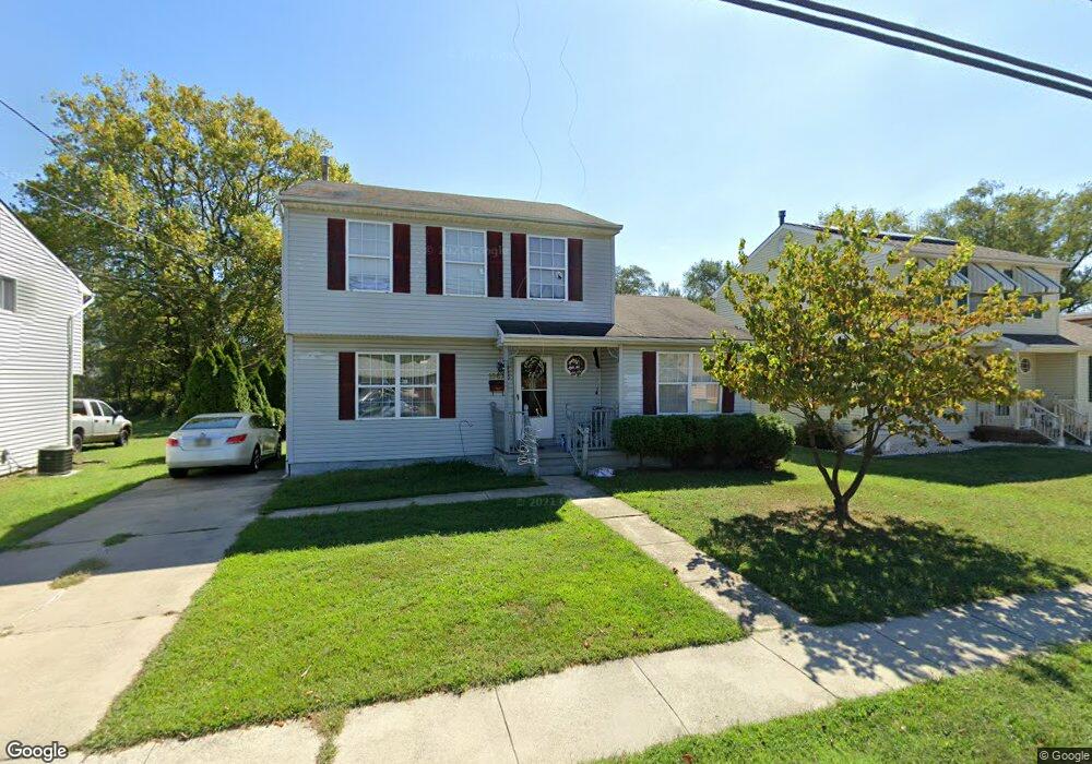
1667 Swedesboro Ave Paulsboro, NJ 08066
Estimated Value: $217,077 - $346,000
--
Bed
--
Bath
1,560
Sq Ft
$180/Sq Ft
Est. Value
About This Home
This home is located at 1667 Swedesboro Ave, Paulsboro, NJ 08066 and is currently estimated at $281,269, approximately $180 per square foot. 1667 Swedesboro Ave is a home located in Gloucester County with nearby schools including Billingsport Elementary School, Loudenslager Elementary School, and Paulsboro High School.
Ownership History
Date
Name
Owned For
Owner Type
Purchase Details
Closed on
Apr 3, 2007
Sold by
Jiles Albert L
Bought by
Jiles Althea R
Current Estimated Value
Create a Home Valuation Report for This Property
The Home Valuation Report is an in-depth analysis detailing your home's value as well as a comparison with similar homes in the area
Home Values in the Area
Average Home Value in this Area
Purchase History
| Date | Buyer | Sale Price | Title Company |
|---|---|---|---|
| Jiles Althea R | -- | None Available |
Source: Public Records
Tax History Compared to Growth
Tax History
| Year | Tax Paid | Tax Assessment Tax Assessment Total Assessment is a certain percentage of the fair market value that is determined by local assessors to be the total taxable value of land and additions on the property. | Land | Improvement |
|---|---|---|---|---|
| 2025 | $6,090 | $138,400 | $20,100 | $118,300 |
| 2024 | $6,084 | $138,400 | $20,100 | $118,300 |
| 2023 | $6,084 | $138,400 | $20,100 | $118,300 |
| 2022 | $5,973 | $138,400 | $20,100 | $118,300 |
| 2021 | $5,852 | $138,400 | $20,100 | $118,300 |
| 2020 | $5,821 | $138,400 | $20,100 | $118,300 |
| 2019 | $5,638 | $138,400 | $20,100 | $118,300 |
| 2018 | $5,316 | $138,400 | $20,100 | $118,300 |
| 2017 | $5,294 | $138,400 | $20,100 | $118,300 |
| 2016 | $5,043 | $138,400 | $20,100 | $118,300 |
| 2015 | $5,014 | $138,400 | $20,100 | $118,300 |
| 2014 | $4,951 | $147,000 | $26,200 | $120,800 |
Source: Public Records
Map
Nearby Homes
- 1214 Walter Ave
- 1224 Heddon Ave
- 1534 Pine St
- 255 Elizabeth Ave
- 1519 Pine St
- 131 Jessup St
- 269 W Broad St
- 0 Lodge Ave
- 8 S Delaware St
- L18 20 W Broad St
- L5 Lodge Ave
- L8 Lodge Ave
- 219 Vanneman Blvd
- 227 W Buck St
- 122 W Washington St
- 335 W Buck St
- 344 W Washington St
- 11 W Washington St
- 1043 Penn Line Rd
- 330 Croce Ave
- 1671 Swedesboro Ave
- 1661 Swedesboro Ave
- 1675 Swedesboro Ave
- 1664 Swedesboro Ave
- 1684 Swedesboro Ave
- 1683 Swedesboro Ave
- 1660 Swedesboro Ave
- 1221 Walter Ave
- 1655 Swedesboro Ave
- 1211 Walter Ave
- 1231 Walter Ave
- 1690 Swedesboro Ave
- 1645 Swedesboro Ave
- 1695 Swedesboro Ave
- 1237 Walter Ave
- 1658 Swedesboro Ave
- 1694 Swedesboro Ave
- 1639-43 Swedesboro Ave
- 462 Huff Ave
- 1639 Swedesboro Ave Unit 43