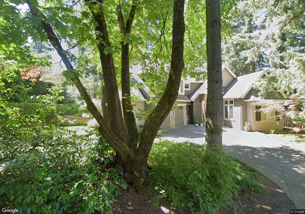
16671 Fir Ln Lake Oswego, OR 97034
Palisades NeighborhoodEstimated Value: $1,636,507 - $2,253,000
3
Beds
4
Baths
3,129
Sq Ft
$622/Sq Ft
Est. Value
About This Home
This home is located at 16671 Fir Ln, Lake Oswego, OR 97034 and is currently estimated at $1,946,377, approximately $622 per square foot. 16671 Fir Ln is a home located in Clackamas County with nearby schools including Westridge Elementary School, Lakeridge Middle School, and Lakeridge High School.
Ownership History
Date
Name
Owned For
Owner Type
Purchase Details
Closed on
Dec 5, 2013
Sold by
Balch Powers Enterprises Llc
Bought by
Romero Omar Y and Romero Heather W
Current Estimated Value
Home Financials for this Owner
Home Financials are based on the most recent Mortgage that was taken out on this home.
Original Mortgage
$656,000
Outstanding Balance
$486,286
Interest Rate
4.08%
Mortgage Type
New Conventional
Estimated Equity
$1,460,091
Purchase Details
Closed on
Jul 24, 2012
Sold by
Laurence Balch Llc
Bought by
Balch Powers Enterprises Llc
Purchase Details
Closed on
Feb 21, 2012
Sold by
Nihei Lorraine E
Bought by
Laurence Balch Llc
Purchase Details
Closed on
Nov 20, 2007
Sold by
Wilkins Mary Ethel
Bought by
Wilkins Mary Ethel and Mary Ethel Wilkins Revocable Living Tr
Create a Home Valuation Report for This Property
The Home Valuation Report is an in-depth analysis detailing your home's value as well as a comparison with similar homes in the area
Home Values in the Area
Average Home Value in this Area
Purchase History
| Date | Buyer | Sale Price | Title Company |
|---|---|---|---|
| Romero Omar Y | $820,000 | Ticor Title | |
| Balch Powers Enterprises Llc | -- | Fidelity Natl Title Co Of Or | |
| Laurence Balch Llc | $240,000 | Ticor Title | |
| Wilkins Mary Ethel | -- | None Available |
Source: Public Records
Mortgage History
| Date | Status | Borrower | Loan Amount |
|---|---|---|---|
| Open | Romero Omar Y | $656,000 |
Source: Public Records
Tax History Compared to Growth
Tax History
| Year | Tax Paid | Tax Assessment Tax Assessment Total Assessment is a certain percentage of the fair market value that is determined by local assessors to be the total taxable value of land and additions on the property. | Land | Improvement |
|---|---|---|---|---|
| 2025 | $19,783 | $1,030,140 | -- | -- |
| 2024 | $19,255 | $1,000,136 | -- | -- |
| 2023 | $19,255 | $971,006 | $0 | $0 |
| 2022 | $18,135 | $942,725 | $0 | $0 |
| 2021 | $16,750 | $915,267 | $0 | $0 |
| 2020 | $16,329 | $888,609 | $0 | $0 |
| 2019 | $15,927 | $862,728 | $0 | $0 |
| 2018 | $15,146 | $837,600 | $0 | $0 |
| 2017 | $14,615 | $813,204 | $0 | $0 |
| 2016 | $13,306 | $789,518 | $0 | $0 |
| 2015 | $12,855 | $766,522 | $0 | $0 |
| 2014 | $12,688 | $744,196 | $0 | $0 |
Source: Public Records
Map
Nearby Homes
- 2255 Glen Haven Rd
- 0 S Shore Blvd
- 16878 Canyon Dr
- 1931 Park Forest Ct
- 1951 Greentree Rd
- 1847 Woodland Terrace
- 2627 Park Rd
- 2240 Summit Ct
- 17035 Westview Dr
- 17360 Alpine Way
- 1990 Indian Trail
- 15948 Twin Fir Rd
- 1410 Woodland Terrace
- 15947 Twin Fir Rd
- 17349 Banyan Ln
- 1300 Tyndall Ct
- 17210 Cedar Rd
- 2306 Mayors Ln
- 16636 Maple Cir
- 1224 Tyndall Ct
- 2315 Southshore Blvd
- 16653 Fir Ln
- 16672 Fir Ln
- 2240 SW South Shore Blvd
- 2271 Southshore Blvd
- 16645 Fir Ln
- 2260 S Shore Blvd
- 2260 Southshore Blvd
- 2280 Southshore Blvd
- 2250 Southshore Blvd
- 16586 Phantom Bluff Ct
- 16640 Fir Ln
- 2300 Southshore Blvd
- 2240 Southshore Blvd
- 16586 SW Phantom Bluff Ct
- 16700 Phantom Bluff Ct
- 16835 Fernwood Dr
- 2340 Southshore Blvd
- 16835 Fernwood Dr-Motivatd
- 16470 Phantom Bluff Ct