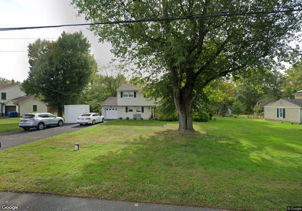
1668 Brookdale Dr Martinsville, NJ 08836
Estimated Value: $721,000 - $845,000
--
Bed
--
Bath
1,852
Sq Ft
$416/Sq Ft
Est. Value
About This Home
This home is located at 1668 Brookdale Dr, Martinsville, NJ 08836 and is currently estimated at $770,611, approximately $416 per square foot. 1668 Brookdale Dr is a home located in Somerset County with nearby schools including Crim Primary School, Bridgewater-Raritan Middle School, and Hillside Intermediate School.
Ownership History
Date
Name
Owned For
Owner Type
Purchase Details
Closed on
Oct 31, 2003
Sold by
Wagner Kenneth Kevin
Bought by
Diprospero Thomas and Diprospero Karen
Current Estimated Value
Home Financials for this Owner
Home Financials are based on the most recent Mortgage that was taken out on this home.
Original Mortgage
$150,000
Outstanding Balance
$69,589
Interest Rate
6.01%
Estimated Equity
$701,022
Purchase Details
Closed on
Jan 10, 1995
Sold by
Peruta Philomena
Bought by
Wagner Ken and Wagner Pam
Home Financials for this Owner
Home Financials are based on the most recent Mortgage that was taken out on this home.
Original Mortgage
$140,000
Interest Rate
9.23%
Create a Home Valuation Report for This Property
The Home Valuation Report is an in-depth analysis detailing your home's value as well as a comparison with similar homes in the area
Home Values in the Area
Average Home Value in this Area
Purchase History
| Date | Buyer | Sale Price | Title Company |
|---|---|---|---|
| Diprospero Thomas | $435,000 | -- | |
| Wagner Ken | $240,000 | -- |
Source: Public Records
Mortgage History
| Date | Status | Borrower | Loan Amount |
|---|---|---|---|
| Open | Diprospero Thomas | $150,000 | |
| Previous Owner | Wagner Ken | $140,000 |
Source: Public Records
Tax History Compared to Growth
Tax History
| Year | Tax Paid | Tax Assessment Tax Assessment Total Assessment is a certain percentage of the fair market value that is determined by local assessors to be the total taxable value of land and additions on the property. | Land | Improvement |
|---|---|---|---|---|
| 2025 | $11,439 | $601,400 | $291,700 | $309,700 |
| 2024 | $11,439 | $587,200 | $291,700 | $295,500 |
| 2023 | $10,184 | $513,300 | $291,700 | $221,600 |
| 2022 | $9,955 | $482,800 | $291,700 | $191,100 |
| 2021 | $9,689 | $471,900 | $291,700 | $180,200 |
| 2020 | $9,499 | $451,700 | $291,700 | $160,000 |
| 2019 | $9,689 | $456,400 | $291,700 | $164,700 |
| 2018 | $9,595 | $453,000 | $291,700 | $161,300 |
| 2017 | $9,377 | $442,300 | $291,700 | $150,600 |
| 2016 | $9,223 | $441,700 | $291,700 | $150,000 |
| 2015 | $9,143 | $438,100 | $291,700 | $146,400 |
| 2014 | $8,940 | $421,900 | $291,700 | $130,200 |
Source: Public Records
Map
Nearby Homes
- 7 Meyers Way
- 1831 Washington Valley Rd
- 1869 Washington Valley Rd
- 10 Assante Ln
- 1930 Mountain Top Rd
- 1825 Kennesaw Way
- 1600 Mountain Top Rd
- 1899 Washington Valley Rd
- 114 Branch Rd
- 6 Hardwood Ct
- 61 Christy Dr
- 1266 Mount Vernon Rd
- 57 Christy Dr
- 6 Mount Horeb Rd
- 34 Solomon Dr
- 499 Foothill Rd
- 5 2nd St
- 1 Wishnow Way
- 112 Loft Dr Unit II112
- 800 Star View Way
- 1662 Brookdale Dr
- 1672 Brookdale Dr
- 1669 Brookdale Dr
- 1673 Brookdale Dr
- 1663 Brookdale Dr
- 1678 Brookdale Dr
- 1658 Brookdale Dr
- 1679 Brookdale Dr
- 1657 Brookdale Dr
- 1684 Brookdale Dr
- 1652 Brookdale Dr
- 1640 Brookdale Dr
- 1653 Brookdale Dr
- 1685 Brookdale Dr
- 1648 Brookdale Dr
- 1688 Brookdale Dr
- 1689 Brookdale Dr
- 1649 Brookdale Dr
- 1325 Tullo Rd
- 1088 Tullo Rd