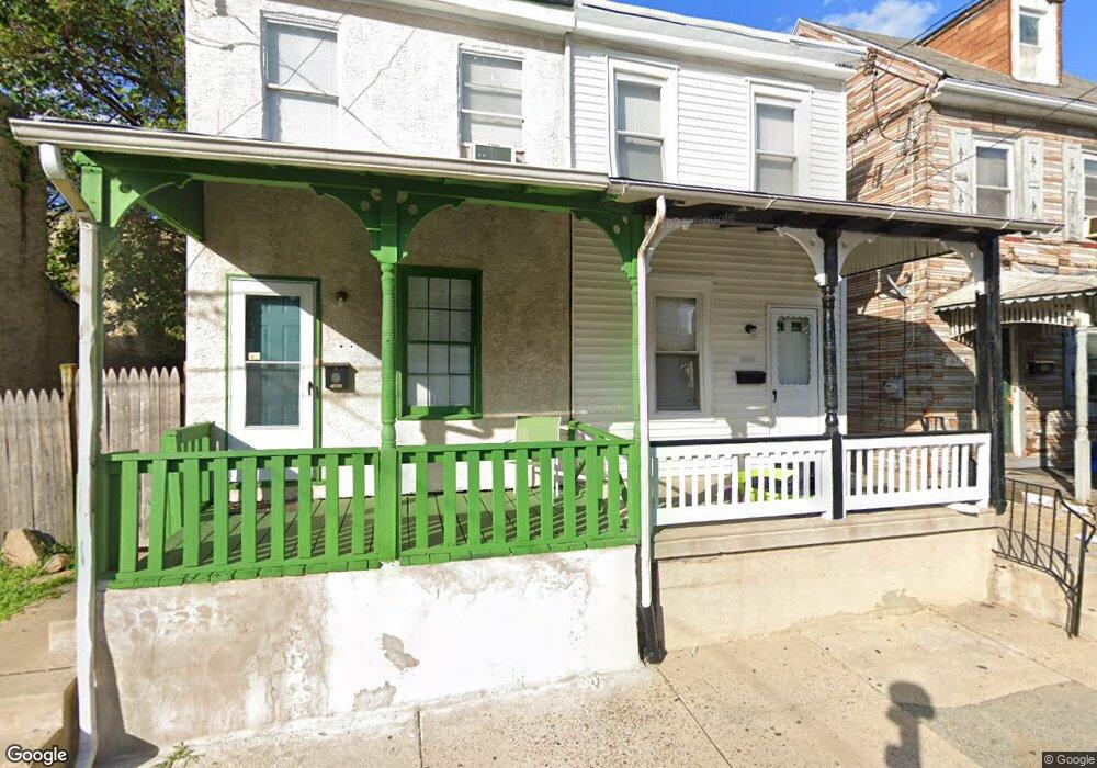
1669 Fillmore St Philadelphia, PA 19124
Frankford NeighborhoodEstimated Value: $111,000 - $147,000
--
Bed
--
Bath
936
Sq Ft
$139/Sq Ft
Est. Value
About This Home
This home is located at 1669 Fillmore St, Philadelphia, PA 19124 and is currently estimated at $129,971, approximately $138 per square foot. 1669 Fillmore St is a home located in Philadelphia County with nearby schools including Harding Warren G Middle School, Frankford High School, and Mastery Schools Smedley Elementary.
Ownership History
Date
Name
Owned For
Owner Type
Purchase Details
Closed on
Nov 14, 2018
Sold by
Rudy David G and Rudy Mary
Bought by
David G Rudy And Mary J Rudy Trust
Current Estimated Value
Purchase Details
Closed on
Jun 23, 1999
Sold by
Rudy David G
Bought by
Rudy David G and Rudy Mary
Purchase Details
Closed on
Apr 27, 1999
Sold by
Demarco Drew
Bought by
Rudy David G and Rudy Mary J
Purchase Details
Closed on
Dec 15, 1998
Sold by
Waltz Christine Embery and Estate Of Eleanora Yorgey
Bought by
Demarco Drew
Create a Home Valuation Report for This Property
The Home Valuation Report is an in-depth analysis detailing your home's value as well as a comparison with similar homes in the area
Home Values in the Area
Average Home Value in this Area
Purchase History
| Date | Buyer | Sale Price | Title Company |
|---|---|---|---|
| David G Rudy And Mary J Rudy Trust | -- | None Available | |
| Rudy David G | -- | -- | |
| Rudy David G | $21,500 | -- | |
| Demarco Drew | $7,500 | -- |
Source: Public Records
Tax History Compared to Growth
Tax History
| Year | Tax Paid | Tax Assessment Tax Assessment Total Assessment is a certain percentage of the fair market value that is determined by local assessors to be the total taxable value of land and additions on the property. | Land | Improvement |
|---|---|---|---|---|
| 2026 | $1,127 | $111,500 | $22,300 | $89,200 |
| 2025 | $1,127 | $111,500 | $22,300 | $89,200 |
| 2024 | $1,127 | $111,500 | $22,300 | $89,200 |
| 2023 | $1,127 | $80,500 | $16,100 | $64,400 |
| 2022 | $374 | $80,500 | $16,100 | $64,400 |
| 2021 | $704 | $0 | $0 | $0 |
| 2020 | $539 | $0 | $0 | $0 |
| 2019 | $676 | $0 | $0 | $0 |
| 2018 | $420 | $0 | $0 | $0 |
| 2017 | $420 | $0 | $0 | $0 |
| 2016 | $398 | $0 | $0 | $0 |
| 2015 | $858 | $0 | $0 | $0 |
| 2014 | -- | $64,000 | $14,872 | $49,128 |
| 2012 | -- | $4,480 | $657 | $3,823 |
Source: Public Records
Map
Nearby Homes
- 1636 Fillmore St
- 1688 Fillmore St
- 1615 Fillmore St
- 1629 Foulkrod St
- 4843 Duffield St
- 4735 Frankford Ave
- 4839 Griscom St
- 1724 Harrison St
- 4814 Griscom St
- 1519 Foulkrod St
- 4943 Duffield St
- 1636 Margaret St
- 1515 Foulkrod St
- 1626 Margaret St
- 4714 Hawthorne St
- 4734 44 Oxford Ave
- 4925 Penn St
- 4938 Mulberry St
- 4942 Mulberry St
- 5009 Hawthorne St
- 1667 Fillmore St
- 1671 Fillmore St
- 1663 Fillmore St
- 1661 Fillmore St
- 4841 Darrah St
- 4843 Darrah St
- 1659 Fillmore St
- 1677 Fillmore St
- 4845 Darrah St
- 1679 Fillmore St
- 4847 Darrah St
- 4835 Darrah St
- 1654 Harrison St
- 1683 Fillmore St
- 4831 Darrah St Unit 33
- 1685 Fillmore St
- 1660 Fillmore St
- 1650 Harrison St
- 1664 Harrison St
- 1664 Fillmore St