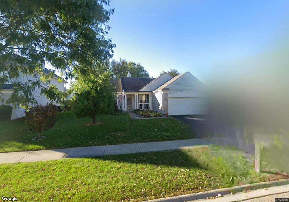
1669 Grantham Ln Aurora, IL 60503
Far Southeast NeighborhoodEstimated Value: $395,682 - $406,000
3
Beds
2
Baths
1,563
Sq Ft
$257/Sq Ft
Est. Value
About This Home
This home is located at 1669 Grantham Ln, Aurora, IL 60503 and is currently estimated at $402,227, approximately $257 per square foot. 1669 Grantham Ln is a home located in Kendall County with nearby schools including The Wheatlands Elementary School, Bednarcik Jr. High School, and Oswego East High School.
Ownership History
Date
Name
Owned For
Owner Type
Purchase Details
Closed on
Mar 5, 2021
Sold by
Kaminski Linda A
Bought by
Kaminski Linda A and Linda A Kaminski Trust
Current Estimated Value
Purchase Details
Closed on
Jun 25, 2003
Sold by
Wilk David J and Wilk Heidi A
Bought by
Kaminski Linda A and Yocus Virginia M
Home Financials for this Owner
Home Financials are based on the most recent Mortgage that was taken out on this home.
Original Mortgage
$147,000
Outstanding Balance
$62,193
Interest Rate
5.31%
Mortgage Type
Purchase Money Mortgage
Estimated Equity
$340,034
Purchase Details
Closed on
Oct 18, 2001
Sold by
Drh Cambridge Homes Inc
Bought by
Wilk David J and Wilk Heidi A
Home Financials for this Owner
Home Financials are based on the most recent Mortgage that was taken out on this home.
Original Mortgage
$183,720
Interest Rate
6.37%
Create a Home Valuation Report for This Property
The Home Valuation Report is an in-depth analysis detailing your home's value as well as a comparison with similar homes in the area
Home Values in the Area
Average Home Value in this Area
Purchase History
| Date | Buyer | Sale Price | Title Company |
|---|---|---|---|
| Kaminski Linda A | -- | Attorney | |
| Kaminski Linda A | $217,000 | Ticor | |
| Wilk David J | $199,000 | -- |
Source: Public Records
Mortgage History
| Date | Status | Borrower | Loan Amount |
|---|---|---|---|
| Open | Kaminski Linda A | $147,000 | |
| Previous Owner | Wilk David J | $183,720 |
Source: Public Records
Tax History
| Year | Tax Paid | Tax Assessment Tax Assessment Total Assessment is a certain percentage of the fair market value that is determined by local assessors to be the total taxable value of land and additions on the property. | Land | Improvement |
|---|---|---|---|---|
| 2024 | $4,889 | $115,122 | $28,223 | $86,899 |
| 2023 | $5,539 | $102,787 | $25,199 | $77,588 |
| 2022 | $5,539 | $94,300 | $23,118 | $71,182 |
| 2021 | $5,753 | $85,727 | $21,016 | $64,711 |
| 2020 | $5,822 | $84,046 | $20,604 | $63,442 |
| 2019 | $5,958 | $78,279 | $20,604 | $57,675 |
| 2018 | $6,198 | $75,574 | $19,892 | $55,682 |
| 2017 | $6,281 | $69,654 | $18,334 | $51,320 |
| 2016 | $6,957 | $66,023 | $17,378 | $48,645 |
| 2015 | $7,163 | $62,879 | $16,550 | $46,329 |
| 2014 | -- | $59,320 | $15,613 | $43,707 |
| 2013 | -- | $59,919 | $15,771 | $44,148 |
Source: Public Records
Map
Nearby Homes
- 2208 Grand Pointe Trail
- 2060 Lyndhurst Ln
- 2013 Lyndhurst Ln Unit 2
- 2051 Canyon Creek Ct
- 1973 Eastwick Ln
- 1800 Diamond Creek Ln Unit 1
- 2084 Canyon Creek Ct
- 552 Lincoln Station Dr Unit 2301
- 1935 Chesterfield Ln
- 628 Lincoln Station Dr Unit 303
- 1733 Stable Ln
- 1715 Baler Ave
- 1738 Baler Ave
- 1733 Baler Ave
- 1841 Baler Ave
- 1853 Baler Ave
- 1740 Baler Ave
- 1900 Canyon Creek Dr
- 1959 Misty Ridge Ct Unit 15
- 1975 Misty Ridge Ct Unit 1-1
- 1663 Grantham Ln
- 1675 Grantham Ln
- 2144 Grand Pointe Trail
- 2138 Grand Pointe Trail
- 1657 Grantham Ln
- 1681 Grantham Ln Unit 2
- 2150 Grand Pointe Trail
- 1670 Grantham Ln
- 1676 Grantham Ln
- 2132 Grand Pointe Trail
- 2156 Grand Pointe Trail
- 1651 Grantham Ln
- 1687 Grantham Ln
- 2113 Conway Ln
- 1682 Grantham Ln
- 2126 Grand Pointe Trail
- 2102 Conway Ln
- 2105 Conway Ln
- 2162 Grand Pointe Trail
- 1645 Grantham Ln Unit 3
Your Personal Tour Guide
Ask me questions while you tour the home.