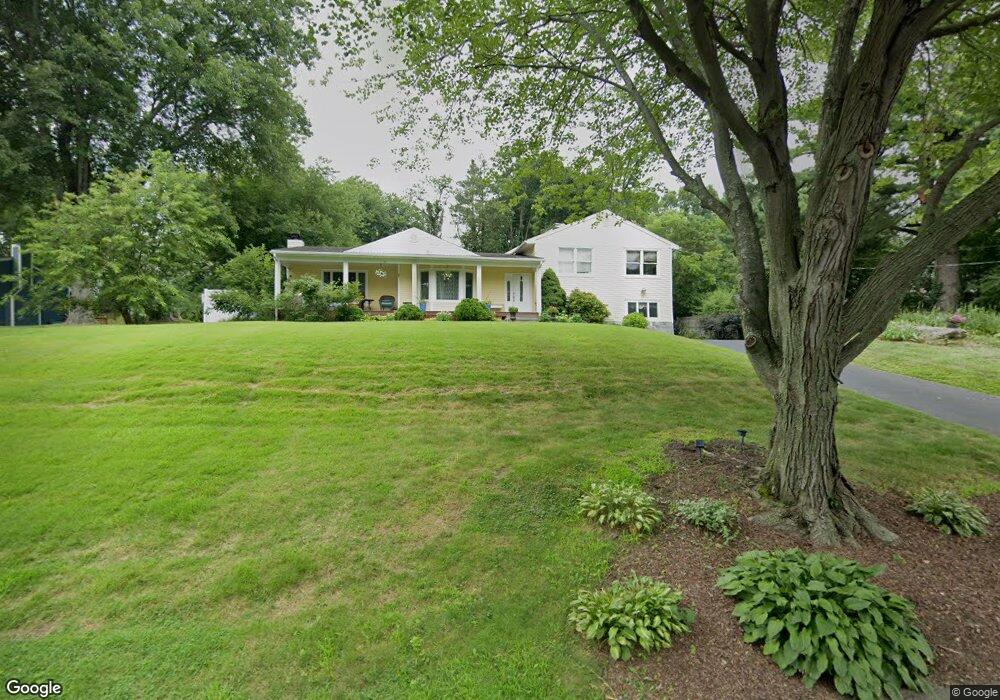
167 Barryscott Dr Fairfield, CT 06825
Fairfield Woods NeighborhoodEstimated Value: $624,000 - $1,033,032
4
Beds
3
Baths
2,731
Sq Ft
$316/Sq Ft
Est. Value
About This Home
This home is located at 167 Barryscott Dr, Fairfield, CT 06825 and is currently estimated at $862,258, approximately $315 per square foot. 167 Barryscott Dr is a home located in Fairfield County with nearby schools including Jennings Elementary School, Fairfield Woods Middle School, and Fairfield Warde High School.
Ownership History
Date
Name
Owned For
Owner Type
Purchase Details
Closed on
Sep 2, 1999
Sold by
Caparosa James L and Caparosa Mona E
Bought by
Ibanez Fernando D and Ibanez Sofia
Current Estimated Value
Home Financials for this Owner
Home Financials are based on the most recent Mortgage that was taken out on this home.
Original Mortgage
$50,000
Interest Rate
7.85%
Purchase Details
Closed on
Sep 6, 1994
Sold by
Williamson James and Williamson Laura
Bought by
Caparosa James L and Caparosa Mona E
Create a Home Valuation Report for This Property
The Home Valuation Report is an in-depth analysis detailing your home's value as well as a comparison with similar homes in the area
Home Values in the Area
Average Home Value in this Area
Purchase History
| Date | Buyer | Sale Price | Title Company |
|---|---|---|---|
| Ibanez Fernando D | $232,000 | -- | |
| Ibanez Fernando D | $232,000 | -- | |
| Caparosa James L | $207,500 | -- | |
| Caparosa James L | $207,500 | -- |
Source: Public Records
Mortgage History
| Date | Status | Borrower | Loan Amount |
|---|---|---|---|
| Closed | Caparosa James L | $100,000 | |
| Open | Caparosa James L | $151,655 | |
| Closed | Caparosa James L | $50,000 |
Source: Public Records
Tax History Compared to Growth
Tax History
| Year | Tax Paid | Tax Assessment Tax Assessment Total Assessment is a certain percentage of the fair market value that is determined by local assessors to be the total taxable value of land and additions on the property. | Land | Improvement |
|---|---|---|---|---|
| 2025 | $12,323 | $434,070 | $248,710 | $185,360 |
| 2024 | $12,111 | $434,070 | $248,710 | $185,360 |
| 2023 | $11,941 | $434,070 | $248,710 | $185,360 |
| 2022 | $11,824 | $434,070 | $248,710 | $185,360 |
| 2021 | $11,711 | $434,070 | $248,710 | $185,360 |
| 2020 | $10,622 | $396,480 | $213,640 | $182,840 |
| 2019 | $10,622 | $396,480 | $213,640 | $182,840 |
| 2018 | $10,451 | $396,480 | $213,640 | $182,840 |
| 2017 | $10,237 | $396,480 | $213,640 | $182,840 |
| 2016 | $10,090 | $396,480 | $213,640 | $182,840 |
| 2015 | $9,074 | $366,030 | $225,470 | $140,560 |
| 2014 | $8,931 | $366,030 | $225,470 | $140,560 |
Source: Public Records
Map
Nearby Homes
- 706 Judd St
- 270 Oakwood Dr
- 31 High Ridge Rd
- 27 Bloomfield Dr
- 115 Mayfair Rd
- 210 Pansy Rd
- 67 Campfield Dr
- 332 Szost Dr
- 1009 High St
- 3 Old Black Rock Turnpike
- 152 Roseville St
- 148 Roseville St
- 244 Tunxis Hill Cut Off
- 143 Sawyer Rd
- 242 Valleyview Rd
- 359 Reid St
- 34 Ridgedale Rd
- 162 Country Rd Unit 162
- 24 Warsaw St
- 221 Hunyadi Ave
- 192 Barryscott Dr
- 170 Barryscott Dr
- 191 Barryscott Dr
- 148 Barryscott Dr
- 210 Barryscott Dr
- 211 Barryscott Dr
- 139 Barryscott Dr
- 132 Barryscott Dr
- 257 Barryscott Dr
- 240 Barryscott Dr
- 175 Farist Rd
- 226 Barryscott Dr
- 103 Barryscott Dr
- 260 Barryscott Dr
- 102 Barryscott Dr
- 213 Farist Rd
- 1920 Black Rock Turnpike
- 193 Farist Rd
- 1910 Black Rock Turnpike
- 153 Farist Rd