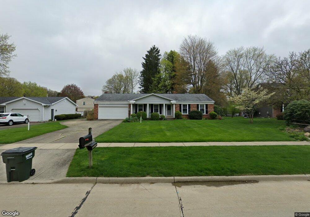
167 High Point Cir Tallmadge, OH 44278
Estimated Value: $278,647 - $316,000
3
Beds
2
Baths
1,886
Sq Ft
$160/Sq Ft
Est. Value
About This Home
This home is located at 167 High Point Cir, Tallmadge, OH 44278 and is currently estimated at $302,162, approximately $160 per square foot. 167 High Point Cir is a home located in Summit County with nearby schools including Tallmadge Middle School, Tallmadge High School, and Steel Academy.
Ownership History
Date
Name
Owned For
Owner Type
Purchase Details
Closed on
Oct 3, 2020
Sold by
Benson Ray E and Benson David L
Bought by
Harstine Brenda S and Harstine David K
Current Estimated Value
Purchase Details
Closed on
Nov 10, 2017
Sold by
Benson Jean A
Bought by
Harstine Brenda S and Benson Ray E
Purchase Details
Closed on
Nov 1, 2017
Sold by
Benson Jean A and Benson Ray E
Bought by
Benson Jean A
Create a Home Valuation Report for This Property
The Home Valuation Report is an in-depth analysis detailing your home's value as well as a comparison with similar homes in the area
Home Values in the Area
Average Home Value in this Area
Purchase History
| Date | Buyer | Sale Price | Title Company |
|---|---|---|---|
| Harstine Brenda S | $110,133 | None Available | |
| Harstine Brenda S | -- | None Available | |
| Benson Jean A | -- | None Available |
Source: Public Records
Tax History Compared to Growth
Tax History
| Year | Tax Paid | Tax Assessment Tax Assessment Total Assessment is a certain percentage of the fair market value that is determined by local assessors to be the total taxable value of land and additions on the property. | Land | Improvement |
|---|---|---|---|---|
| 2025 | $3,994 | $80,059 | $14,189 | $65,870 |
| 2024 | $3,994 | $80,059 | $14,189 | $65,870 |
| 2023 | $3,994 | $80,059 | $14,189 | $65,870 |
| 2022 | $3,888 | $63,711 | $11,260 | $52,451 |
| 2021 | $3,905 | $63,711 | $11,260 | $52,451 |
| 2020 | $3,342 | $63,710 | $11,260 | $52,450 |
| 2019 | $3,338 | $57,820 | $10,500 | $47,320 |
| 2018 | $2,940 | $57,820 | $10,500 | $47,320 |
| 2017 | $2,641 | $57,820 | $10,500 | $47,320 |
| 2016 | $2,849 | $52,440 | $10,500 | $41,940 |
| 2015 | $2,641 | $52,440 | $10,500 | $41,940 |
| 2014 | $2,623 | $52,440 | $10,500 | $41,940 |
| 2013 | $2,598 | $52,800 | $10,500 | $42,300 |
Source: Public Records
Map
Nearby Homes
- 213 Green Hill Dr
- 353 Southeast Ave
- 331 Southeast Ave
- 313 Southeast Ave
- 185 Reserve Dr
- 288 S Munroe Rd
- 243 S Munroe Rd
- 130 Strecker Dr
- 786 Southeast Ave
- 810 Norton Dr
- 523 S Munroe Rd
- 0 East Ave
- 549 S Munroe Rd
- 206 Fawnwood Dr
- 500 Dottie Ct Unit 109
- 2333 Eastwood Ave
- 2330 Eastwood Ave
- 689 Alaho St
- 2354 Savoy Ave
- 758 Humble Rd
- 175 High Point Cir
- 155 High Point Cir
- 230 Green Hill Dr
- 191 High Point Cir
- 202 Green Hill Dr
- 201 Orchard Dr
- 238 Green Hill Dr
- 205 High Point Cir
- 435 Green Meadow Dr
- 441 Green Meadow Dr
- 192 Green Hill Dr
- 221 Green Hill Dr
- 191 Orchard Dr
- 248 Green Hill Dr
- 231 Green Hill Dr
- 445 Green Meadow Dr
- 188 High Point Cir
- 203 Green Hill Dr
- 425 Green Meadow Dr
- 196 Orchard Dr