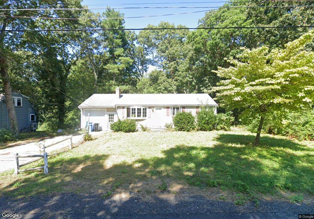
167 Janice Cir Wrentham, MA 02093
Estimated Value: $408,000 - $562,644
2
Beds
1
Bath
912
Sq Ft
$554/Sq Ft
Est. Value
About This Home
This home is located at 167 Janice Cir, Wrentham, MA 02093 and is currently estimated at $505,161, approximately $553 per square foot. 167 Janice Cir is a home located in Norfolk County with nearby schools including Delaney Elementary School, Charles E Roderick, and The Sage School.
Ownership History
Date
Name
Owned For
Owner Type
Purchase Details
Closed on
Jul 6, 1971
Bought by
Daniels Robert L and Daniels Nancy E
Current Estimated Value
Create a Home Valuation Report for This Property
The Home Valuation Report is an in-depth analysis detailing your home's value as well as a comparison with similar homes in the area
Home Values in the Area
Average Home Value in this Area
Purchase History
| Date | Buyer | Sale Price | Title Company |
|---|---|---|---|
| Daniels Robert L | -- | -- |
Source: Public Records
Tax History Compared to Growth
Tax History
| Year | Tax Paid | Tax Assessment Tax Assessment Total Assessment is a certain percentage of the fair market value that is determined by local assessors to be the total taxable value of land and additions on the property. | Land | Improvement |
|---|---|---|---|---|
| 2025 | $5,655 | $487,900 | $299,600 | $188,300 |
| 2024 | $5,290 | $440,800 | $299,600 | $141,200 |
| 2023 | $5,000 | $396,200 | $272,300 | $123,900 |
| 2022 | $4,421 | $323,400 | $209,500 | $113,900 |
| 2021 | $4,615 | $328,000 | $219,500 | $108,500 |
| 2020 | $4,389 | $308,000 | $198,000 | $110,000 |
| 2019 | $4,109 | $291,000 | $182,800 | $108,200 |
| 2018 | $4,198 | $294,800 | $182,800 | $112,000 |
| 2017 | $3,984 | $279,600 | $179,300 | $100,300 |
| 2016 | $3,908 | $273,700 | $174,100 | $99,600 |
| 2015 | $3,788 | $252,900 | $167,400 | $85,500 |
| 2014 | $3,521 | $230,000 | $147,600 | $82,400 |
Source: Public Records
Map
Nearby Homes
- 1 Lorraine Metcalf Dr
- 270 Dedham St
- 362 East St
- 10 Nature View Dr
- 15 Nature View Dr
- 65 Pond St
- 319 Taunton St
- 25 Foxboro Rd
- 131 Creek St Unit 7
- 120 Hawes St
- 11 Earle Stewart Ln
- 483 Thurston St
- 246 Forest Grove Ave
- 10 W Birch Rd
- 0 W Birch Rd
- 3 Oak Rd
- Lot 3 - 14 Earle Stewart Ln
- Lot 1 - Blueberry 2 Car Plan at King Philip Estates
- Lot 8 - Blueberry 2 Car Plan at King Philip Estates
- Lot 6 - Blueberry 3 Car Plan at King Philip Estates
- 159 Janice Cir
- 175 Janice Cir
- 151 Janice Cir
- 162 Janice Cir
- 186 Janice Cir
- 183 Janice Cir
- 154 Janice Cir
- 90 Lorraine Metcalf Dr
- 191 Janice Cir
- 136 Hamilton Rd
- 145 Hamilton Rd
- 198 Janice Cir
- 218 Janice Cir
- 80 Lorraine Metcalf Dr
- 226 Janice Cir
- 105 King James Way
- 100 Lorraine Metcalf Dr
- 199 Janice Cir
- 95 King James Way
- 70 Lorraine Metcalf Dr