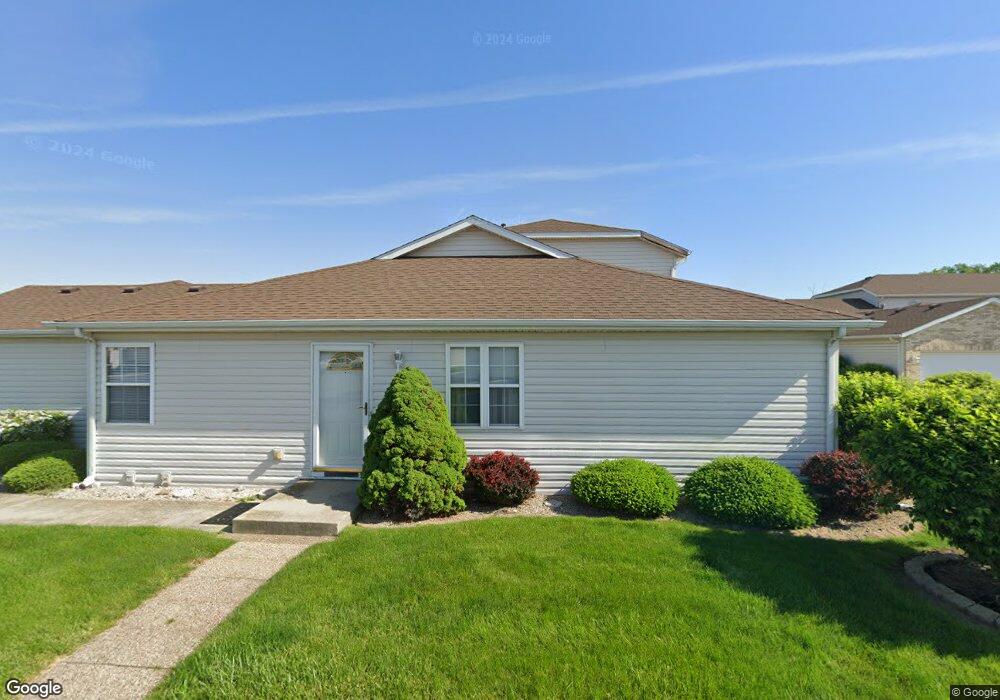
167 Mallard Pointe Dr Unit 2 Valparaiso, IN 46385
Porter County NeighborhoodEstimated Value: $199,000 - $219,000
3
Beds
3
Baths
1,498
Sq Ft
$138/Sq Ft
Est. Value
About This Home
This home is located at 167 Mallard Pointe Dr Unit 2, Valparaiso, IN 46385 and is currently estimated at $207,233, approximately $138 per square foot. 167 Mallard Pointe Dr Unit 2 is a home located in Porter County with nearby schools including Liberty Elementary School, Liberty Intermediate School, and Chesterton Middle School.
Ownership History
Date
Name
Owned For
Owner Type
Purchase Details
Closed on
Jul 21, 2023
Sold by
Mannin Kenneth A
Bought by
Bonner Melissa L and Mulder Hank
Current Estimated Value
Home Financials for this Owner
Home Financials are based on the most recent Mortgage that was taken out on this home.
Original Mortgage
$110,000
Outstanding Balance
$107,337
Interest Rate
6.71%
Mortgage Type
New Conventional
Estimated Equity
$99,896
Create a Home Valuation Report for This Property
The Home Valuation Report is an in-depth analysis detailing your home's value as well as a comparison with similar homes in the area
Home Values in the Area
Average Home Value in this Area
Purchase History
| Date | Buyer | Sale Price | Title Company |
|---|---|---|---|
| Bonner Melissa L | $185,000 | Chicago Title |
Source: Public Records
Mortgage History
| Date | Status | Borrower | Loan Amount |
|---|---|---|---|
| Open | Bonner Melissa L | $110,000 |
Source: Public Records
Tax History Compared to Growth
Tax History
| Year | Tax Paid | Tax Assessment Tax Assessment Total Assessment is a certain percentage of the fair market value that is determined by local assessors to be the total taxable value of land and additions on the property. | Land | Improvement |
|---|---|---|---|---|
| 2024 | $1,328 | $165,700 | $6,800 | $158,900 |
| 2023 | $1,029 | $165,200 | $6,500 | $158,700 |
| 2022 | $918 | $145,700 | $6,500 | $139,200 |
| 2021 | $867 | $112,100 | $6,000 | $106,100 |
| 2020 | $848 | $112,100 | $6,000 | $106,100 |
| 2019 | $760 | $102,000 | $6,000 | $96,000 |
| 2018 | $1,355 | $104,500 | $6,000 | $98,500 |
| 2017 | $1,389 | $104,600 | $6,000 | $98,600 |
| 2016 | $1,410 | $103,300 | $6,000 | $97,300 |
| 2014 | $1,763 | $114,100 | $6,000 | $108,100 |
| 2013 | -- | $108,900 | $6,000 | $102,900 |
Source: Public Records
Map
Nearby Homes
- 186 Mallard Pointe Dr
- 792 Merganser Ln
- 231 Southwind Dr
- 244 Falcon Way
- 812 Concord St
- 240 Southwind Dr
- 748 N 200 W
- 210 Papillon Dr
- 120 W Us Highway 6
- 122 W 850 N
- 249 W 700 N
- 229 W 700 N
- 244 W 700 N
- 776-1 Baltimore Rd
- 275 W 700 N
- 761 Capitol Rd
- 746-1 Capitol Rd
- 775-1 Eagle Creek Rd
- 794 Eagle Creek Rd
- 723 Capitol Rd
- 167 Mallard Pointe Dr
- 169 Mallard Pointe Dr
- 165 Mallard Pointe Dr Unit 3
- 163 Mallard Pointe Dr
- 0 Mallard Pointe Dr
- 0 Mallard Pointe Dr
- 0 Mallard Pointe Dr Unit NRA352844
- 151 Mallard Pointe Dr
- 153 Mallard Pointe Dr
- 153 Mallard Pointe Dr Unit 5
- 155 Mallard Pointe Dr Unit 2
- 175 Mallard Pointe Dr Unit 9
- 157 Mallard Pointe Dr
- 157 Mallard Pointe Dr Unit 2
- 177 Mallard Pointe Dr
- 177 Mallard Pointe Dr Unit 9-D
- 173 Mallard Pointe Dr
- 171 Mallard Pointe Dr
- 171 Mallard Pointe Dr