Estimated Value: $334,000 - $532,181
--
Bed
2
Baths
2,338
Sq Ft
$193/Sq Ft
Est. Value
About This Home
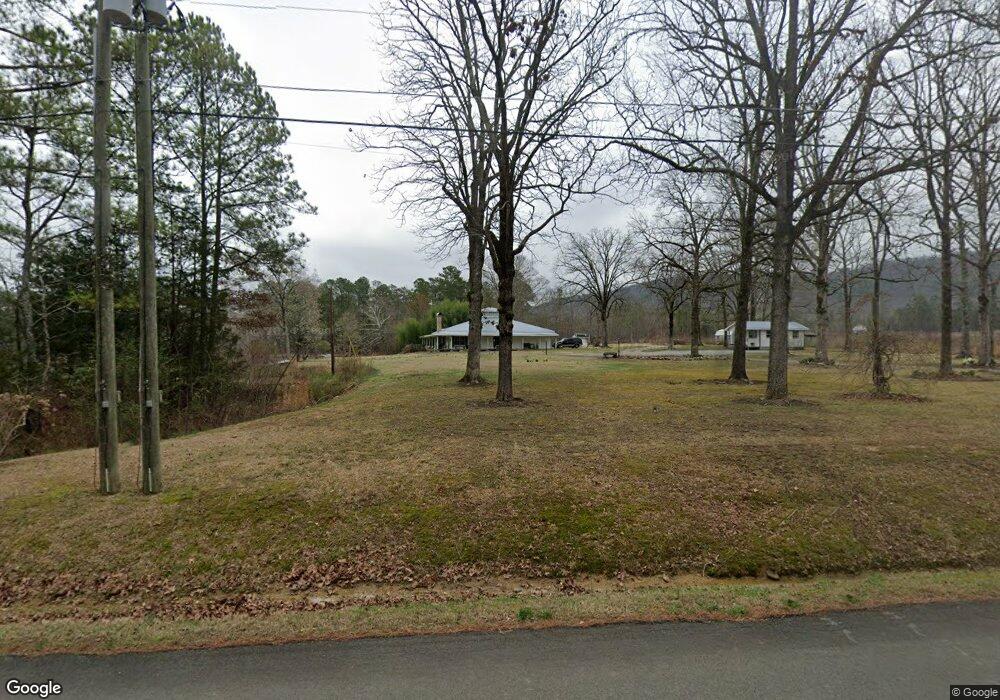
This home is located at 167 Manning Lake Rd SW, Rome, GA 30165 and is currently estimated at $450,727, approximately $192 per square foot. 167 Manning Lake Rd SW is a home with nearby schools including Coosa Middle School and Coosa High School.
Ownership History
Date
Name
Owned For
Owner Type
Purchase Details
Closed on
Dec 19, 1996
Sold by
Manning Orville Duette
Bought by
Manning Orville Duette and Manning Peggy J
Current Estimated Value
Purchase Details
Closed on
Dec 4, 1996
Bought by
P and R
Purchase Details
Closed on
Apr 6, 1978
Bought by
P and R
Purchase Details
Closed on
Jan 1, 1947
Bought by
Manning O D
Create a Home Valuation Report for This Property
The Home Valuation Report is an in-depth analysis detailing your home's value as well as a comparison with similar homes in the area
Home Values in the Area
Average Home Value in this Area
Purchase History
| Date | Buyer | Sale Price | Title Company |
|---|---|---|---|
| Manning Orville Duette | -- | -- | |
| P | -- | -- | |
| Manning Orville Duette | $25,000 | -- | |
| Manning Bobby Joe | $25,000 | -- | |
| P | -- | -- | |
| Manning Bobby Joe | $25,000 | -- | |
| Manning Bobby Joe | -- | -- | |
| P | -- | -- | |
| Manning O D | -- | -- |
Source: Public Records
Tax History Compared to Growth
Tax History
| Year | Tax Paid | Tax Assessment Tax Assessment Total Assessment is a certain percentage of the fair market value that is determined by local assessors to be the total taxable value of land and additions on the property. | Land | Improvement |
|---|---|---|---|---|
| 2024 | $4,397 | $181,957 | $72,638 | $109,319 |
| 2023 | $3,930 | $179,414 | $72,638 | $106,776 |
| 2022 | $3,309 | $147,920 | $57,458 | $90,462 |
| 2021 | $2,709 | $122,181 | $40,923 | $81,258 |
| 2020 | $2,543 | $114,551 | $36,210 | $78,341 |
| 2019 | $2,450 | $111,566 | $36,210 | $75,356 |
| 2018 | $2,261 | $103,713 | $31,497 | $72,216 |
| 2017 | $2,204 | $100,374 | $31,497 | $68,877 |
| 2016 | $2,216 | $99,552 | $31,480 | $68,072 |
| 2015 | $2,187 | $100,312 | $31,480 | $68,832 |
| 2014 | $2,187 | $101,981 | $31,480 | $70,501 |
Source: Public Records
Map
Nearby Homes
- 0 Roberts Rd SW Unit 10525813
- 0 Roberts Rd SW Unit 7582010
- 248 Smith Rd SW
- 37 Willowrun Dr SW
- 1 Willowrun Dr SW
- 0 Mt Alto Rd Sw Lot Unit WP001
- 26 Berryrun Dr SW
- 22 Gowen Dr SW
- The Foxcroft Plan at North Haven
- The Benson II Plan at North Haven
- The Coleman Plan at North Haven
- The Bradley Plan at North Haven
- The McGinnis Plan at North Haven
- The Pearson Plan at North Haven
- The Caldwell Plan at North Haven
- The Grayson Plan at North Haven
- 27 Stonebrook Dr SW
- 2 Stonebrook Dr SW
- 121 Kenwood Dr SW
- 52 Glenda Dr SW
- 174 Manning Lake Rd SW
- 200 Manning Lake Rd SW
- 200 Manning Lake Rd SW
- 200 Manning Lake Rd SW
- 200 Manning Lake Rd SW
- 83 Manning Lake Rd SW
- 78 Manning Lake Rd SW
- 221 Holbrook Dr SW Unit PVT
- 59 Manning Lake Rd SW
- 59 Manning Lake Rd SW
- 48 Manning Lake Rd SW
- 35 Manning Lake Rd SW
- 35 Manning Lake Rd SW
- 34 Manning Lake Rd SW
- 702 Smith Rd SW
- 24 Manning Lake Rd SW
- 945 Burnett Ferry Rd SW
- 997 Burnett Ferry Rd SW
- 1011 Burnett Ferry Rd SW
- 903 Burnett Ferry Rd SW