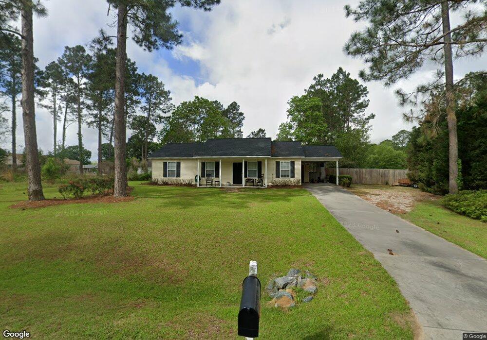
167 Red Maple Cir Moultrie, GA 31768
Estimated Value: $176,502 - $226,000
Studio
2
Baths
1,222
Sq Ft
$163/Sq Ft
Est. Value
About This Home
This home is located at 167 Red Maple Cir, Moultrie, GA 31768 and is currently estimated at $198,876, approximately $162 per square foot. 167 Red Maple Cir is a home located in Colquitt County with nearby schools including Funston Elementary School, C.A. Gray Junior High School, and Willie J. Williams Middle School.
Ownership History
Date
Name
Owned For
Owner Type
Purchase Details
Closed on
May 24, 2006
Sold by
Sunbelt Builders Moultrie
Bought by
Bennett Amy G
Current Estimated Value
Home Financials for this Owner
Home Financials are based on the most recent Mortgage that was taken out on this home.
Original Mortgage
$95,009
Outstanding Balance
$54,126
Interest Rate
6.5%
Mortgage Type
FHA
Estimated Equity
$144,750
Purchase Details
Closed on
Mar 13, 2006
Sold by
Stallings Thomas W
Bought by
Sunbelt Builders Moultrie Inc
Purchase Details
Closed on
Oct 27, 2003
Sold by
Jones Lynn L
Bought by
Stallings Thomas W
Purchase Details
Closed on
Feb 8, 1982
Bought by
Jones Lynn L
Create a Home Valuation Report for This Property
The Home Valuation Report is an in-depth analysis detailing your home's value as well as a comparison with similar homes in the area
Purchase History
| Date | Buyer | Sale Price | Title Company |
|---|---|---|---|
| Bennett Amy G | $96,500 | -- | |
| Sunbelt Builders Moultrie Inc | $6,000 | -- | |
| Stallings Thomas W | $119,000 | -- | |
| Jones Lynn L | $23,400 | -- |
Source: Public Records
Mortgage History
| Date | Status | Borrower | Loan Amount |
|---|---|---|---|
| Open | Bennett Amy G | $95,009 |
Source: Public Records
Tax History
| Year | Tax Paid | Tax Assessment Tax Assessment Total Assessment is a certain percentage of the fair market value that is determined by local assessors to be the total taxable value of land and additions on the property. | Land | Improvement |
|---|---|---|---|---|
| 2025 | $1,977 | $88,045 | $3,200 | $84,845 |
| 2024 | $1,977 | $65,456 | $3,200 | $62,256 |
| 2023 | $1,538 | $53,948 | $3,200 | $50,748 |
| 2022 | $1,183 | $44,500 | $3,200 | $41,300 |
| 2021 | $1,067 | $39,530 | $3,200 | $36,330 |
| 2020 | $1,006 | $36,490 | $3,200 | $33,290 |
| 2019 | $1,106 | $36,428 | $3,200 | $33,228 |
| 2018 | $1,097 | $36,428 | $3,200 | $33,228 |
| 2017 | $1,087 | $36,428 | $3,200 | $33,228 |
| 2016 | $1,095 | $36,428 | $3,200 | $33,228 |
| 2015 | $1,099 | $36,428 | $3,200 | $33,228 |
| 2014 | $1,134 | $36,428 | $3,200 | $33,228 |
| 2013 | -- | $36,427 | $3,200 | $33,227 |
Source: Public Records
Map
Nearby Homes
- 827 Bonnie Tuk Rd
- Lot 45 Fox Trot Dr
- LOT 52 Fox Trot Dr
- LOT 58 Fox Trot Dr
- LOT 56 Fox Trot Dr
- LOT 54 Fox Trot Dr
- 0 Fox Trot Dr
- LOT 53 Fox Trot Dr
- LOT 55 Fox Trot Dr
- 176 Fox Trot Dr
- LOT 29 Merganser Ln
- LOT 32 Merganser Ln
- LOT 28 Merganser Ln
- LOT 26 Merganser Ln
- LOT 30 Merganser Ln
- LOT 39 Westwoods Dr
- LOT 1 Westwoods Dr
- LOT 23 Westwoods Dr
- LOT 35 Westwoods Dr
- LOT 36 Westwoods Dr
- 166 Pineridge St
- 160 Pineridge St
- 152 Pineridge St NW
- 174 Red Maple Cir
- 178 Red Maple Cir
- 138 Pineridge St
- 186 Red Maple Cir
- 172 Red Maple Cir
- 143 Red Maple Cir
- 167 Pineridge St
- 180 Pineridge St
- 173 Pineridge St
- lot 3 Pineridge St
- 149 Pineridge St
- 168 Red Maple Cir
- 133 Red Maple Cir
- 141 Pineridge St
- 193 Pineridge St
- 131 Pineridge St
- 377 Oak Ln
Your Personal Tour Guide
Ask me questions while you tour the home.