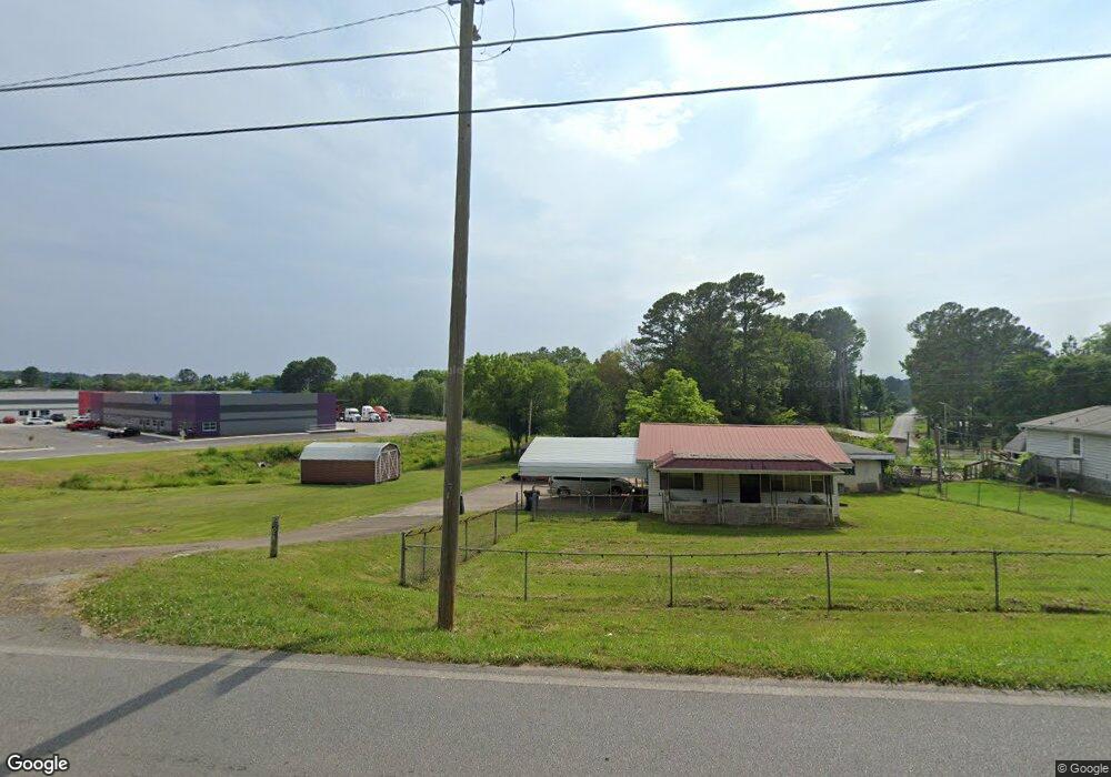
167 Scruggs Rd Ringgold, GA 30736
Westside NeighborhoodEstimated Value: $120,000 - $186,000
--
Bed
1
Bath
729
Sq Ft
$204/Sq Ft
Est. Value
About This Home
This home is located at 167 Scruggs Rd, Ringgold, GA 30736 and is currently estimated at $148,970, approximately $204 per square foot. 167 Scruggs Rd is a home located in Catoosa County with nearby schools including West Side Elementary School, Lakeview Middle School, and Lakeview-Fort Oglethorpe High School.
Ownership History
Date
Name
Owned For
Owner Type
Purchase Details
Closed on
Jun 27, 2024
Sold by
C & C Residential Properties Inc
Bought by
Pacific Premier Trust
Current Estimated Value
Purchase Details
Closed on
Jan 26, 2024
Sold by
Skidmore Debra L
Bought by
C & C Residential Properties Inc
Purchase Details
Closed on
Feb 26, 2018
Sold by
Swaney Dorothy M
Bought by
Swaney Dorothy M and Skidmore Debra L
Purchase Details
Closed on
Jan 3, 2007
Sold by
Swaney Dorothy M
Bought by
Swaney Dorothy M
Create a Home Valuation Report for This Property
The Home Valuation Report is an in-depth analysis detailing your home's value as well as a comparison with similar homes in the area
Home Values in the Area
Average Home Value in this Area
Purchase History
| Date | Buyer | Sale Price | Title Company |
|---|---|---|---|
| Pacific Premier Trust | $136,550 | -- | |
| C & C Residential Properties Inc | $85,000 | -- | |
| Swaney Dorothy M | -- | -- | |
| Swaney Dorothy M | -- | -- | |
| Swaney Dorothy M | -- | -- |
Source: Public Records
Tax History Compared to Growth
Tax History
| Year | Tax Paid | Tax Assessment Tax Assessment Total Assessment is a certain percentage of the fair market value that is determined by local assessors to be the total taxable value of land and additions on the property. | Land | Improvement |
|---|---|---|---|---|
| 2024 | $608 | $28,503 | $7,800 | $20,703 |
| 2023 | $516 | $23,028 | $7,800 | $15,228 |
| 2022 | $438 | $19,582 | $7,800 | $11,782 |
| 2021 | $453 | $19,582 | $7,800 | $11,782 |
| 2020 | $410 | $17,712 | $7,800 | $9,912 |
| 2019 | $438 | $17,712 | $7,800 | $9,912 |
| 2018 | $373 | $15,112 | $5,200 | $9,912 |
| 2017 | $77 | $15,071 | $5,200 | $9,871 |
| 2016 | $75 | $14,341 | $5,200 | $9,141 |
| 2015 | -- | $14,341 | $5,200 | $9,141 |
| 2014 | -- | $13,141 | $4,000 | $9,141 |
| 2013 | -- | $14,736 | $6,635 | $8,100 |
Source: Public Records
Map
Nearby Homes
- 35 Karen Dr
- 354 Karen Dr
- 27 Templin Hills Ln
- 618 Larry Dr
- 103 N Pointe Rd
- 615 Larry Dr
- 21 Breezewood Rd
- 224 N Brent Dr
- 48 W Highland Dr
- 325 Cindy Cir
- 198 Biggs Rd
- 137 Winchester Dr
- 92 Sue Ln
- 98 Winchester Dr
- 181 Stanley Pkwy
- 137 Elm Ave
- 302 Huntley Meadows Dr
- 385 Winchester Dr
- 5 Winchester Dr
- 398 Winchester Dr
- 63 Carrol Dr
- 63 Carrol Dr
- 75 Carrol Dr
- 18 Carrol Dr
- 89 Carrol Dr
- 92 Carrol Dr
- 23 Karen Dr
- 49 Karen Dr
- 106 Carrol Dr Undeveoped Dr
- 63 Karen Dr
- 106 Carrol Dr
- 75 Karen Dr
- 0 Karen Dr Unit 1347739
- 0 Karen Dr Unit RTC2741936
- 0 Karen Dr Unit 20137789
- 0 Karen Dr Unit 1039999
- 0 Karen Dr Unit 1038510
- 0 Karen Dr Unit 1038512
- 0 Karen Dr 60
- 83 Karen Dr