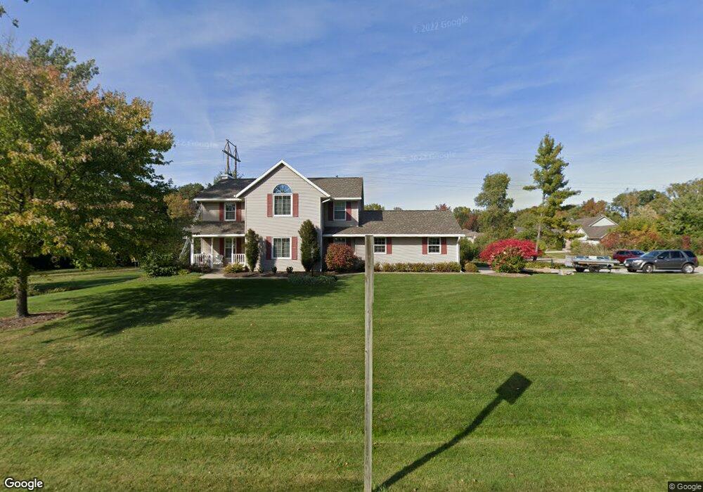
1670 Berkshire Dr Green Bay, WI 54313
Estimated Value: $418,965 - $480,000
--
Bed
--
Bath
--
Sq Ft
0.97
Acres
About This Home
This home is located at 1670 Berkshire Dr, Green Bay, WI 54313 and is currently estimated at $453,491. 1670 Berkshire Dr is a home located in Brown County with nearby schools including Hillcrest Elementary School, Pulaski Community Middle School, and Pulaski High School.
Ownership History
Date
Name
Owned For
Owner Type
Purchase Details
Closed on
Sep 4, 2025
Sold by
Kaiser Mark A and Kaiser Nina M
Bought by
Kee Matthew Duane and Bernhardt Elizabeth Mae
Current Estimated Value
Home Financials for this Owner
Home Financials are based on the most recent Mortgage that was taken out on this home.
Original Mortgage
$279,900
Outstanding Balance
$279,651
Interest Rate
6.58%
Estimated Equity
$173,840
Purchase Details
Closed on
Dec 27, 2022
Sold by
Kaiser Mark A and Kaiser Nina M
Bought by
Kaiser Mark A and Kaiser Nina M
Create a Home Valuation Report for This Property
The Home Valuation Report is an in-depth analysis detailing your home's value as well as a comparison with similar homes in the area
Home Values in the Area
Average Home Value in this Area
Purchase History
| Date | Buyer | Sale Price | Title Company |
|---|---|---|---|
| Kee Matthew Duane | $479,900 | Liberty Title & Abstract Inc | |
| Kaiser Mark A | -- | -- |
Source: Public Records
Mortgage History
| Date | Status | Borrower | Loan Amount |
|---|---|---|---|
| Open | Kee Matthew Duane | $279,900 |
Source: Public Records
Tax History Compared to Growth
Tax History
| Year | Tax Paid | Tax Assessment Tax Assessment Total Assessment is a certain percentage of the fair market value that is determined by local assessors to be the total taxable value of land and additions on the property. | Land | Improvement |
|---|---|---|---|---|
| 2024 | $4,799 | $301,100 | $67,600 | $233,500 |
| 2023 | $4,847 | $301,100 | $67,600 | $233,500 |
| 2022 | $4,158 | $301,100 | $67,600 | $233,500 |
| 2021 | $3,946 | $301,100 | $67,600 | $233,500 |
| 2020 | $4,448 | $254,800 | $59,300 | $195,500 |
| 2019 | $4,520 | $254,800 | $59,300 | $195,500 |
| 2018 | $4,495 | $254,800 | $59,300 | $195,500 |
| 2017 | $4,396 | $254,800 | $59,300 | $195,500 |
| 2016 | $4,427 | $254,800 | $59,300 | $195,500 |
| 2015 | $4,531 | $254,800 | $59,300 | $195,500 |
| 2014 | $4,841 | $254,800 | $59,300 | $195,500 |
| 2013 | $4,841 | $254,800 | $59,300 | $195,500 |
Source: Public Records
Map
Nearby Homes
- 4600 Seminole Trail
- 541 Security Blvd
- 4527 Choctaw Trail
- 4514 Mohawk Ct
- 4551 Choctaw Trail
- 652 Lincoln Ridge
- 692 Lincoln Ridge
- 1364 Lexington Ct
- 3375 Shawano Ave
- 486 Dewey Decker Dr
- 181 Parkside Ct
- 2833 Friendly Cir
- 730 Pinecrest Rd
- 3130 Early Bird Ln
- 2882 Howard Commons
- 2560 N Trillium Cir
- 2850 Elm Tree Hill
- 2610 Sumac Place
- 3442 Leeds Castle Dr
- 4179 Hillcrest Dr
- 1675 Seminole Ct
- 1667 Seminole Ct
- 1654 Berkshire Dr
- 1669 Berkshire Dr
- 1692 Berkshire Dr
- 4694 Seminole Trail
- 1659 Seminole Ct
- 0 Cobbleskill Ct
- 1651 Berkshire Dr
- 4300 Cobbleskill Ct Unit BLOCK
- 4300 Cobbleskill Ct
- 1674 Seminole Ct
- 4686 Seminole Trail
- 4335 Cobbleskill Ct
- 1656 Seminole Ct
- 4383 Trent Dr
- 1638 Berkshire Dr
- 4340 Williamsburg Ct
- 4393 Trent Dr
- 4342 Cobbleskill Ct