Estimated Value: $199,000 - $212,000
4
Beds
2
Baths
1,527
Sq Ft
$134/Sq Ft
Est. Value
About This Home
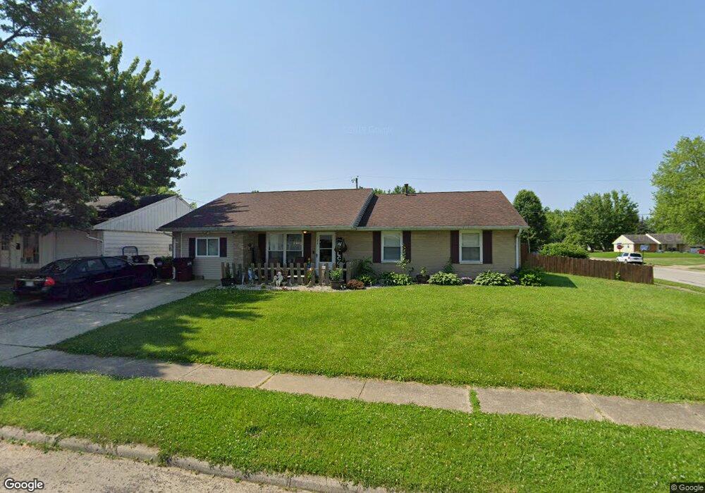
This home is located at 1670 Commonwealth Dr, Xenia, OH 45385 and is currently estimated at $204,932, approximately $134 per square foot. 1670 Commonwealth Dr is a home located in Greene County with nearby schools including Xenia High School, Summit Academy Community School for Alternative Learners - Xenia, and Legacy Christian Academy.
Ownership History
Date
Name
Owned For
Owner Type
Purchase Details
Closed on
Jan 8, 2007
Sold by
Esteppe Pamela S and Esteppe Arthur
Bought by
Ohio Valley Property Management Llc
Current Estimated Value
Purchase Details
Closed on
Sep 29, 2004
Sold by
Hodge Marlin T and Hodge Madonna
Bought by
Esteppe Pamela S
Home Financials for this Owner
Home Financials are based on the most recent Mortgage that was taken out on this home.
Original Mortgage
$96,900
Interest Rate
8.87%
Mortgage Type
Unknown
Purchase Details
Closed on
Jun 26, 2002
Sold by
Craft Harry D and Craft Bonnie L
Bought by
Hodge Marlin T and Hodge Madonna
Home Financials for this Owner
Home Financials are based on the most recent Mortgage that was taken out on this home.
Original Mortgage
$62,000
Interest Rate
6.93%
Create a Home Valuation Report for This Property
The Home Valuation Report is an in-depth analysis detailing your home's value as well as a comparison with similar homes in the area
Home Values in the Area
Average Home Value in this Area
Purchase History
| Date | Buyer | Sale Price | Title Company |
|---|---|---|---|
| Ohio Valley Property Management Llc | $68,000 | None Available | |
| Esteppe Pamela S | $96,900 | -- | |
| Hodge Marlin T | $87,000 | -- |
Source: Public Records
Mortgage History
| Date | Status | Borrower | Loan Amount |
|---|---|---|---|
| Previous Owner | Esteppe Pamela S | $96,900 | |
| Previous Owner | Hodge Marlin T | $62,000 |
Source: Public Records
Tax History Compared to Growth
Tax History
| Year | Tax Paid | Tax Assessment Tax Assessment Total Assessment is a certain percentage of the fair market value that is determined by local assessors to be the total taxable value of land and additions on the property. | Land | Improvement |
|---|---|---|---|---|
| 2024 | $2,261 | $52,850 | $12,370 | $40,480 |
| 2023 | $2,261 | $52,850 | $12,370 | $40,480 |
| 2022 | $1,880 | $37,470 | $7,280 | $30,190 |
| 2021 | $1,905 | $37,470 | $7,280 | $30,190 |
| 2020 | $1,825 | $37,470 | $7,280 | $30,190 |
| 2019 | $1,549 | $29,930 | $7,200 | $22,730 |
| 2018 | $1,555 | $29,930 | $7,200 | $22,730 |
| 2017 | $1,510 | $29,930 | $7,200 | $22,730 |
| 2016 | $1,416 | $26,750 | $7,200 | $19,550 |
| 2015 | $1,420 | $26,750 | $7,200 | $19,550 |
| 2014 | $1,360 | $26,750 | $7,200 | $19,550 |
Source: Public Records
Map
Nearby Homes
- 1403 Texas Dr
- 1866 Roxbury Dr
- 1778 Arapaho Dr
- 1829 Gayhart Dr
- 1769 Gayhart Dr
- 1908 Whitt St
- 1255 Colorado Dr
- 1107 Arkansas Dr
- 1653 Seneca Dr
- 1618 Navajo Dr
- 1272 Bellbrook Ave
- 2499 Jenny Marie Dr
- 1208 Bellbrook Ave
- 2257 Maryland Dr
- 2142 Michigan Dr
- 2345 Tennessee Dr
- 2540 Jenny Marie Dr
- 2421 Louisiana Dr
- 2540 Cornwall Dr
- 1568 Cheyenne Dr
- 1684 Commonwealth Dr
- 1646 Commonwealth Dr
- 1700 Commonwealth Dr
- 1645 Commonwealth Dr
- 1743 Roxbury Dr
- 1738 Atkinson Dr
- 1659 Commonwealth Dr
- 1621 Commonwealth Dr
- 1632 Commonwealth Dr
- 1710 Commonwealth Dr
- 1673 Commonwealth Dr
- 1677 Roxbury Dr
- 1755 Roxbury Dr
- 1607 Commonwealth Dr
- 1771 Atkinson Dr
- 1750 Roxbury Dr
- 1327 Texas Dr
- 1618 Commonwealth Dr
- 1683 Commonwealth Dr
- 1313 Texas Dr