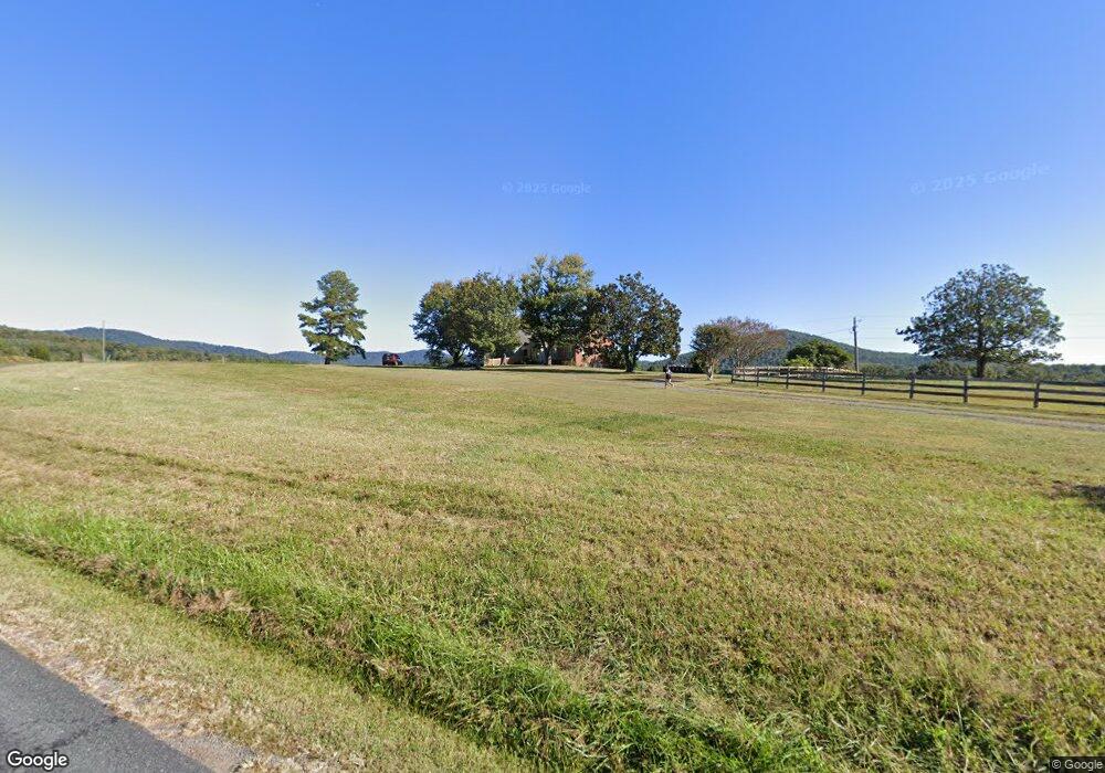
1670 High Peak Rd Monroe, VA 24574
Estimated Value: $375,000 - $680,000
5
Beds
3
Baths
4,575,542
Sq Ft
$0/Sq Ft
Est. Value
About This Home
This home is located at 1670 High Peak Rd, Monroe, VA 24574 and is currently estimated at $529,570, approximately $0 per square foot. 1670 High Peak Rd is a home located in Amherst County with nearby schools including Amherst Elementary School, Amherst Middle School, and Amherst County High School.
Ownership History
Date
Name
Owned For
Owner Type
Purchase Details
Closed on
Dec 18, 2020
Sold by
Newton Frederick Mullino
Bought by
Frederic M Newton 2020 Irrevocable Trust
Current Estimated Value
Purchase Details
Closed on
Nov 4, 2020
Sold by
Newton Frederic Mullino and Newton Louise Cooke
Bought by
Newton Frederic Mullino
Purchase Details
Closed on
Mar 4, 2011
Sold by
Layne Douglas N
Bought by
Newton Frederic M and Newton Louise C
Create a Home Valuation Report for This Property
The Home Valuation Report is an in-depth analysis detailing your home's value as well as a comparison with similar homes in the area
Home Values in the Area
Average Home Value in this Area
Purchase History
| Date | Buyer | Sale Price | Title Company |
|---|---|---|---|
| Frederic M Newton 2020 Irrevocable Trust | -- | None Available | |
| Newton Frederic Mullino | -- | None Available | |
| Newton Frederic M | $175,542 | None Available |
Source: Public Records
Tax History Compared to Growth
Tax History
| Year | Tax Paid | Tax Assessment Tax Assessment Total Assessment is a certain percentage of the fair market value that is determined by local assessors to be the total taxable value of land and additions on the property. | Land | Improvement |
|---|---|---|---|---|
| 2025 | $1,740 | $285,200 | $61,600 | $223,600 |
| 2024 | $1,740 | $421,800 | $198,200 | $223,600 |
| 2023 | $2,573 | $421,800 | $198,200 | $223,600 |
| 2022 | $2,573 | $421,800 | $198,200 | $223,600 |
| 2021 | $2,573 | $421,800 | $198,200 | $223,600 |
| 2020 | $2,573 | $421,800 | $198,200 | $223,600 |
| 2019 | $2,455 | $402,400 | $204,200 | $198,200 |
| 2018 | $2,455 | $402,400 | $204,200 | $198,200 |
| 2017 | $1,621 | $402,400 | $204,200 | $198,200 |
| 2016 | $2,455 | $402,400 | $204,200 | $198,200 |
| 2015 | $1,488 | $402,400 | $204,200 | $198,200 |
| 2014 | $1,488 | $402,400 | $204,200 | $198,200 |
Source: Public Records
Map
Nearby Homes
- 295 Foxcroft Dr
- 2294 High Peak Rd
- 166 Matohe Rd
- 202 Ridgecrest Dr
- 216 Burford Farm Rd
- 139 Indigo Ridge
- 1159 Cedar Gate Rd
- 0 Wares Gap Rd Unit 351733
- 0 Crawford's Hill Place
- 893 Cedar Gate Rd
- 1765 Winesap Rd
- 839 Cedar Gate Rd
- 1343 Wares Gap Rd
- 144 Manse Rd
- tbd Wares Gap Rd
- 12 Gun Mountain Dr
- 106 Monacan Park Rd
- 171 Faulconerville Dr
- 1024 Sunset Dr
- 621 Cedar Gate Rd
- 1754 High Peak Rd
- 1765 High Peak Rd
- 1562 High Peak Rd
- 1495 High Peak Rd
- 1870 High Peak Rd
- 1477 High Peak Rd
- 1767 High Peak Rd
- 1518 High Peak Rd
- 411 Foxcroft Dr
- 1431 High Peak Rd
- 399 Foxcroft Dr
- 410 Foxcroft Dr
- 224 Tobacco Row Ln
- 1769 High Peak Rd
- 201 Tobacco Row Ln
- 387 Foxcroft Dr
- 1373 High Peak Rd
- 286 Foxcroft Dr
- 1962 High Peak Rd
- 371 Foxcroft Dr