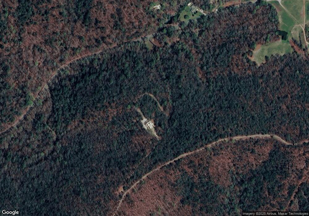
1670 Highway 129 N Cleveland, GA 30528
Estimated Value: $693,116 - $827,000
--
Bed
3
Baths
3,057
Sq Ft
$254/Sq Ft
Est. Value
About This Home
This home is located at 1670 Highway 129 N, Cleveland, GA 30528 and is currently estimated at $777,039, approximately $254 per square foot. 1670 Highway 129 N is a home located in Lumpkin County with nearby schools including Lumpkin County High School.
Ownership History
Date
Name
Owned For
Owner Type
Purchase Details
Closed on
Oct 29, 2021
Sold by
Milender Andra
Bought by
C & A Escapes Llc
Current Estimated Value
Purchase Details
Closed on
Oct 28, 2020
Sold by
Hopkins Gary
Bought by
Milender Michael and Milender Andra
Purchase Details
Closed on
Sep 15, 2011
Sold by
Hopkins Gary and Hopkins Jan T
Bought by
Hopkins Gary and Hopkins Jan T
Purchase Details
Closed on
Apr 2, 1999
Sold by
Haynes Roy
Bought by
Hopkins Gary and Hopkins Jan T
Purchase Details
Closed on
Mar 24, 1998
Sold by
Corbin Wayne
Bought by
Haynes Roy
Purchase Details
Closed on
Mar 9, 1973
Bought by
Corbin Wayne
Create a Home Valuation Report for This Property
The Home Valuation Report is an in-depth analysis detailing your home's value as well as a comparison with similar homes in the area
Home Values in the Area
Average Home Value in this Area
Purchase History
| Date | Buyer | Sale Price | Title Company |
|---|---|---|---|
| C & A Escapes Llc | $613,600 | -- | |
| Milender Michael | $613,600 | -- | |
| Hopkins Gary | -- | -- | |
| Hopkins Gary | $13,200 | -- | |
| Haynes Roy | $65,000 | -- | |
| Corbin Wayne | -- | -- |
Source: Public Records
Tax History Compared to Growth
Tax History
| Year | Tax Paid | Tax Assessment Tax Assessment Total Assessment is a certain percentage of the fair market value that is determined by local assessors to be the total taxable value of land and additions on the property. | Land | Improvement |
|---|---|---|---|---|
| 2024 | $5,325 | $226,409 | $65,896 | $160,513 |
| 2023 | $4,463 | $189,761 | $59,906 | $129,855 |
| 2022 | $4,159 | $168,006 | $49,920 | $118,086 |
| 2021 | $3,822 | $149,317 | $49,920 | $99,397 |
| 2020 | $1,051 | $144,619 | $47,837 | $96,782 |
| 2019 | $1,073 | $144,619 | $47,837 | $96,782 |
| 2018 | $944 | $132,859 | $47,837 | $85,022 |
| 2017 | $940 | $129,537 | $47,837 | $81,700 |
| 2016 | $3,506 | $119,222 | $47,837 | $71,385 |
| 2015 | $3,111 | $119,222 | $47,837 | $71,385 |
| 2014 | $3,111 | $120,013 | $47,837 | $72,176 |
| 2013 | -- | $120,803 | $47,837 | $72,966 |
Source: Public Records
Map
Nearby Homes
- 0 Harkins Rd Unit 10533789
- 0 Harkins Rd Unit 7588388
- 7306 Highway 129 N
- 39 Terrace Cir
- 113 Terrace Cir
- 104 Terrace Cir
- 26 Terrace Cir
- 257 Foot Hills Dr
- 91 Brookside Dr
- 181 Creekview Dr
- 158 Creekview Dr
- 457 Celie Ann Seabolt Rd
- 0 Paradise Valley Rd Unit 10468779
- 0 Highway 129 N Unit 10623203
- 117 Foot Hills Dr
- 169 Wild Horse Cove Cir
- 132 Wild Horse Cove Cir
- 15103 Highway 19 N
- 310 Highland Trail
- 1670 Turners Corner Rd
- 1837 Turners Corner Rd
- 1778 Turners Corner Rd
- 1797 Turners Corner Rd
- 1889 Turners Corner Rd
- 789 Johns Dr
- 8518 Highway 129 N
- 600 Johns Dr
- 1727 Turners Corner Rd
- 656 Johns Dr
- 8221 Hwy 129 N
- 8221 Highway 129 N
- 8221 Highway 129 N
- 0 Johns Dr Unit LotWP001 22664992
- 0 Johns Dr Unit 7507795
- 0 Johns Dr Unit 7507714
- 0 Johns Dr Unit 8611393
- 0 Johns Dr Unit 8611390
- 0 Johns Dr
- 1200 Highway 129 N
