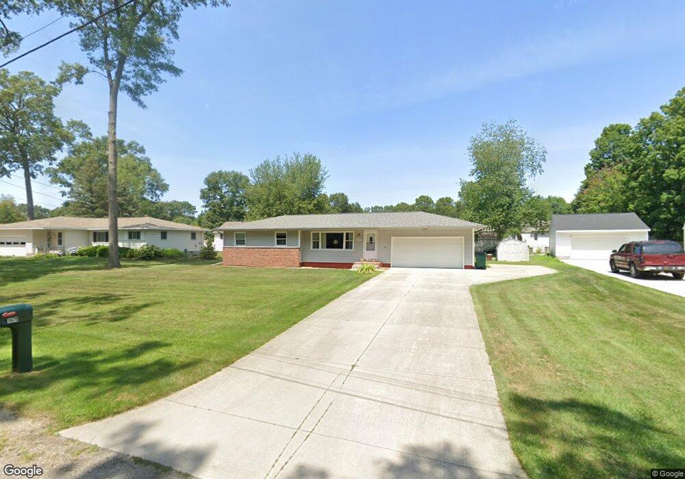
1670 Manistee Rd Muskegon, MI 49445
Estimated Value: $239,513 - $309,000
3
Beds
1
Bath
1,126
Sq Ft
$235/Sq Ft
Est. Value
About This Home
This home is located at 1670 Manistee Rd, Muskegon, MI 49445 and is currently estimated at $264,628, approximately $235 per square foot. 1670 Manistee Rd is a home located in Muskegon County with nearby schools including Reeths-Puffer High School.
Ownership History
Date
Name
Owned For
Owner Type
Purchase Details
Closed on
Mar 31, 2025
Sold by
Press James G
Bought by
James G Press Trust and Press
Current Estimated Value
Purchase Details
Closed on
Apr 3, 2008
Sold by
Elliott Barbara J and Giles Barbara J
Bought by
Press James G
Home Financials for this Owner
Home Financials are based on the most recent Mortgage that was taken out on this home.
Original Mortgage
$90,286
Interest Rate
6.1%
Mortgage Type
FHA
Create a Home Valuation Report for This Property
The Home Valuation Report is an in-depth analysis detailing your home's value as well as a comparison with similar homes in the area
Home Values in the Area
Average Home Value in this Area
Purchase History
| Date | Buyer | Sale Price | Title Company |
|---|---|---|---|
| James G Press Trust | -- | None Listed On Document | |
| James G Press Trust | -- | None Listed On Document | |
| Press James G | -- | Harbor Title |
Source: Public Records
Mortgage History
| Date | Status | Borrower | Loan Amount |
|---|---|---|---|
| Previous Owner | Press James G | $90,286 |
Source: Public Records
Tax History Compared to Growth
Tax History
| Year | Tax Paid | Tax Assessment Tax Assessment Total Assessment is a certain percentage of the fair market value that is determined by local assessors to be the total taxable value of land and additions on the property. | Land | Improvement |
|---|---|---|---|---|
| 2025 | $1,873 | $109,900 | $0 | $0 |
| 2024 | $665 | $109,700 | $0 | $0 |
| 2023 | $636 | $94,200 | $0 | $0 |
| 2022 | $1,704 | $71,500 | $0 | $0 |
| 2021 | $1,658 | $65,200 | $0 | $0 |
| 2020 | $1,641 | $61,500 | $0 | $0 |
| 2019 | $1,613 | $60,000 | $0 | $0 |
| 2018 | $1,591 | $57,200 | $0 | $0 |
| 2017 | $1,610 | $54,600 | $0 | $0 |
| 2016 | $542 | $50,000 | $0 | $0 |
| 2015 | -- | $47,000 | $0 | $0 |
| 2014 | -- | $47,300 | $0 | $0 |
| 2013 | -- | $43,900 | $0 | $0 |
Source: Public Records
Map
Nearby Homes
- 1709 Hampstead Dr
- 1596 Nottingham Ct
- 1024 Bear Lake Rd
- 1516 W Addison Way Unit 54
- 1518 W Addison Way Unit 54
- 1513 W Addison Way Unit 28
- 1310 W Giles Rd
- 780 Horton Rd
- 1603 Horton Rd
- 1045 Greenbriar Dr
- 1234 W Giles Rd
- 1141 N Robinhood Dr
- 0 Horton Rd Unit 25046889
- 690 W Wedgewood Dr
- 1463 Glenwood Ave
- 421 W Chadwick Dr
- 1499 Glenwood Ave
- 1616 Westwind Ct
- 1601 Westwind Ct
- 834 Dykstra Rd
- 1684 Manistee Rd
- 0 Manistee Rd Unit 2824661
- 1650 Manistee Rd
- 1633 Hampstead Dr
- 1613 Hampstead Dr
- 1700 Manistee Rd
- 1649 Hampstead Dr
- 1609 Hampstead Dr
- 1665 Manistee Rd
- 1170 Cadillac Dr
- 1710 Hampstead Dr
- 1612 Hampstead Dr
- 1695 Manistee Rd
- 1667 Hampstead Dr
- 1714 Manistee Rd
- 1605 Hampstead Dr
- 1154 Cadillac Dr
- 1709 Manistee Rd
- 1232 Banbury Way
- 1681 Hampstead Dr