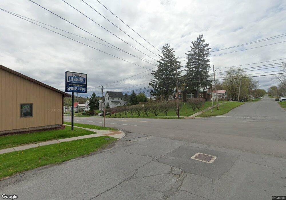
16700 County Route 59 Dexter, NY 13634
Estimated Value: $344,595 - $380,000
3
Beds
3
Baths
1,792
Sq Ft
$202/Sq Ft
Est. Value
About This Home
This home is located at 16700 County Route 59, Dexter, NY 13634 and is currently estimated at $362,298, approximately $202 per square foot. 16700 County Route 59 is a home located in Jefferson County with nearby schools including General Brown Junior/Senior High School.
Ownership History
Date
Name
Owned For
Owner Type
Purchase Details
Closed on
Nov 23, 2011
Sold by
Powell Debra
Bought by
Powell Anthony
Current Estimated Value
Home Financials for this Owner
Home Financials are based on the most recent Mortgage that was taken out on this home.
Original Mortgage
$137,500
Interest Rate
4.09%
Mortgage Type
Purchase Money Mortgage
Purchase Details
Closed on
Apr 4, 1997
Sold by
Rehm John F
Bought by
Powell Debra J
Purchase Details
Closed on
Dec 16, 1994
Sold by
Bell David C Price Floyd D
Bought by
Rehm John F and Rehm Elizabeth
Create a Home Valuation Report for This Property
The Home Valuation Report is an in-depth analysis detailing your home's value as well as a comparison with similar homes in the area
Home Values in the Area
Average Home Value in this Area
Purchase History
| Date | Buyer | Sale Price | Title Company |
|---|---|---|---|
| Powell Anthony | -- | -- | |
| Powell Debra J | $10,000 | -- | |
| Rehm John F | $7,000 | -- |
Source: Public Records
Mortgage History
| Date | Status | Borrower | Loan Amount |
|---|---|---|---|
| Closed | Powell Anthony | $137,500 |
Source: Public Records
Tax History Compared to Growth
Tax History
| Year | Tax Paid | Tax Assessment Tax Assessment Total Assessment is a certain percentage of the fair market value that is determined by local assessors to be the total taxable value of land and additions on the property. | Land | Improvement |
|---|---|---|---|---|
| 2024 | $4,234 | $195,500 | $25,900 | $169,600 |
| 2023 | $4,854 | $195,500 | $25,900 | $169,600 |
| 2022 | $4,598 | $195,500 | $25,900 | $169,600 |
| 2021 | $4,518 | $195,500 | $25,900 | $169,600 |
| 2020 | $3,577 | $195,500 | $25,900 | $169,600 |
| 2019 | $3,472 | $195,500 | $25,900 | $169,600 |
| 2018 | $3,472 | $195,500 | $25,900 | $169,600 |
| 2017 | $3,237 | $185,500 | $25,900 | $159,600 |
| 2016 | $3,189 | $185,500 | $25,900 | $159,600 |
| 2015 | -- | $136,000 | $18,000 | $118,000 |
| 2014 | -- | $136,000 | $18,000 | $118,000 |
Source: Public Records
Map
Nearby Homes
- 23652 Ackerman Rd Unit 656
- 0 Timmerman Rd
- 17695 County Route 59
- 14335 Nys Rte 12e
- 17869 County Route 59
- 15541 Foster Park Rd
- 15625 Foster Park Rd
- 20467 Morin Ln
- 15764 Maynard Ave S
- 133 Vollum - Lot 5 Rd
- 23109 Stone Rd
- 20304 Burton Rd
- 220 Water St
- 107 W Kirby St
- 401 Pike St
- 23214 County Route 59
- 25501 Road 152
- 109 Funnycide Dr
- 209 Monroe St
- 214 E Bronson St
- 16691 County Route 59
- 16721 County Route 59
- 16765 County Route 59
- 16743 County Route 59
- 16848 County Route 59
- 16848 Co Rt 59 Rd
- 16866 County Route 59
- 16634 County Route 59
- 16590 County Route 59
- 16584 County Route 59
- 16538 County Route 59
- 16579 County Route 59
- 13462 Middle Rd
- 16861 County Route 59
- 16861 County Route 59 Unit 749000
- 16839 County Route 59
- 13469 Middle Rd
- 13505 Middle Rd
- Lot 4 County Route 59
- 16478 County Route 59
