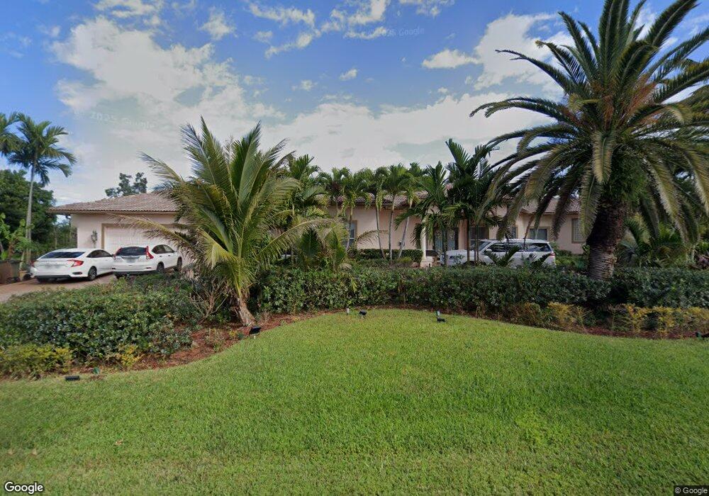
16701 SW 63rd Manor Southwest Ranches, FL 33331
Estimated Value: $1,538,280 - $1,826,000
4
Beds
5
Baths
3,800
Sq Ft
$448/Sq Ft
Est. Value
About This Home
This home is located at 16701 SW 63rd Manor, Southwest Ranches, FL 33331 and is currently estimated at $1,702,820, approximately $448 per square foot. 16701 SW 63rd Manor is a home located in Broward County with nearby schools including Hawkes Bluff Elementary School, Silver Trail Middle School, and West Broward High School.
Ownership History
Date
Name
Owned For
Owner Type
Purchase Details
Closed on
Dec 19, 2002
Sold by
Sands Stephen R and Sands Deborah S
Bought by
Ismail Mohammad Tahir and Tahir Jamila
Current Estimated Value
Home Financials for this Owner
Home Financials are based on the most recent Mortgage that was taken out on this home.
Original Mortgage
$590,400
Outstanding Balance
$249,039
Interest Rate
5.99%
Estimated Equity
$1,453,781
Purchase Details
Closed on
Jan 18, 2001
Sold by
Clara J Schosnig Tr
Bought by
Sands Stephen R and Sands Deborah S
Purchase Details
Closed on
May 6, 1996
Sold by
Schosnig Herbert R and Schosnig Clara J
Bought by
Schosnig Clara J
Create a Home Valuation Report for This Property
The Home Valuation Report is an in-depth analysis detailing your home's value as well as a comparison with similar homes in the area
Home Values in the Area
Average Home Value in this Area
Purchase History
| Date | Buyer | Sale Price | Title Company |
|---|---|---|---|
| Ismail Mohammad Tahir | $738,000 | First American Title Ins Co | |
| Sands Stephen R | $127,000 | -- | |
| Schosnig Clara J | -- | -- |
Source: Public Records
Mortgage History
| Date | Status | Borrower | Loan Amount |
|---|---|---|---|
| Open | Ismail Mohammad Tahir | $590,400 | |
| Previous Owner | Schosnig Clara J | $350,000 | |
| Closed | Ismail Mohammad Tahir | $73,800 |
Source: Public Records
Tax History Compared to Growth
Tax History
| Year | Tax Paid | Tax Assessment Tax Assessment Total Assessment is a certain percentage of the fair market value that is determined by local assessors to be the total taxable value of land and additions on the property. | Land | Improvement |
|---|---|---|---|---|
| 2025 | $11,405 | $626,990 | -- | -- |
| 2024 | $11,187 | $609,320 | -- | -- |
| 2023 | $11,187 | $591,580 | $0 | $0 |
| 2022 | $10,578 | $574,350 | $0 | $0 |
| 2021 | $10,239 | $557,630 | $0 | $0 |
| 2020 | $10,085 | $549,940 | $0 | $0 |
| 2019 | $10,092 | $537,580 | $0 | $0 |
| 2018 | $9,882 | $527,560 | $0 | $0 |
| 2017 | $9,410 | $516,710 | $0 | $0 |
| 2016 | $9,274 | $506,090 | $0 | $0 |
| 2015 | $9,361 | $502,580 | $0 | $0 |
| 2014 | $9,389 | $498,600 | $0 | $0 |
| 2013 | -- | $495,580 | $106,010 | $389,570 |
Source: Public Records
Map
Nearby Homes
- 17000 SW 63rd Manor
- 16541 SW 62nd St
- 16684 SW 59th Ct
- 16386 Erie Place
- 16301 SW 62nd St
- 17130 Magnolia Estates Dr
- 6530 SW 172nd Ave
- 16700 Berkshire Ct
- 16740 Berkshire Ct
- 16800 Berkshire Ct
- 16372 Segovia Cir N
- 16332 Segovia Cir N
- 5901 SW 160th Ave
- 16403 Segovia Cir S
- 16825 Berkshire Ct
- 6221 Sedgewyck Cir W
- 16730 Stratford Ct
- 15982 SW 61st St
- 16566 Mariposa Cir N
- 15824 Cotswold Ct
- 16700 SW 63rd Manor
- 16640 SW 62nd St
- 16731 SW 63rd Manor
- 16730 SW 62nd St
- 16730 SW 63rd Manor
- 6221 SW 166th Ave
- 16751 SW 64th St
- 16780 SW 62nd St
- 16601 SW 64th St
- 6211 SW 166th Ave
- 16801 SW 64th St
- 16800 SW 62nd St
- 16800 SW 63rd Manor
- 16700 SW 64th St
- 0 SW 63 Mnr Manor Unit R10649309
- 6500 SW 166th Avenue Approx
- 16790 SW 64th St
- 16621 SW 62nd St
- 16631 SW 62nd St
- 16725 SW 62nd St