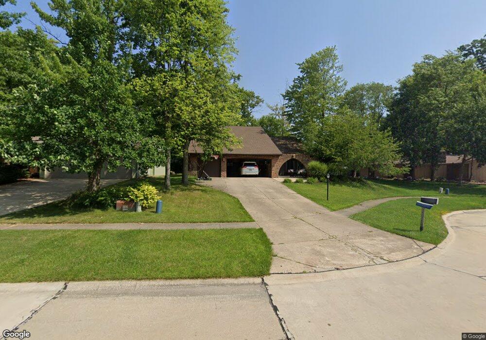
16702 Aspen Cir Strongsville, OH 44136
Estimated Value: $408,000 - $461,000
4
Beds
3
Baths
2,950
Sq Ft
$145/Sq Ft
Est. Value
About This Home
This home is located at 16702 Aspen Cir, Strongsville, OH 44136 and is currently estimated at $428,520, approximately $145 per square foot. 16702 Aspen Cir is a home located in Cuyahoga County with nearby schools including Strongsville High School, Saint Ambrose Catholic School, and Sts Joseph & John Interparochial School.
Ownership History
Date
Name
Owned For
Owner Type
Purchase Details
Closed on
Mar 1, 2004
Sold by
Schulze Michael J and Schulze Lenore Z
Bought by
Gradisher Nathan A and Gradisher Elaine M
Current Estimated Value
Home Financials for this Owner
Home Financials are based on the most recent Mortgage that was taken out on this home.
Original Mortgage
$169,100
Outstanding Balance
$79,251
Interest Rate
5.71%
Mortgage Type
Purchase Money Mortgage
Estimated Equity
$349,269
Purchase Details
Closed on
Jul 6, 1993
Sold by
Burger Carol L
Bought by
Schulze Michael
Purchase Details
Closed on
Jun 28, 1993
Sold by
Burger Kenneth P
Bought by
Burger Carol L
Purchase Details
Closed on
Sep 17, 1985
Sold by
Phipps Linda M
Bought by
Burger Kenneth P
Purchase Details
Closed on
Sep 29, 1978
Bought by
Phipps Linda M
Purchase Details
Closed on
Jan 1, 1978
Bought by
Northeast Land Co
Create a Home Valuation Report for This Property
The Home Valuation Report is an in-depth analysis detailing your home's value as well as a comparison with similar homes in the area
Home Values in the Area
Average Home Value in this Area
Purchase History
| Date | Buyer | Sale Price | Title Company |
|---|---|---|---|
| Gradisher Nathan A | $199,000 | Signature Title | |
| Schulze Michael | $158,000 | -- | |
| Burger Carol L | -- | -- | |
| Burger Kenneth P | $135,000 | -- | |
| Phipps Linda M | $110,900 | -- | |
| Production Homes Inc | $23,000 | -- | |
| Northeast Land Co | -- | -- |
Source: Public Records
Mortgage History
| Date | Status | Borrower | Loan Amount |
|---|---|---|---|
| Open | Gradisher Nathan A | $169,100 |
Source: Public Records
Tax History Compared to Growth
Tax History
| Year | Tax Paid | Tax Assessment Tax Assessment Total Assessment is a certain percentage of the fair market value that is determined by local assessors to be the total taxable value of land and additions on the property. | Land | Improvement |
|---|---|---|---|---|
| 2024 | $5,992 | $127,610 | $19,985 | $107,625 |
| 2023 | $5,955 | $95,100 | $20,230 | $74,870 |
| 2022 | $5,911 | $95,100 | $20,230 | $74,870 |
| 2021 | $5,865 | $95,100 | $20,230 | $74,870 |
| 2020 | $5,434 | $77,950 | $16,590 | $61,360 |
| 2019 | $5,248 | $221,600 | $47,400 | $174,200 |
| 2018 | $4,763 | $77,560 | $16,590 | $60,970 |
| 2017 | $4,863 | $73,300 | $13,130 | $60,170 |
| 2016 | $4,823 | $73,300 | $13,130 | $60,170 |
| 2015 | $4,891 | $73,300 | $13,130 | $60,170 |
| 2014 | $4,891 | $73,300 | $13,130 | $60,170 |
Source: Public Records
Map
Nearby Homes
- 16711 Beech Cir
- 16486 S Red Rock Dr
- 17745 Brick Mill Run
- 18229 Howe Rd
- 17130 Golden Star Dr
- 15772 Boston Rd
- 19364 Ridgeline Ct
- 15604-REAR Boston Rd
- 19694 Benbow Rd
- 97 Weathervane Ln
- 19740 Benbow Rd
- 17159 Turkey Meadow Ln
- 17682 Drake Rd
- 14985 Camden Cir
- 18411 Yorktown Oval
- 15188 Trails Landing
- 18987 Laurell Cir
- 17934 Cambridge Oval
- 159 Sunflower Dr
- 18294 Drake Rd
- 16734 Aspen Cir
- 16670 Aspen Cir
- 16687 Falmouth Dr
- 16766 Aspen Cir
- 16721 Falmouth Dr
- 16669 Falmouth Dr
- 16638 Aspen Cir
- 16745 Falmouth Dr
- 16695 Aspen Cir
- 16727 Aspen Cir
- 16633 Falmouth Dr
- 18905 Misty Lake Dr
- 18947 Misty Lake Dr
- 16631 Aspen Cir
- 16759 Aspen Cir
- 16663 Aspen Cir
- 18871 Misty Lake Dr
- 16575 Falmouth Dr
- 18922 Bears Paw Ln
- 19033 Misty Lake Dr