Estimated Value: $194,000 - $206,000
3
Beds
1
Bath
1,276
Sq Ft
$157/Sq Ft
Est. Value
About This Home
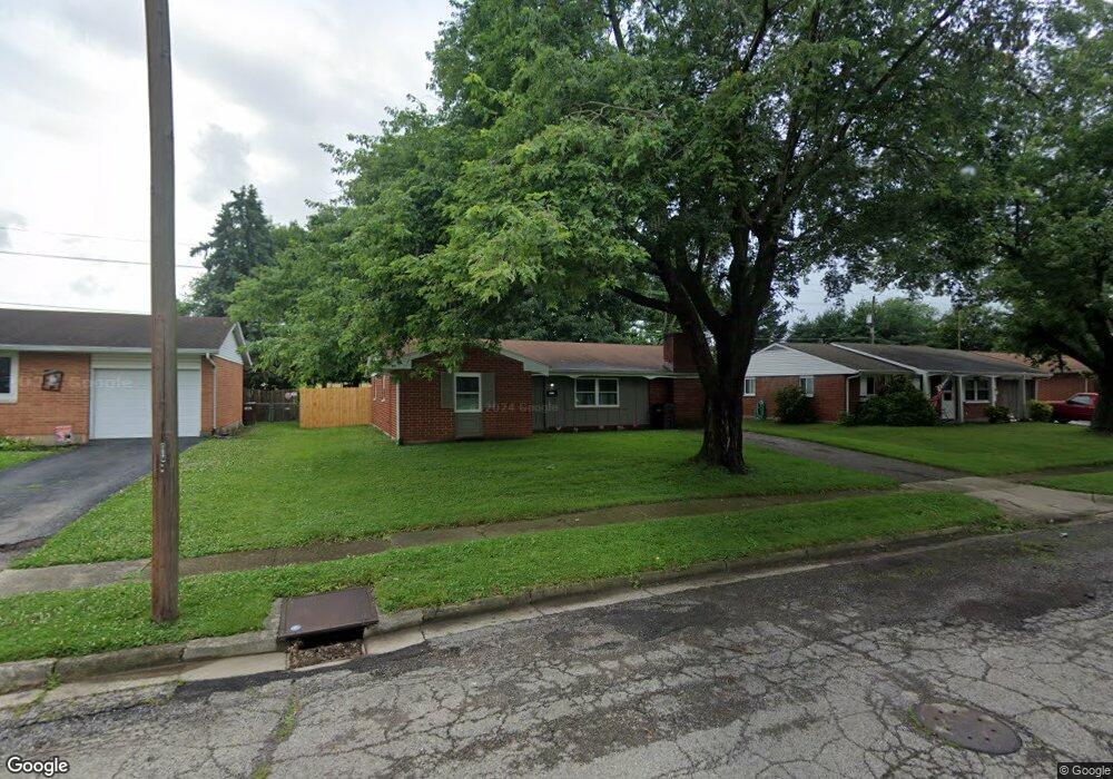
This home is located at 1671 Arapaho Dr, Xenia, OH 45385 and is currently estimated at $199,736, approximately $156 per square foot. 1671 Arapaho Dr is a home located in Greene County with nearby schools including Xenia High School, Summit Academy Community School for Alternative Learners - Xenia, and Legacy Christian Academy.
Ownership History
Date
Name
Owned For
Owner Type
Purchase Details
Closed on
Oct 22, 2020
Sold by
Lacy Robert
Bought by
Shanks Kelly M
Current Estimated Value
Home Financials for this Owner
Home Financials are based on the most recent Mortgage that was taken out on this home.
Original Mortgage
$108,007
Outstanding Balance
$96,066
Interest Rate
2.9%
Mortgage Type
New Conventional
Estimated Equity
$103,670
Purchase Details
Closed on
Aug 2, 2004
Sold by
Lacy Robert and Lacy Bette J
Bought by
Lacy Robert
Purchase Details
Closed on
Dec 17, 2003
Sold by
Beam Lowell and Beam Patricia
Bought by
Lacy Robert and Lacy Bette J
Purchase Details
Closed on
Apr 19, 2000
Sold by
Beam William O and Beam Hazel S
Bought by
Beam William Lowell and Crumbacher Susan
Purchase Details
Closed on
Mar 6, 2000
Sold by
Beam William O and Beam Hazel S
Bought by
Beam Hazel S
Create a Home Valuation Report for This Property
The Home Valuation Report is an in-depth analysis detailing your home's value as well as a comparison with similar homes in the area
Home Values in the Area
Average Home Value in this Area
Purchase History
| Date | Buyer | Sale Price | Title Company |
|---|---|---|---|
| Shanks Kelly M | $110,000 | None Available | |
| Lacy Robert | -- | -- | |
| Lacy Robert | $83,000 | -- | |
| Beam William Lowell | -- | -- | |
| Beam Hazel S | -- | -- |
Source: Public Records
Mortgage History
| Date | Status | Borrower | Loan Amount |
|---|---|---|---|
| Open | Shanks Kelly M | $108,007 |
Source: Public Records
Tax History Compared to Growth
Tax History
| Year | Tax Paid | Tax Assessment Tax Assessment Total Assessment is a certain percentage of the fair market value that is determined by local assessors to be the total taxable value of land and additions on the property. | Land | Improvement |
|---|---|---|---|---|
| 2024 | $2,085 | $48,730 | $11,140 | $37,590 |
| 2023 | $2,085 | $48,730 | $11,140 | $37,590 |
| 2022 | $1,738 | $34,640 | $6,550 | $28,090 |
| 2021 | $1,761 | $34,640 | $6,550 | $28,090 |
| 2020 | $2,109 | $34,640 | $6,550 | $28,090 |
| 2019 | $1,509 | $29,160 | $6,370 | $22,790 |
| 2018 | $1,515 | $29,160 | $6,370 | $22,790 |
| 2017 | $1,240 | $29,160 | $6,370 | $22,790 |
| 2016 | $1,395 | $26,350 | $6,370 | $19,980 |
| 2015 | $2,259 | $26,350 | $6,370 | $19,980 |
| 2014 | $1,599 | $26,350 | $6,370 | $19,980 |
Source: Public Records
Map
Nearby Homes
- 1778 Arapaho Dr
- 1403 Texas Dr
- 1866 Roxbury Dr
- 1272 Bellbrook Ave
- 1769 Gayhart Dr
- 1618 Navajo Dr
- 1829 Gayhart Dr
- 1208 Bellbrook Ave
- 1908 Whitt St
- 1653 Seneca Dr
- 1255 Colorado Dr
- 1107 Arkansas Dr
- 1144 Rockwell Dr
- 1568 Cheyenne Dr
- 2499 Jenny Marie Dr
- 2257 Maryland Dr
- 2142 Michigan Dr
- 2758 Wyoming Dr
- 2345 Tennessee Dr
- 2540 Jenny Marie Dr
- 1657 Arapaho Dr
- 1683 Arapaho Dr
- 1645 Arapaho Dr
- 1697 Arapaho Dr
- 1682 Arapaho Dr
- 1397 Iroquois Dr
- 1631 Arapaho Dr
- 1711 Arapaho Dr
- 1696 Arapaho Dr
- 1638 Arapaho Dr
- 1710 Arapaho Dr
- 1619 Arapaho Dr
- 1727 Arapaho Dr
- 1624 Arapaho Dr
- 1699 Maumee Dr
- 1669 Maumee Dr
- 1713 Maumee Dr
- 1726 Arapaho Dr
- 1655 Maumee Dr
- 1605 Arapaho Dr