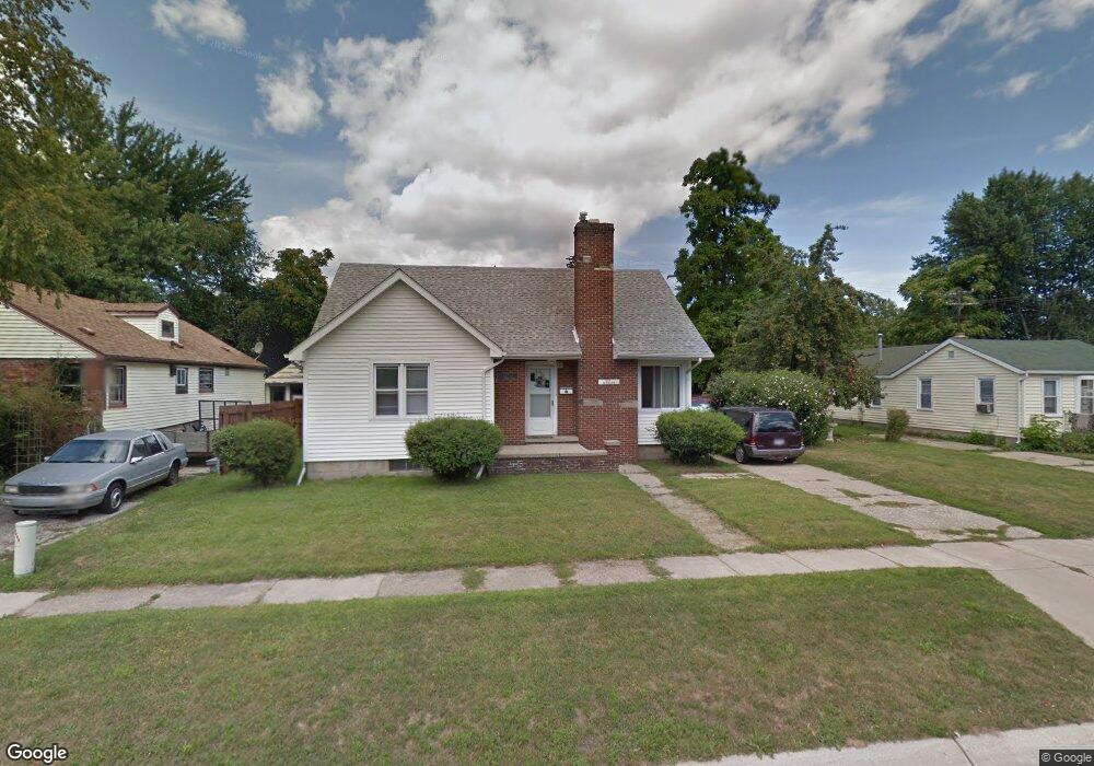
1671 McBrady St Port Huron, MI 48060
Estimated Value: $144,000 - $158,947
2
Beds
1
Bath
1,038
Sq Ft
$145/Sq Ft
Est. Value
About This Home
This home is located at 1671 McBrady St, Port Huron, MI 48060 and is currently estimated at $150,987, approximately $145 per square foot. 1671 McBrady St is a home located in St. Clair County with nearby schools including H.D. Crull Elementary School, Holland Woods Middle School, and Port Huron Northern High School.
Ownership History
Date
Name
Owned For
Owner Type
Purchase Details
Closed on
Sep 2, 2021
Sold by
Brian Robert
Bought by
Brian Robert and Brian Lanie
Current Estimated Value
Purchase Details
Closed on
Sep 4, 2008
Sold by
Hepting Robert A and Hepting Freida
Bought by
Hepting Robert A and Green Sandra
Create a Home Valuation Report for This Property
The Home Valuation Report is an in-depth analysis detailing your home's value as well as a comparison with similar homes in the area
Home Values in the Area
Average Home Value in this Area
Purchase History
| Date | Buyer | Sale Price | Title Company |
|---|---|---|---|
| Brian Robert | -- | Huron Title Company | |
| Hepting Robert A | -- | None Available |
Source: Public Records
Tax History Compared to Growth
Tax History
| Year | Tax Paid | Tax Assessment Tax Assessment Total Assessment is a certain percentage of the fair market value that is determined by local assessors to be the total taxable value of land and additions on the property. | Land | Improvement |
|---|---|---|---|---|
| 2025 | $1,758 | $70,300 | $0 | $0 |
| 2024 | $1,316 | $66,200 | $0 | $0 |
| 2023 | $1,243 | $58,600 | $0 | $0 |
| 2022 | $1,264 | $50,000 | $0 | $0 |
| 2020 | $1,214 | $43,200 | $43,200 | $0 |
| 2019 | $1,192 | $29,500 | $0 | $0 |
| 2018 | $1,166 | $29,500 | $0 | $0 |
| 2017 | $1,042 | $27,700 | $0 | $0 |
| 2016 | $884 | $27,700 | $0 | $0 |
| 2015 | $868 | $25,100 | $25,100 | $0 |
| 2014 | $868 | $24,200 | $24,200 | $0 |
| 2013 | -- | $24,300 | $0 | $0 |
Source: Public Records
Map
Nearby Homes
- 1649 Whipple St
- 1733 Whipple St
- 1620 McBrady St
- 1819 Riverside Dr
- 1907 Riverside Dr
- 1433 Poplar St
- 0000 Campau Ave
- 1417 Kearney St
- 29 Taylor St
- 1819 Kern St
- 1321 Nelson St
- 1825 Kern St
- 2400 Stone St Unit 2414
- 2215 Hancock St
- 146 Taylor St
- 00 Campau Ave
- 917 Saint Clair St
- 2838 Elmwood St
- 1116 Hancock St
- 1002 Erie St
- 1673 McBrady St
- 1661 McBrady St
- 1672 Mcpherson St
- 1657 McBrady St
- 1676 McBrady St
- 1672 McBrady St
- 1700 McBrady St
- 1712 Mc Pherson Mc Pherson
- 1650 Mcpherson St
- 1662 McBrady St
- 1700 Mcpherson St
- 1685 McBrady St
- 1646 Mcpherson St
- 1656 McBrady St
- 1674 McBrady St
- 1653 McBrady St
- 1682 McBrady St
- 1710 Mcpherson St
- 1678 McBrady St
- 1712 Mcpherson St