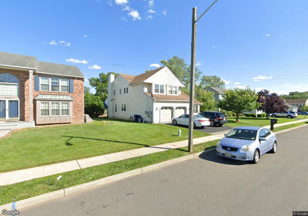
1672 Hudson Ave North Brunswick, NJ 08902
Estimated Value: $731,000 - $897,000
5
Beds
3
Baths
3,252
Sq Ft
$252/Sq Ft
Est. Value
About This Home
This home is located at 1672 Hudson Ave, North Brunswick, NJ 08902 and is currently estimated at $818,243, approximately $251 per square foot. 1672 Hudson Ave is a home located in Middlesex County with nearby schools including John Adams Elementary School, Linwood Middle School, and North Brunswick Twp High School.
Ownership History
Date
Name
Owned For
Owner Type
Purchase Details
Closed on
Dec 1, 2016
Sold by
Woods Margaret J
Bought by
Modi Rohan and Dave Yuti
Current Estimated Value
Home Financials for this Owner
Home Financials are based on the most recent Mortgage that was taken out on this home.
Original Mortgage
$4,764,432
Outstanding Balance
$3,906,522
Interest Rate
4.03%
Mortgage Type
New Conventional
Estimated Equity
-$3,088,279
Purchase Details
Closed on
Nov 11, 1992
Bought by
Woods Margaret J
Create a Home Valuation Report for This Property
The Home Valuation Report is an in-depth analysis detailing your home's value as well as a comparison with similar homes in the area
Home Values in the Area
Average Home Value in this Area
Purchase History
| Date | Buyer | Sale Price | Title Company |
|---|---|---|---|
| Modi Rohan | $473,000 | Simplicity Title Llc | |
| Woods Margaret J | -- | -- |
Source: Public Records
Mortgage History
| Date | Status | Borrower | Loan Amount |
|---|---|---|---|
| Open | Modi Rohan | $4,764,432 |
Source: Public Records
Tax History Compared to Growth
Tax History
| Year | Tax Paid | Tax Assessment Tax Assessment Total Assessment is a certain percentage of the fair market value that is determined by local assessors to be the total taxable value of land and additions on the property. | Land | Improvement |
|---|---|---|---|---|
| 2025 | $14,750 | $232,800 | $59,000 | $182,000 |
| 2024 | $14,485 | $232,800 | $59,000 | $182,000 |
| 2023 | $14,485 | $232,800 | $0 | $0 |
| 2022 | $13,991 | $232,800 | $0 | $0 |
| 2021 | $13,658 | $232,800 | $0 | $0 |
| 2020 | $13,470 | $232,800 | $0 | $0 |
| 2019 | $13,195 | $241,000 | $59,000 | $182,000 |
| 2018 | $12,925 | $241,000 | $59,000 | $182,000 |
| 2017 | $12,697 | $241,000 | $59,000 | $182,000 |
| 2016 | $12,432 | $241,000 | $59,000 | $182,000 |
| 2015 | $12,220 | $241,000 | $59,000 | $182,000 |
| 2014 | $12,082 | $232,800 | $59,000 | $173,800 |
Source: Public Records
Map
Nearby Homes
- 1632 Hudson Ave
- 1365 Sioux Rd
- 1209 Dakota Rd
- 1899 Noah Dr
- 1464 Columbia Dr
- 1067 Grove St
- 1 Michael Ct
- 1074 Schmidt Ln
- 1008 Schmidt Ln
- 1027 Schmidt Ln
- 1103 Schmidt Ln
- 1499 La Rose Ave
- 66 Riverbend Dr
- 174 Nathan Dr
- 1010 N Oaks Blvd
- 210 N Oaks Blvd Unit 210
- 84 Clay St
- 280 Willowbrook Dr
- 1314 N Oaks Blvd
- 4511 Birchwood Ct
- 1664 Hudson Ave
- 1680 Hudson Ave
- 1669 Platte Ave
- 1661 Platte Ave
- 1677 Platte Ave
- 1673 Hudson Ave
- 1656 Hudson Ave
- 1688 Hudson Ave
- 1665 Hudson Ave
- 1653 Platte Ave
- 1681 Hudson Ave
- 1685 Platte Ave
- 1657 Hudson Ave
- 1689 Hudson Ave
- 1698 Hudson Ave
- 1648 Hudson Ave
- 1645 Platte Ave
- 8 Devon Ct
- 1649 Hudson Ave
- 1691 Platte Ave