Estimated Value: $304,000 - $483,705
4
Beds
3
Baths
2,308
Sq Ft
$177/Sq Ft
Est. Value
About This Home
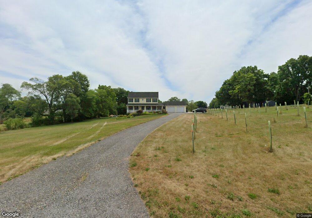
This home is located at 1675 Butter Rd, Dover, PA 17315 and is currently estimated at $407,902, approximately $176 per square foot. 1675 Butter Rd is a home located in York County with nearby schools including Dover Area High School and Lighthouse Christian School.
Ownership History
Date
Name
Owned For
Owner Type
Purchase Details
Closed on
Sep 27, 2001
Sold by
Dehoff David L and Dehoff Julia M
Bought by
Lash David L and Lash Michele L
Current Estimated Value
Home Financials for this Owner
Home Financials are based on the most recent Mortgage that was taken out on this home.
Original Mortgage
$41,400
Interest Rate
6.91%
Create a Home Valuation Report for This Property
The Home Valuation Report is an in-depth analysis detailing your home's value as well as a comparison with similar homes in the area
Home Values in the Area
Average Home Value in this Area
Purchase History
| Date | Buyer | Sale Price | Title Company |
|---|---|---|---|
| Lash David L | $46,000 | -- |
Source: Public Records
Mortgage History
| Date | Status | Borrower | Loan Amount |
|---|---|---|---|
| Closed | Lash David L | $41,400 |
Source: Public Records
Tax History Compared to Growth
Tax History
| Year | Tax Paid | Tax Assessment Tax Assessment Total Assessment is a certain percentage of the fair market value that is determined by local assessors to be the total taxable value of land and additions on the property. | Land | Improvement |
|---|---|---|---|---|
| 2025 | $7,458 | $227,320 | $56,240 | $171,080 |
| 2024 | $7,389 | $227,320 | $56,240 | $171,080 |
| 2023 | $7,390 | $227,320 | $56,240 | $171,080 |
| 2022 | $7,255 | $227,320 | $56,240 | $171,080 |
| 2021 | $6,845 | $227,320 | $56,240 | $171,080 |
| 2020 | $6,784 | $227,320 | $56,240 | $171,080 |
| 2019 | $6,700 | $227,320 | $56,240 | $171,080 |
| 2018 | $6,532 | $227,320 | $56,240 | $171,080 |
| 2017 | $6,532 | $227,320 | $56,240 | $171,080 |
| 2016 | $0 | $227,320 | $56,240 | $171,080 |
| 2015 | -- | $227,320 | $56,240 | $171,080 |
| 2014 | -- | $226,170 | $56,240 | $169,930 |
Source: Public Records
Map
Nearby Homes
- 103 E Canal St
- 1595 Oak Ln
- 4105 Smith Rd
- 33 S Main St
- 4013 Somerset Rd
- 1841 Wyatt Cir
- 0 W Canal Rd
- 3960 Sheppard Dr
- 1920 Temple School Rd
- 86 Cherokee Ave
- 85 Cherokee Ave
- 4008 Country Dr
- 140 Pawnee Ave
- 3756 Fox Chase Dr
- 0 Nursery Rd
- 3975 Craig Ave
- 1030 E Canal Rd
- 1636 Fountain Rock Dr
- 3510 Pebble Run Dr
- 3515 Pebble Run Dr
- 1691 Butter Rd
- 65 Amberview Dr
- 55 Amberview Dr
- 114 Dogwood Dr
- 112 Dogwood Dr
- 57 Amberview Dr
- 110 Dogwood Dr
- 113 Dogwood Dr
- 108 Dogwood Dr
- 111 Dogwood Dr
- 53 Amberview Dr
- 62 Amberview Dr
- 109 Dogwood Dr
- 64 Amberview Dr
- 64 Amberview Dr
- 60 Amberview Dr
- 103 Dogwood Dr
- 106 Dogwood Dr
- 213 Maplewood Dr
- 215 Maplewood Dr