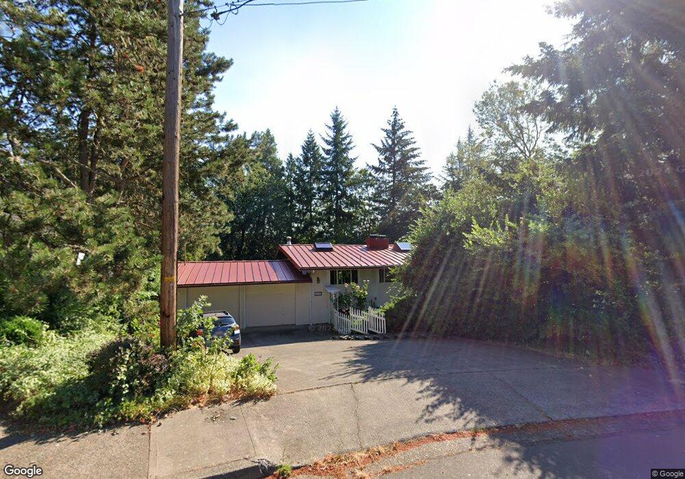
1675 Em Ray Dr Eugene, OR 97405
Crest Drive NeighborhoodEstimated Value: $678,252 - $781,000
4
Beds
3
Baths
1,586
Sq Ft
$459/Sq Ft
Est. Value
About This Home
This home is located at 1675 Em Ray Dr, Eugene, OR 97405 and is currently estimated at $728,313, approximately $459 per square foot. 1675 Em Ray Dr is a home located in Lane County with nearby schools including Adams Elementary School, Arts And Technology Academy At Jefferson, and Churchill High School.
Ownership History
Date
Name
Owned For
Owner Type
Purchase Details
Closed on
Aug 1, 2003
Sold by
Brunson Arthur and Brunson Linda J
Bought by
Golledge Stephen L and Ostmeier Dorothee
Current Estimated Value
Home Financials for this Owner
Home Financials are based on the most recent Mortgage that was taken out on this home.
Original Mortgage
$217,600
Outstanding Balance
$87,603
Interest Rate
5.13%
Mortgage Type
Purchase Money Mortgage
Estimated Equity
$640,710
Purchase Details
Closed on
Nov 18, 1999
Sold by
Etal White Douglas B Te and Etal Patricia R
Bought by
Brunson Arthur and Brunson Linda J
Home Financials for this Owner
Home Financials are based on the most recent Mortgage that was taken out on this home.
Original Mortgage
$181,600
Interest Rate
7.82%
Create a Home Valuation Report for This Property
The Home Valuation Report is an in-depth analysis detailing your home's value as well as a comparison with similar homes in the area
Home Values in the Area
Average Home Value in this Area
Purchase History
| Date | Buyer | Sale Price | Title Company |
|---|---|---|---|
| Golledge Stephen L | $272,000 | Western Title & Escrow Co | |
| Brunson Arthur | $227,000 | Fidelity National Title Ins |
Source: Public Records
Mortgage History
| Date | Status | Borrower | Loan Amount |
|---|---|---|---|
| Open | Golledge Stephen L | $217,600 | |
| Previous Owner | Brunson Arthur | $181,600 | |
| Closed | Golledge Stephen L | $27,200 |
Source: Public Records
Tax History
| Year | Tax Paid | Tax Assessment Tax Assessment Total Assessment is a certain percentage of the fair market value that is determined by local assessors to be the total taxable value of land and additions on the property. | Land | Improvement |
|---|---|---|---|---|
| 2025 | $7,822 | $401,442 | -- | -- |
| 2024 | $7,724 | $389,750 | -- | -- |
| 2023 | $7,724 | $378,399 | $0 | $0 |
| 2022 | $7,236 | $367,378 | $0 | $0 |
| 2021 | $6,797 | $356,678 | $0 | $0 |
| 2020 | $6,821 | $346,290 | $0 | $0 |
| 2019 | $6,585 | $336,204 | $0 | $0 |
| 2018 | $6,158 | $316,905 | $0 | $0 |
| 2017 | $5,745 | $316,905 | $0 | $0 |
| 2016 | $5,568 | $307,675 | $0 | $0 |
| 2015 | $5,382 | $298,714 | $0 | $0 |
| 2014 | $5,243 | $290,014 | $0 | $0 |
Source: Public Records
Map
Nearby Homes
- 0 Mclean Blvd Unit 24671448
- 0 Mclean Blvd Unit 697374759
- 1783 Graham Dr
- 3160 Whitten Dr
- 2030 W 34th Ave
- 1955 W 28th Ave
- 3023 Ashley Loop
- 2850 Garfield St
- 1 Storey Blvd
- 2 Storey Blvd
- 2673 Garfield St
- 3093 Soloman Loop
- 865 W 28th Ave
- 951 W 27th Ave
- 0 W 40th Ave Unit 3 639571582
- 0 Hidden Meadows
- 2225 W 28th Ave
- 3854 Monroe St
- 605 Fulvue Dr
- 3872 Monroe St
- 1695 Em Ray Dr
- 3310 Fillmore St
- 1665 Em Ray Dr
- 3300 Fillmore St
- 3330 Fillmore St
- 3285 Chambers St
- 1670 Em Ray Dr
- 1690 Em Ray Dr
- 1635 Em Ray Dr
- 3340 Fillmore St
- 1650 Em Ray Dr
- 1790 White Oak Dr
- 3275 Chambers St Unit VRM
- 3275 Chambers St
- 3323 Fillmore St
- 3280 Fillmore St
- 3301 Fillmore St
- 3335 Fillmore St
- 1615 Em Ray Dr
- 1796 White Oak Dr
Your Personal Tour Guide
Ask me questions while you tour the home.